Good Sunday morning, North Texas!
Yesterday’s soaking rain has moved out of the region, but we’re still dealing with the leftover cloud deck this morning. Low gray clouds are hanging tough across much of North Texas and may linger into early afternoon before gradual clearing develops from west to east by mid to late afternoon.
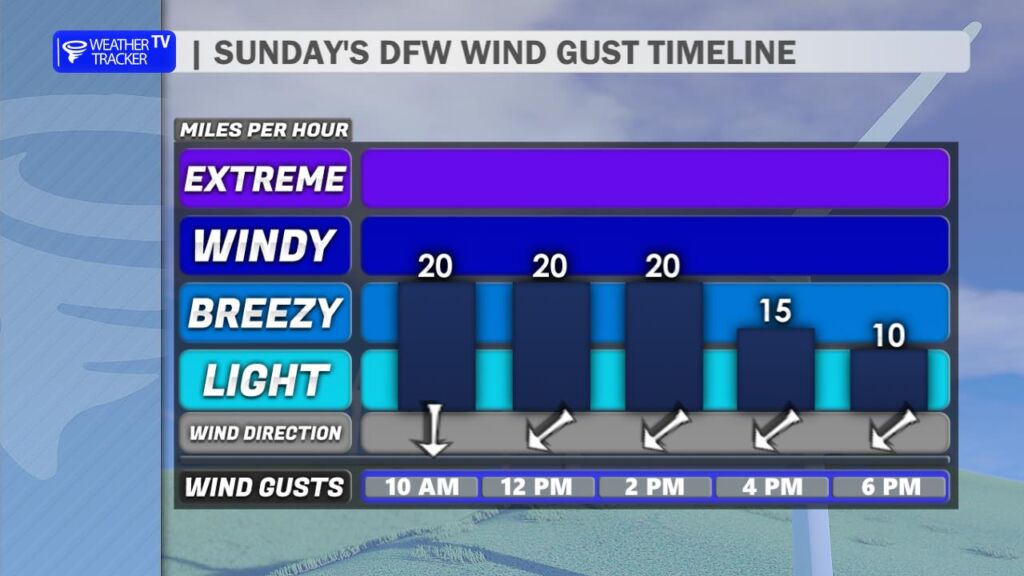
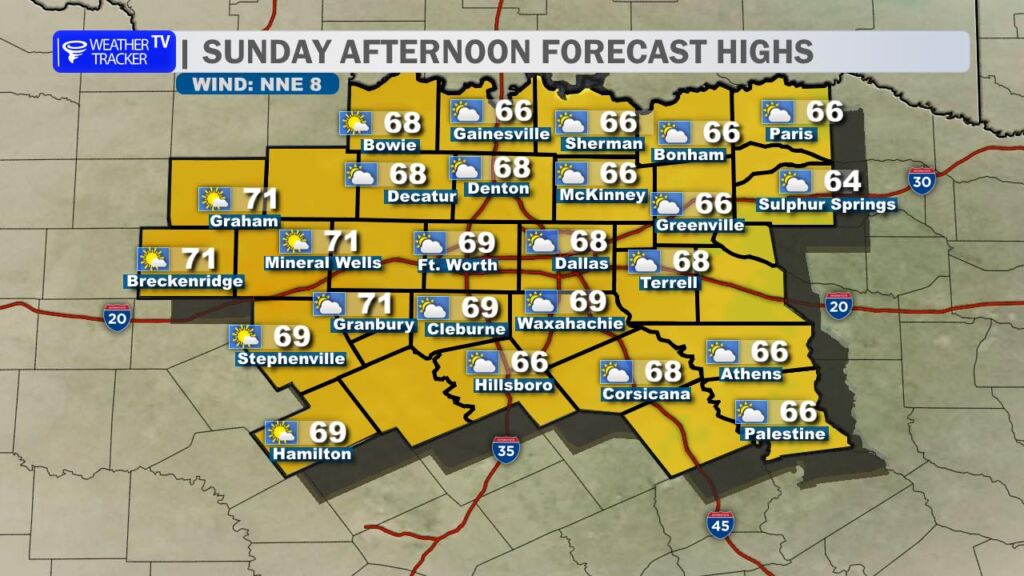
Temperatures today will stay on the cool side, generally topping out in the 60s. While that may feel a bit brisk compared to the recent warmth, it’s technically still a touch above average for mid-February. A north breeze will add to that cool feel, occasionally gusting over 20 mph this afternoon and giving the air a sharper edge.
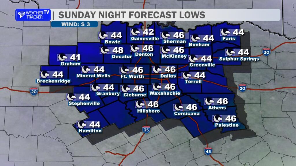
Tonight will be quiet but chilly. Lows dip into the 40s area-wide. With light winds and leftover moisture from Saturday’s rain, areas of patchy – and in some spots dense – fog are expected to develop toward daybreak Monday. Visibility could be reduced for the Monday morning commute, so plan a little extra time if you’re heading out early.
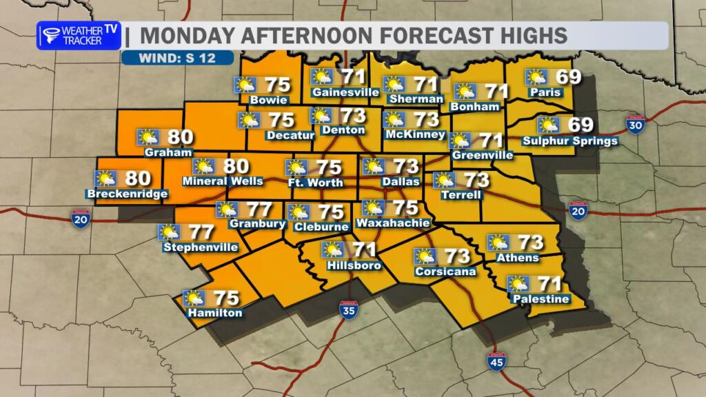
If you’re off for Presidents Day, enjoy it – the forecast looks fantastic. After morning fog lifts, we’ll see a mostly sunny afternoon with a return to much warmer temperatures. Highs climb back into the 70s across most of North Texas, with a few lower 80s possible west toward the Big Country. A light south breeze will signal the beginning of our next warming trend.
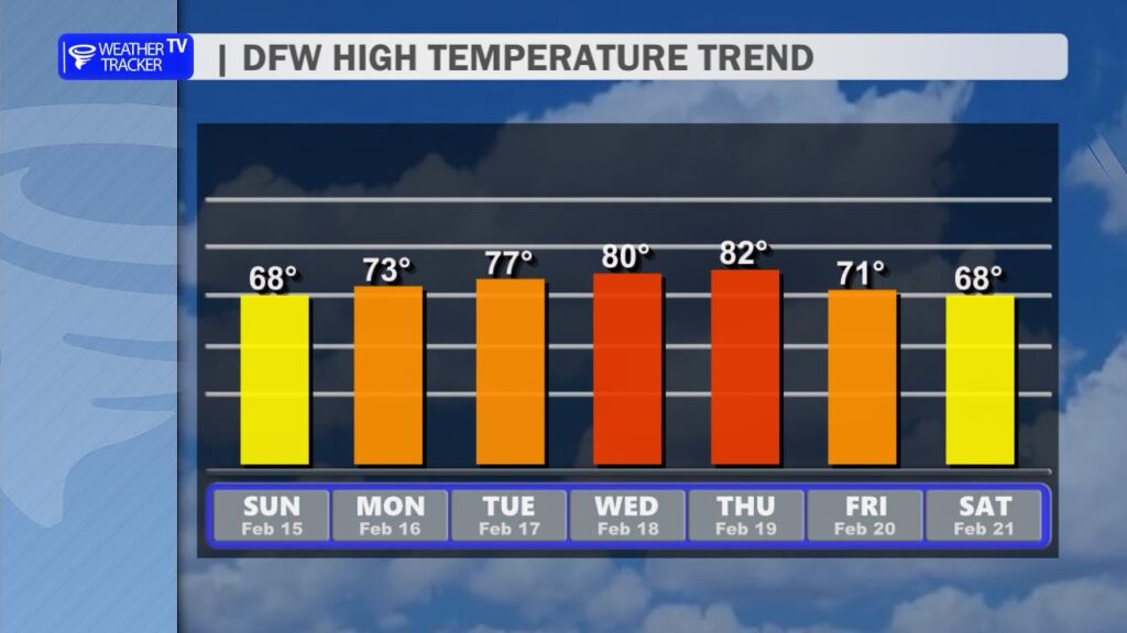
That warming trend continues through the week. Highs surge back into the 80s by Tuesday and likely hold there into midweek. Even though we just picked up beneficial rainfall, the combination of warm temperatures, low humidity, and breezy conditions will begin to elevate wildfire concerns as we move deeper into the week. It’s not an immediate high-end threat, but it is something we’ll be monitoring closely across North Texas.
Enjoy the quiet Sunday – sunshine and spring like warmth are right around the corner. -William