Happy Valentine’s Day, North Texas!
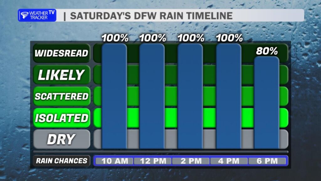
Grab the umbrella before you head out today – it’s going to be a wet one across the region. Periods of rain and thunderstorms are likely through the morning and into the afternoon. Rain chances briefly ease at times, but scattered showers and storms will redevelop again this evening before the upper-level system finally pulls away by daybreak Sunday.
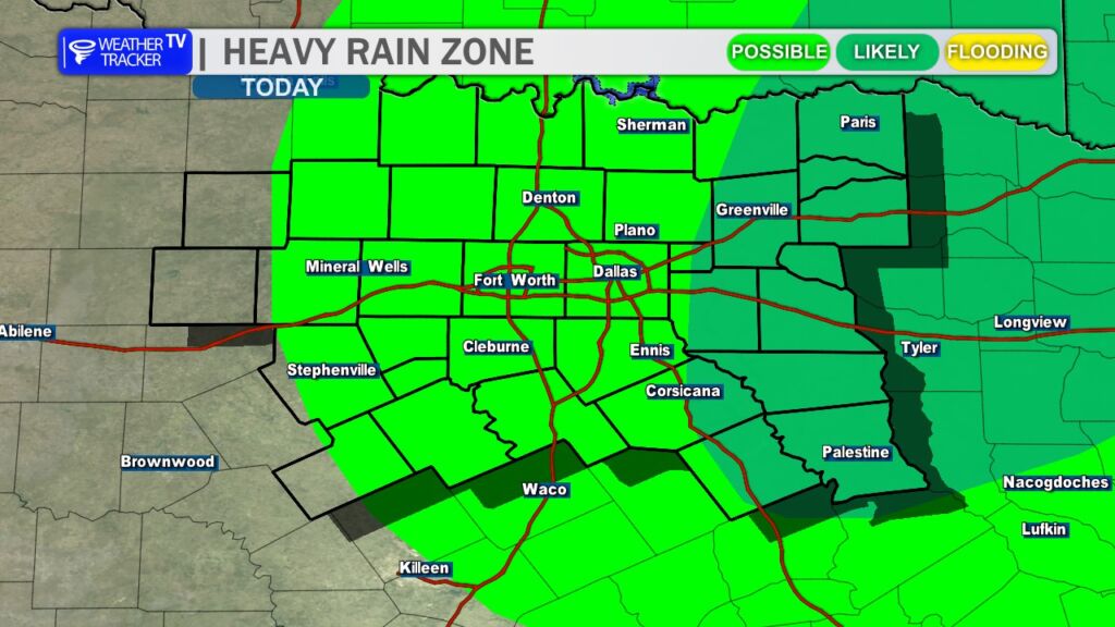
Locally heavy rainfall is possible at times today. While widespread flooding is not expected, you may notice ponding on roadways and minor runoff issues in low-lying or poor-drainage areas. If you encounter water over the road, slow down and allow extra travel time.
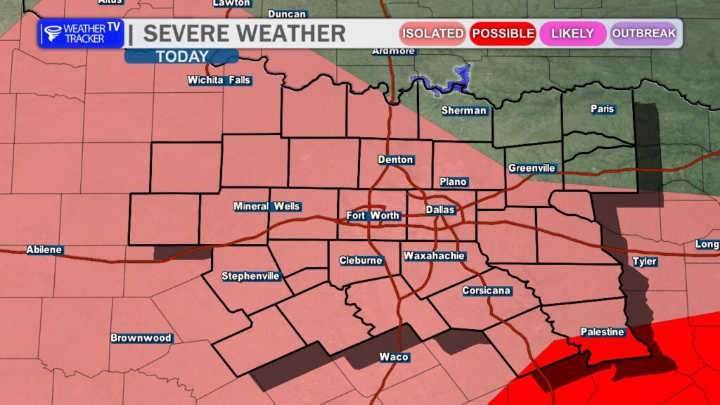
Most of today’s storms should remain below severe limits. However, there is a small window this afternoon where just enough instability could develop for a few stronger storm cores. If that happens, the main threats would be wind gusts up to 60 mph and hail up to quarter size. We’ll be monitoring radar trends closely through the day.
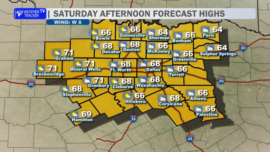
Temperatures won’t move much thanks to the clouds and rain. Expect readings to hold steady in the 60s, possibly touching 70 in a few spots, but overall it will be a mild and damp day.
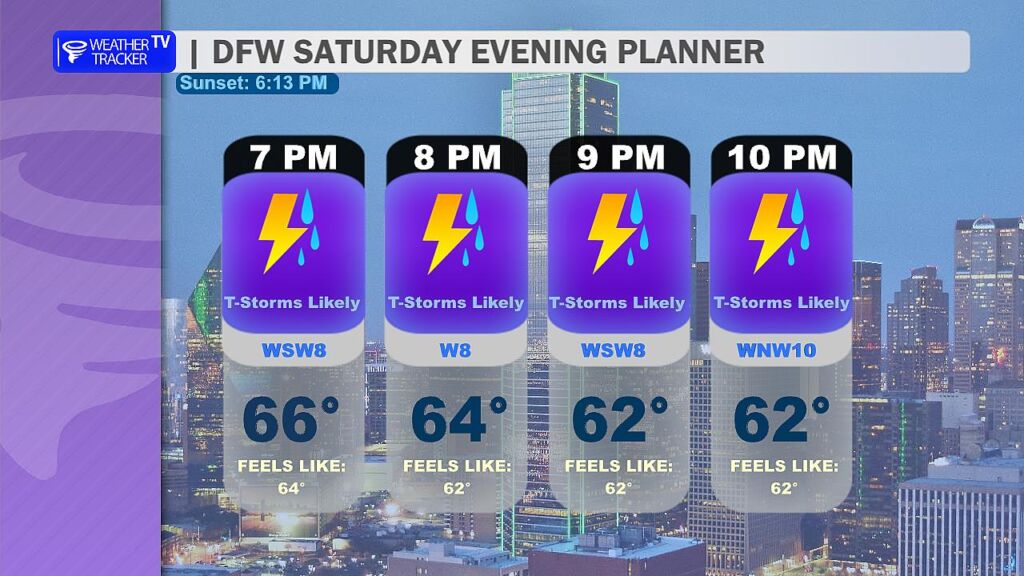
If you have Valentine’s dinner plans this evening, plan for scattered showers and thunderstorms continuing through the night. Temperatures will remain mild in the 60s, so it won’t be cold – just wet.
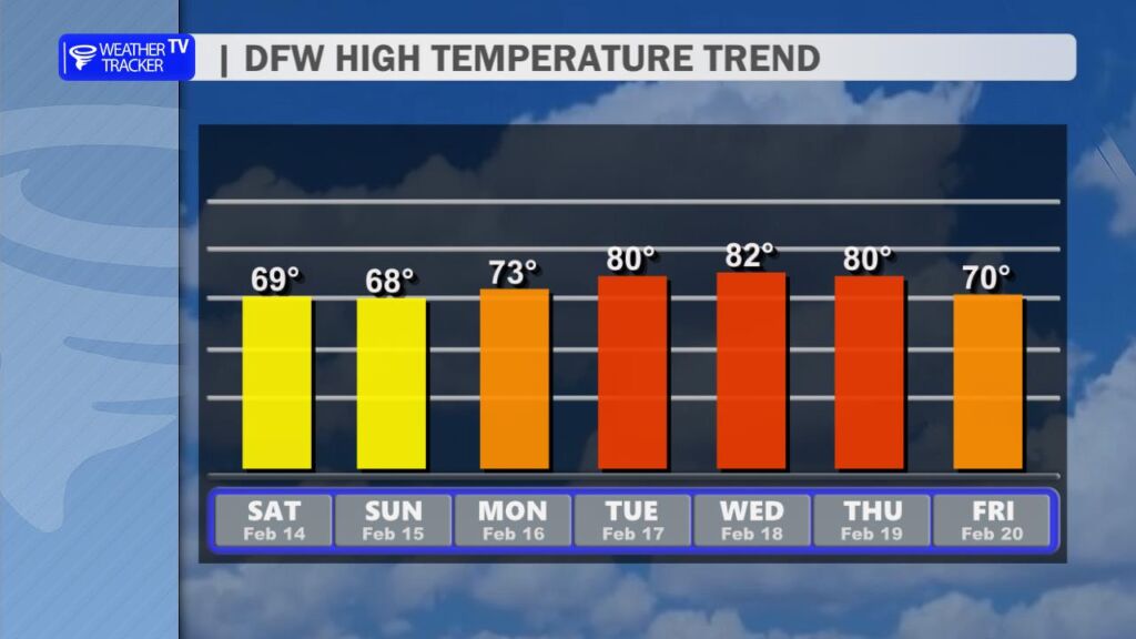
The good news? We dry out on Sunday with improving skies and highs in the 60s. Then get ready for a big rebound next week – temperatures surge back into the upper 70s and lower 80s, bringing an early taste of spring back to North Texas. -William