Good Thursday Morning, North Texas!
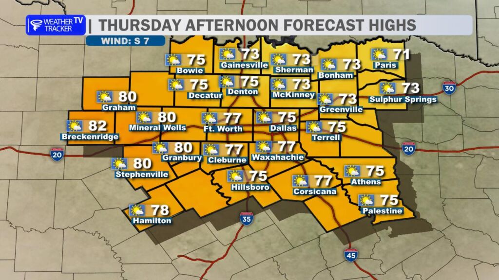
We’re in for another very comfortable and warm afternoon across the region. Expect a mix of sun and passing clouds with highs climbing into the 70s area wide. A light southerly breeze will continue to pull in mild air, making for a pleasant late winter day.
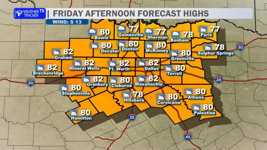
Friday brings even warmer temperatures as the southerly flow strengthens. Highs will surge to around 80 degrees in the Metroplex, with upper 70s to near 80 across much of North Texas. Clouds will gradually increase throughout the day — a sign that our next weather system is organizing to the west.
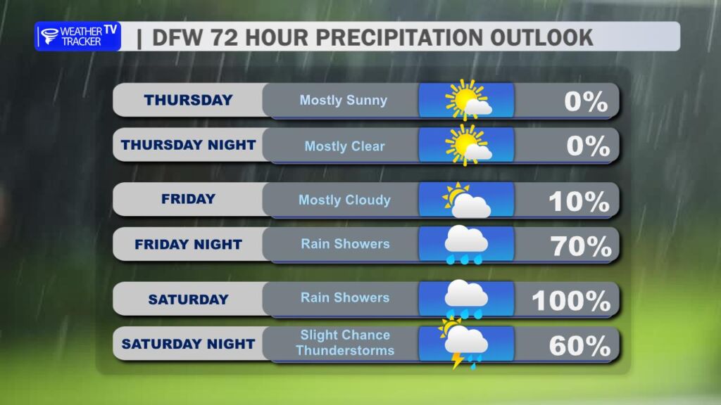
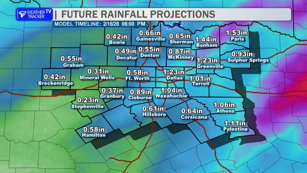
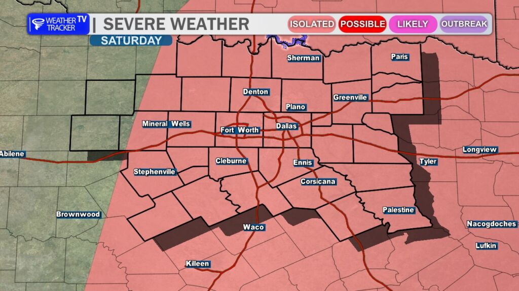
Rain chances begin to ramp up late Friday, especially Friday night, and continue through much of the day Saturday (Valentine’s Day). Periods of showers are likely, and a few thunderstorms will be possible. While severe weather is not the primary concern at this time, some storms could produce locally heavy rainfall. Current projections suggest widespread totals between 0.50″ and 1.00″, which would be beneficial rainfall for many areas.
Rain chances taper off Saturday night as the system exits to the east.
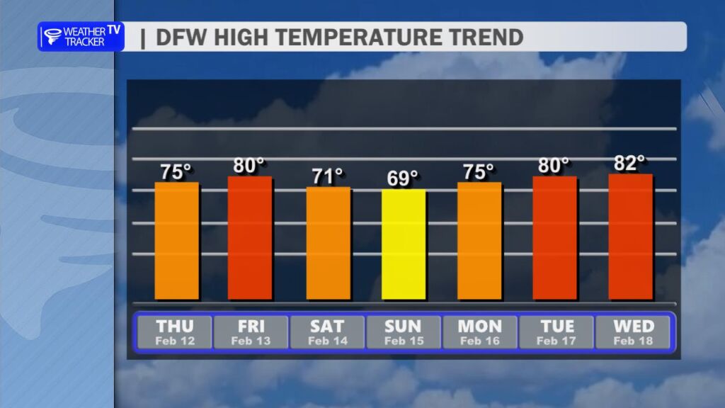
Behind the departing system, temperatures cool slightly on Sunday with highs easing back into the upper 60s and 70s under improving skies. The cooldown will be brief, however, as we quickly warm back up next week with highs returning to around 80 degrees.
Enjoy the mild stretch, and keep the umbrella handy for the start of the weekend! -William