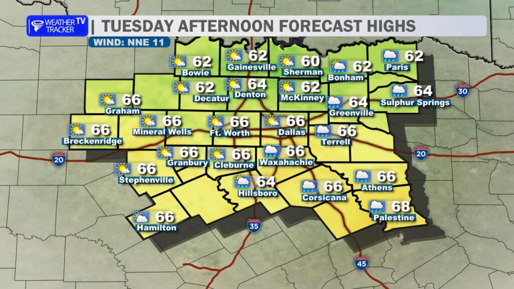
It’s a cloudier start to the day across North Texas as a weather system moves through the region. Along with it, a cold front is sliding south across the area. The good news: this is not an Arctic front. While we will notice a cooler, brisk northerly breeze behind it, temperatures will still manage to climb into the 60s for most locations this afternoon.
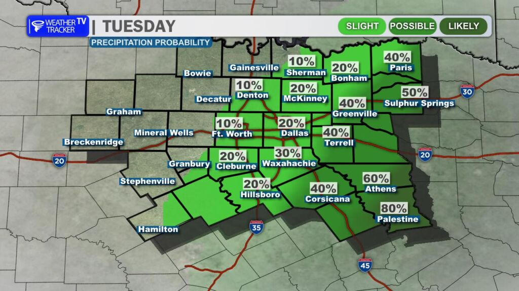
A few scattered showers are possible near and just ahead of the front, with the best chance focused southeast of the Dallas–Fort Worth Metroplex. If you do pick up a shower, rainfall amounts will be light – generally just a few hundredths of an inch, with isolated spots approaching a tenth of an inch at most.
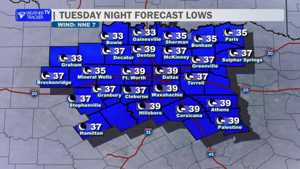
Tonight turns quiet as the system exits the area. Skies clear and colder air settles in, allowing overnight lows to fall into the 30s area-wide. A few locations near the Red River could briefly dip close to the freezing mark by early Wednesday morning.
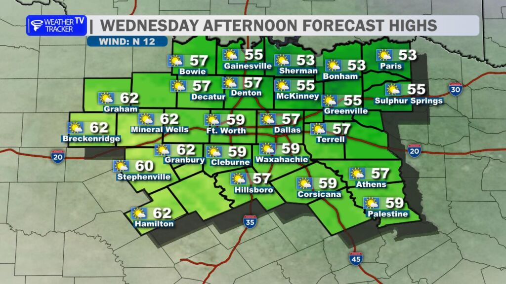
Wednesday will shape up to be the coolest day of the workweek. Clouds will increase through the day, and a gusty north wind will keep temperatures feeling even cooler than the numbers suggest. Afternoon highs will be limited to the 50s.
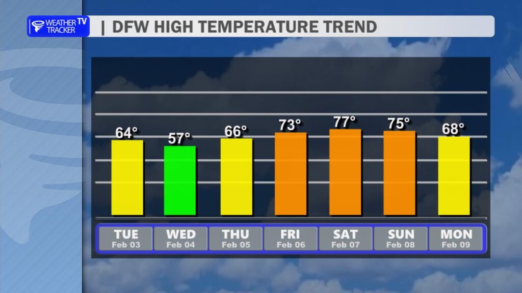
Looking ahead, a big warm-up is in store as we head toward the weekend. Temperatures rebound quickly, with highs soaring back into the 70s. By Saturday, a few spots across North Texas could even flirt with 80 degrees.