Good Sunday morning, North Texas!
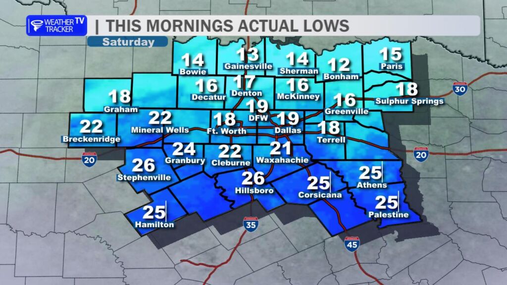
We’re starting the day off on another bitterly cold note, with early-morning lows dropping into the teens and 20s across the region. The good news? Today marks the beginning of a much-needed warming trend.

Sunshine will be the rule this afternoon, and a developing southerly breeze will help temperatures rebound nicely. Highs will vary quite a bit across the area – locations to the northeast, including around Paris, may still struggle to climb out of the upper 40s. Most of North Texas, however, will warm into the 50s, and it wouldn’t be a surprise to see a few spots in the Big Country, including near Breckenridge, briefly touch 60 degrees.
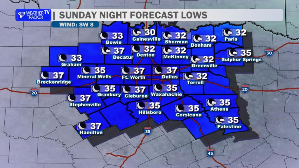
Tonight will be noticeably less cold. Overnight lows fall back into the 30s, with many locations remaining just above the freezing mark – welcome progress compared to recent nights.
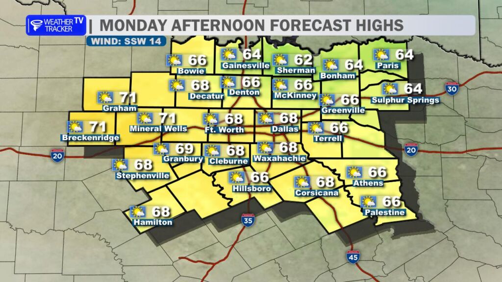
Milder weather really settles in on Monday as highs climb back into the 60s area wide. A steady south breeze continues through the day, and we’ll see an increase in high level cirrus clouds drifting in from the west by late afternoon and evening.
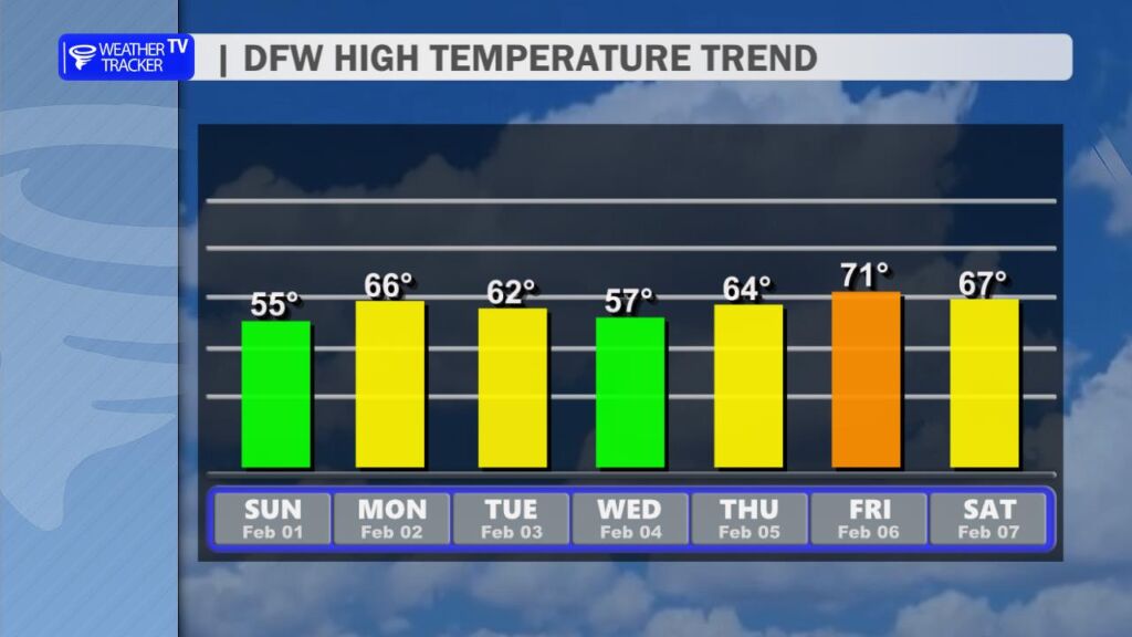
Looking ahead to the work week, temperatures stay much more comfortable than the deep freeze we experienced last week. Expect daytime highs generally in the 50s and 60s.
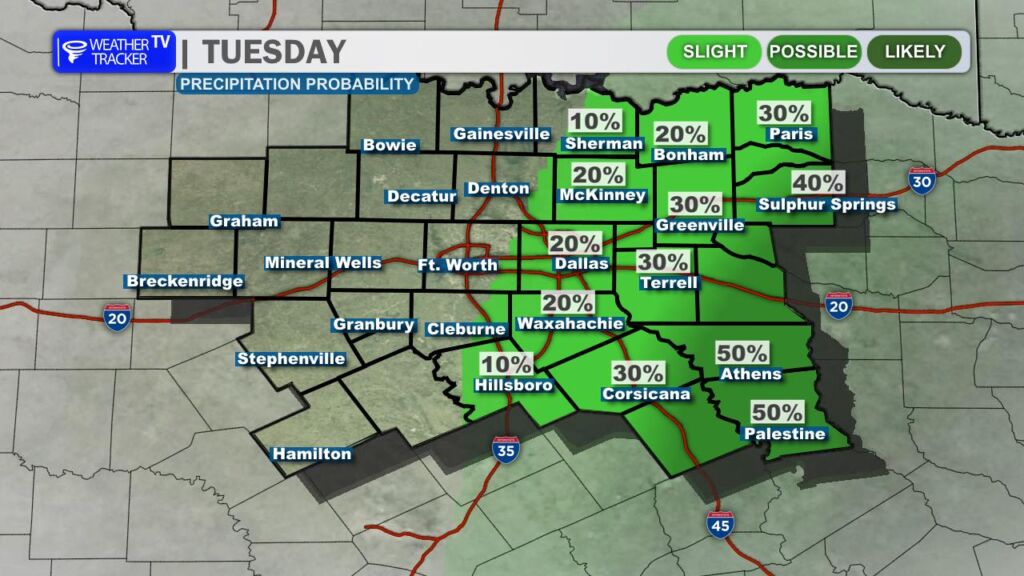
We are still tracking a chance for rain on Tuesday. The latest data this morning continues to favor rain coverage shifting southeast of the DFW Metroplex, with the best rain probabilities focused across our eastern and southeastern counties. We’ll continue to fine-tune that forecast as new data comes in.