North Texas finally saw some meaningful improvement this afternoon as temperatures climbed into the 40s across many locations. That thaw helped quite a bit – we saw melting on area roadways and better travel conditions compared to the past couple of days. The sunshine and above freezing temperatures definitely worked in our favor.
However, we have one more winter weather hurdle to get through tonight and into Wednesday morning.
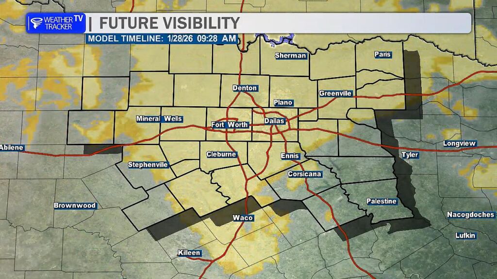
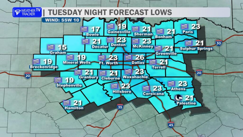
Widespread dense fog is expected to develop overnight as temperatures fall back into the teens and 20s. With readings dropping well below freezing, that fog will become freezing fog – and that’s where the concern ramps back up. Freezing fog can deposit a thin glaze of ice on elevated surfaces like bridges and overpasses, but it can also create slick spots on surface streets, especially in areas that still have lingering slush or compacted sleet.
In addition to icy spots, visibility may be significantly reduced at times – potentially dropping below one mile and even approaching near-zero in areas. That combination of low visibility and new ice development could make for an extremely treacherous Wednesday morning commute.
Now is the time to plan ahead. If you have flexibility to delay travel until later in the morning or closer to midday – when temperatures begin to rise and visibility improves – that would be a wise decision. Conditions should gradually improve once we get past mid-morning, but early travel could be hazardous.
If you have to be on the roads tonight or tomorrow morning – stay alert, allow extra time, and be prepared for rapidly changing conditions and visibility.