Good Monday morning, North Texas!
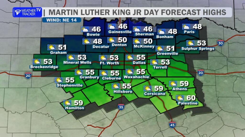
Another breezy cold front is moving through the region today, ushering in another cooler air mass. Skies will be partly cloudy, but temperatures will struggle to warm, with afternoon highs hovering near 50 degrees across the DFW Metroplex. A brisk north wind will add to the chill, remaining elevated throughout the day with occasional gusts up to 20 mph.
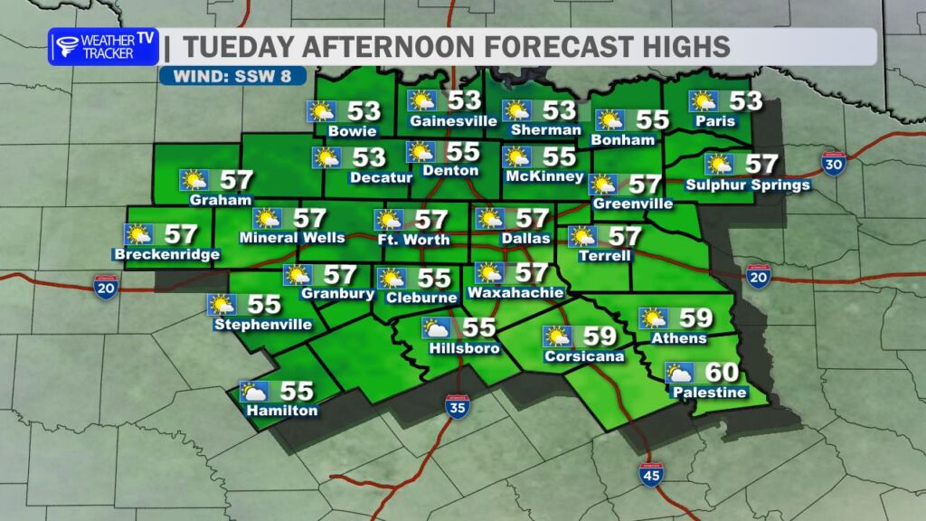
Conditions begin to improve on Tuesday as winds turn back to the south, allowing milder air to return. Expect partly cloudy skies and temperatures climbing into the mid-50s for most locations, making for a more comfortable afternoon.
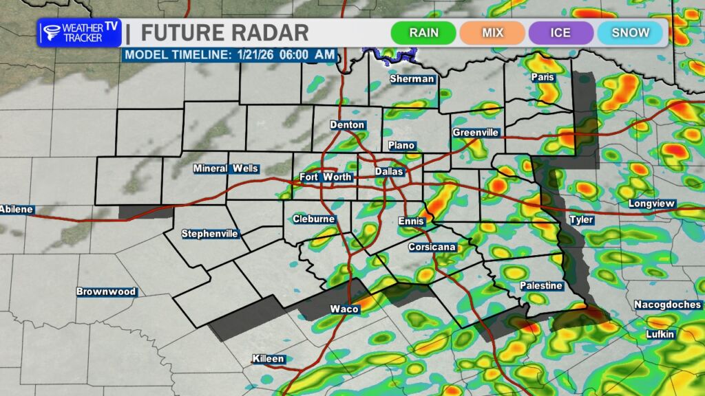
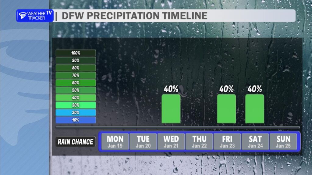
By Wednesday, moisture increases across the region, bringing scattered shower chances. Rainfall amounts look light overall, but it will be a cloudier and occasionally damp day. The highest rain probabilities appear to be east of the DFW area, with on-and-off showers possible through the day.
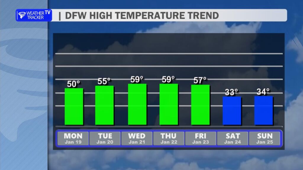
Temperatures through the remainder of the work week will remain fairly steady, with daytime highs staying in the 50s. However, the most significant weather story is shaping up late in the week. A powerful Arctic cold front is expected to arrive late Friday, likely becoming the strongest front of the winter season so far. This front will deliver sharply colder air, with weekend high temperatures struggling to rise above freezing.
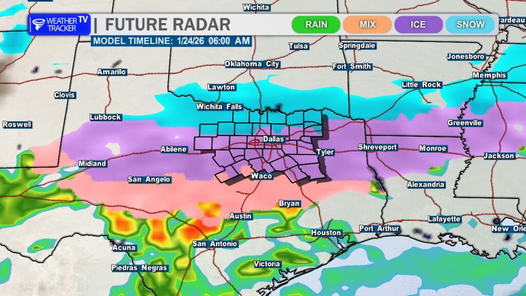
Adding to the concern, this Arctic air will be accompanied by precipitation chances. A wintry mix appears increasingly possible across North Texas beginning late Friday and continuing into Saturday. Current data suggests freezing rain may be the dominant precipitation type for much of the region, while areas closer to the Red River could see a mix of sleet and snow.
As with any potential winter weather event in North Texas, it is far too early to focus on exact details or impacts. Forecast confidence will continue to improve over the coming days as we get closer to the event. For now, the key takeaway is to prepare for very cold conditions and the potential for impactful wintry weather from late Friday through the weekend. Stay tuned for updates as the forecast evolves. -William