Good Saturday morning, North Texas!
Brrr – it’s a chilly start to the weekend across the DFW Metroplex and beyond. Many spots woke up this morning with temperatures in the low to mid 30s, and that blustery north wind is making it feel even colder out there.
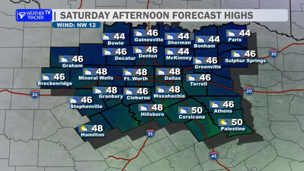
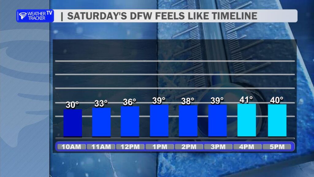
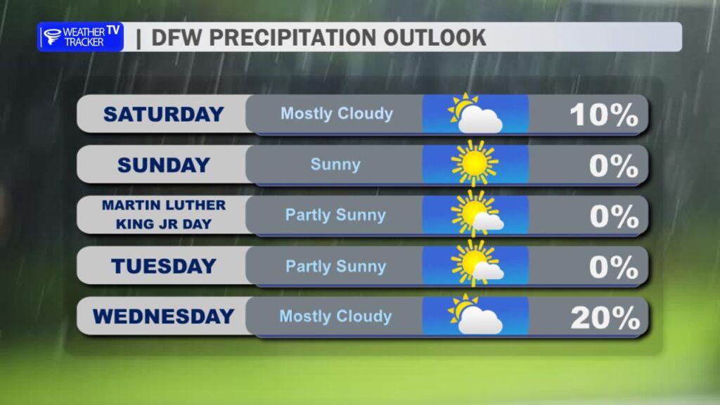
Mostly cloudy skies will stick around, with highs struggling to climb into the upper 40s. The persistent northerly wind will gust over 30 mph at times this afternoon – creating a raw, biting feel. Wind chills? Expect them to hover in the 30s for much of the day, so bundle up if you’re heading out.
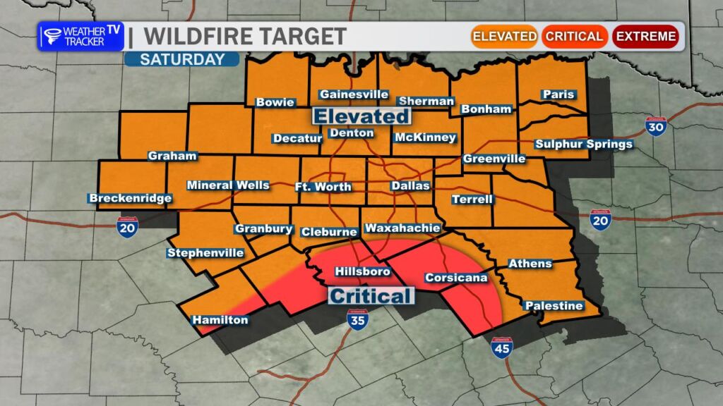
This setup is very similar to yesterday – those gusty north winds, combined with lower humidity and plenty of dry, winter-killed vegetation, are pushing elevated fire danger across much of the region today. Please avoid any open burning, be extra careful with anything that could spark (like outdoor grills or equipment), and help keep our area safe.
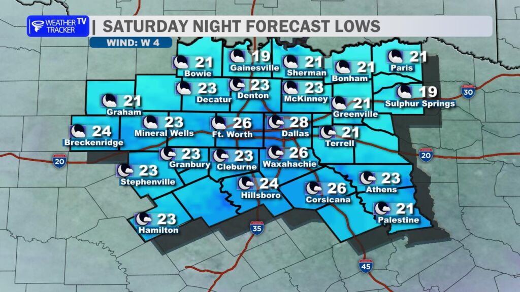
Tonight gets downright cold – lows will drop into the 20s for most locations, with a few spots along the Red River Valley possibly dipping into the teens. Protect the 4 P’s (pipes, plants, pets, and people): Bring outdoor pets inside if possible, or ensure they have warm, dry shelter with plenty of bedding. Cover sensitive plants and drip faucets to prevent frozen pipes.
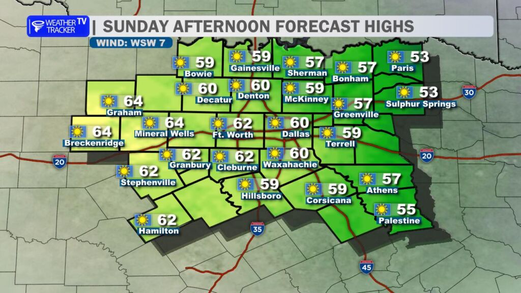
The good news? A nice rebound is on the way for Sunday. Expect mostly sunny skies, light south winds returning, and highs climbing back to around 60° – a much more comfortable day to enjoy the weekend outdoors.
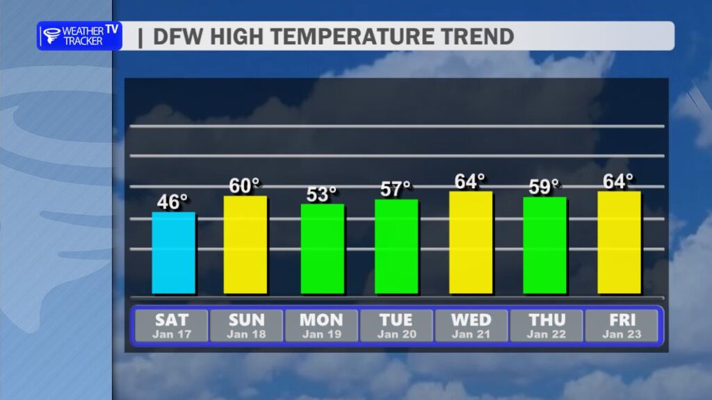
Looking into the work week ahead: Things trend a bit cooler overall, with highs generally drifting back into the 50s under partly to mostly sunny skies early in the week. We’re still keeping an eye on rain chances for Wednesday – scattered showers look possible (especially Wednesday morning), but totals should stay relatively light at this point. No major storm systems on the horizon yet, but we’ll update as details firm up.
Stay warm out there today, everyone. -William