Good Thursday morning, North Texas!
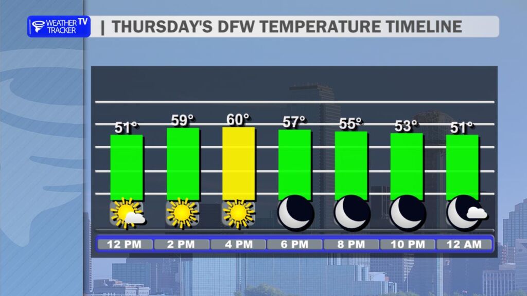
Hope you’re enjoying that bright sunshine already. Today looks like a classic split-weather day across the region, with a milder south wind gradually taking over.
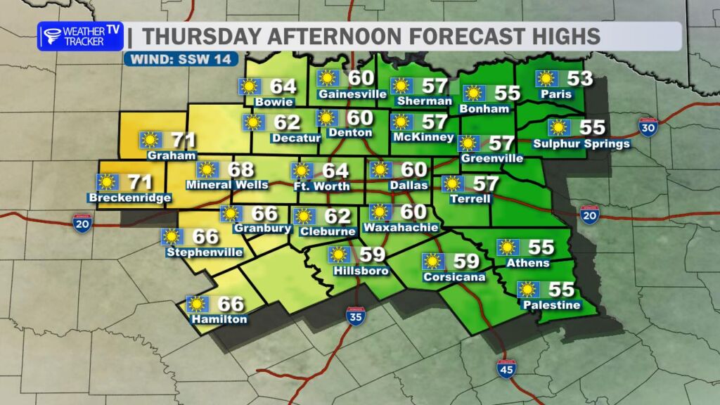
- Western counties (think areas west of I-35W/I-35) should see the milder air arrive sooner – expect pleasant daytime highs in the 60s to near 70° under mostly sunny skies. Perfect for getting outside.
- Eastern counties will hang onto variable winds a bit longer, keeping things cooler with highs mostly stuck in the 50s. Bundle up if you’re out that way.
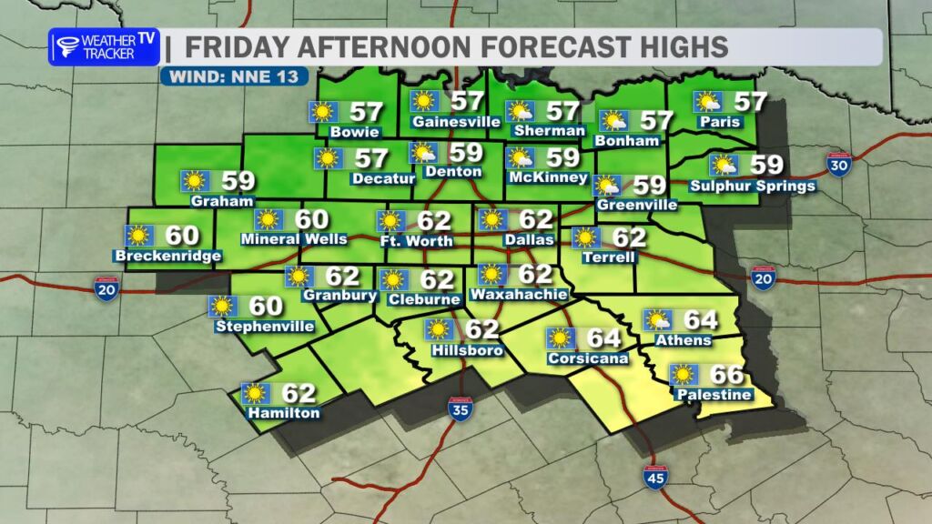
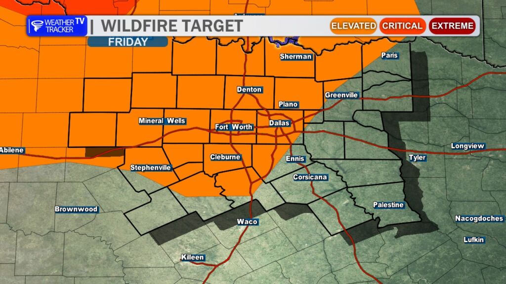
Looking ahead, a weak but breezy cold front pushes through early tomorrow (Friday). Expect gusty northerly winds developing, with peak gusts possibly exceeding 35 mph – hold onto your hats. Daytime highs will cool to a mix of 50s and 60s, and with dropping humidity, elevated fire danger returns across much of the area. Stay fire-smart, especially if you’re burning or outdoors.
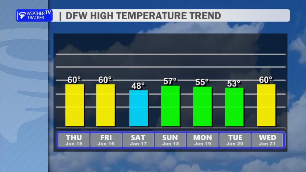
This sets up a noticeably chillier weekend:
- Saturday: Highs struggle into the 40s across the Metroplex, with 50s possible farther out.
- Sunday: A rebound to a mix of 50s for most spots.
The real story comes Saturday night into Sunday morning – a widespread freeze looks very likely across North Texas, with temps dipping at or below freezing for several hours. Protect those plants, pipes, and pets.
Have a fantastic Thursday. -William