Good Wednesday morning, North Texas!
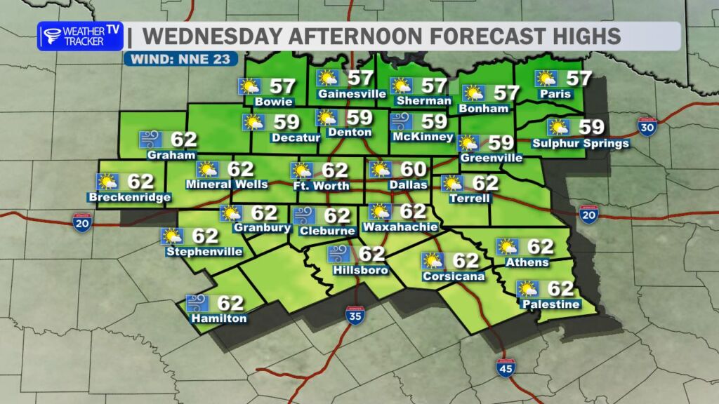
A windy cold front pushed through the area early this morning, ushering in cooler and drier air behind it. While there’s no strong Arctic blast on the way, the post-frontal pattern will keep temperatures held down this afternoon – expect highs mostly in the upper 50s to low 60s under mostly sunny skies. (Some spots west of I-35 could nudge a bit higher, but the breeze will make it feel crisper.)
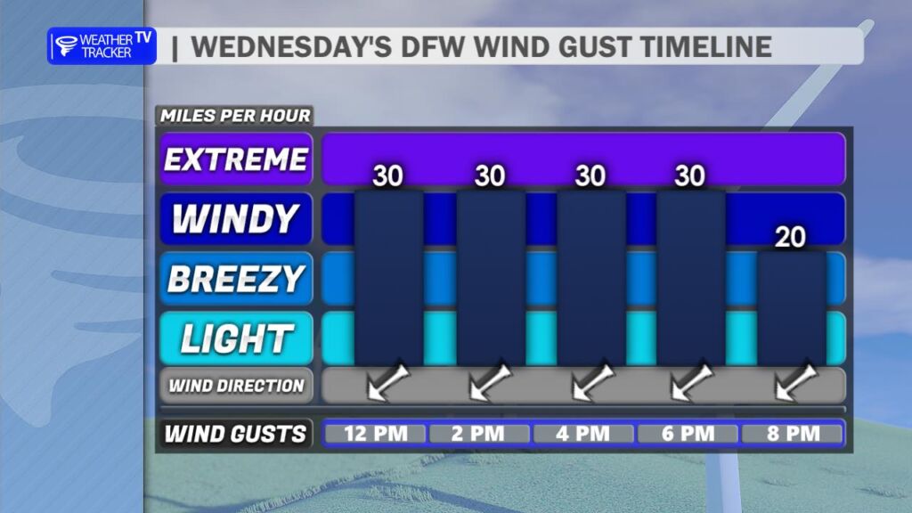
Winds will stay gusty out of the north/northeast at 15-25 mph, with frequent gusts over 30 mph (possibly up to 35 mph in open areas) through the afternoon. Hold onto those hats and secure any loose items outdoors.
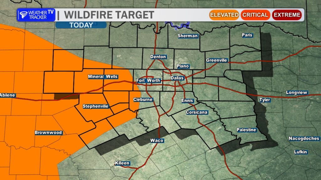
These strong, dry northerly winds are combining with low humidity (dropping into the 20-30% range, especially west of I-35) to elevate fire danger across much of the region – particularly in the Big Country, our western counties, and rural areas with dry grasses. Any outdoor burning is strongly discouraged today – check local burn bans and avoid anything that could spark. Better safe than sorry with these conditions.
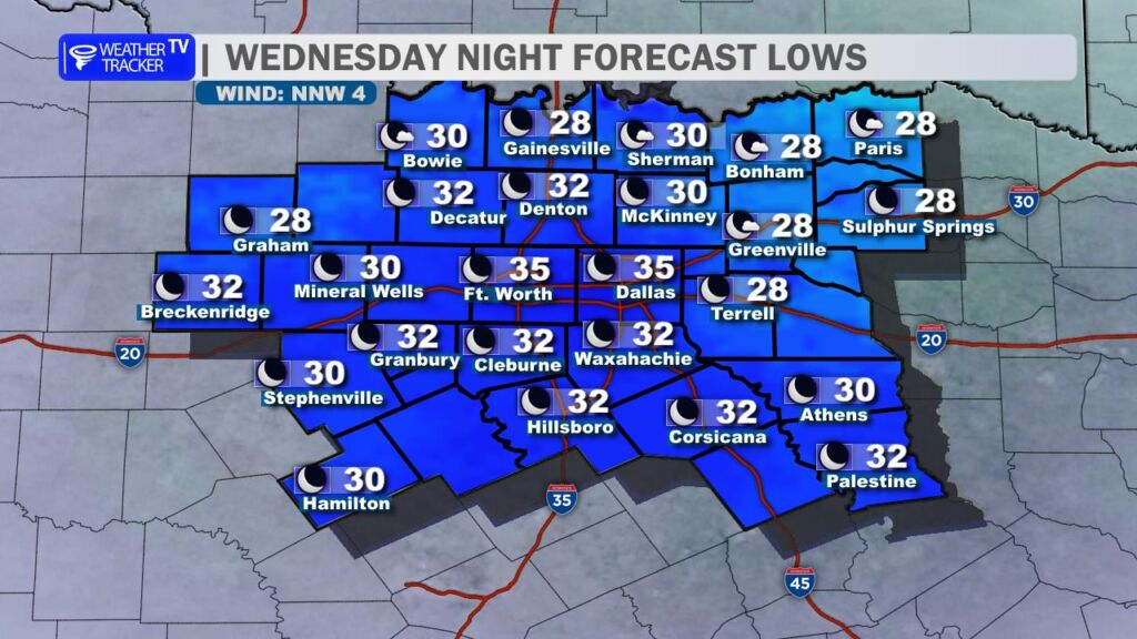
Tonight turns noticeably colder under clearing skies, with lows dipping into the low to mid-30s – most of North Texas will start Thursday at or below freezing for a light freeze.
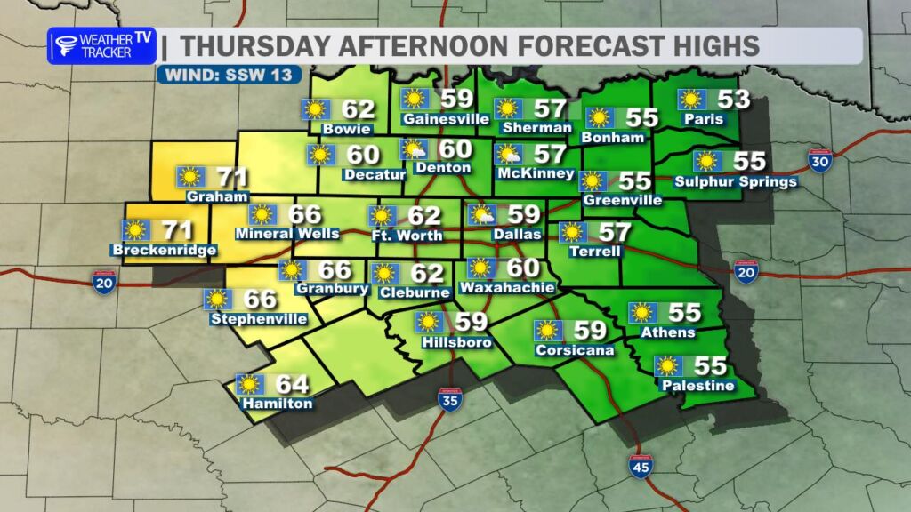
Thursday brings a welcome rebound: Bright sunshine dominates, and milder southerly winds return. Highs will vary across the area – upper 50s east of DFW, climbing into the low to mid-60s (and near 70° possible) west of DFW. A beautiful day ahead.
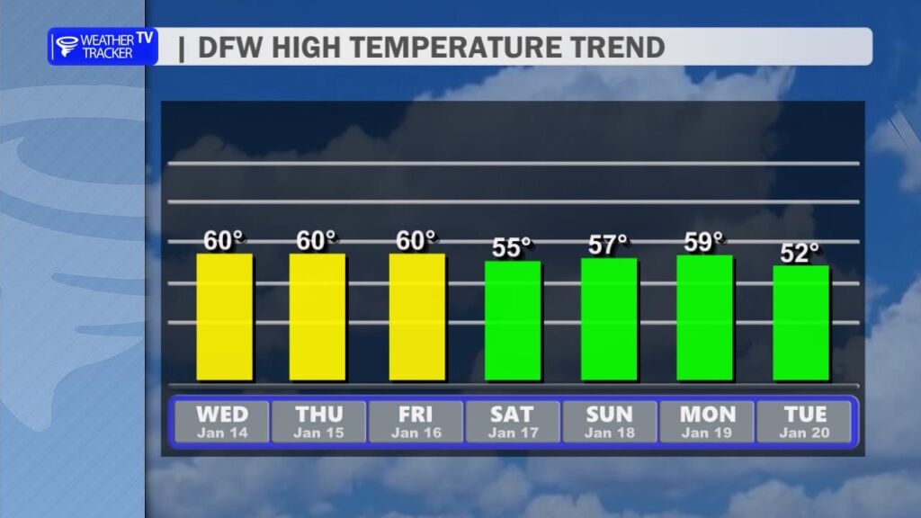
Then, another cold front arrives Friday, setting us up for a cool, dry weekend. Highs stay in the mid-50s both Saturday and Sunday, with mostly sunny to partly cloudy skies and no precipitation in sight. Overnight lows will flirt with freezing again Friday and Saturday nights. -William