Good Wednesday morning, North Texas!
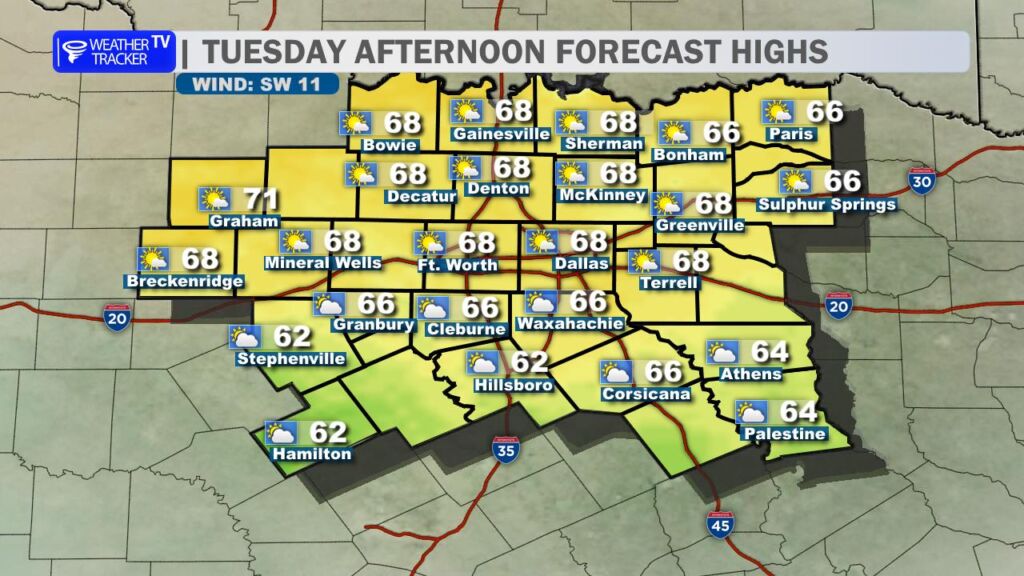
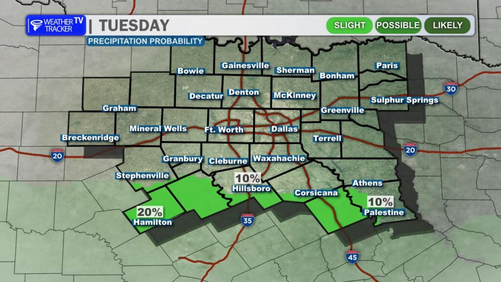
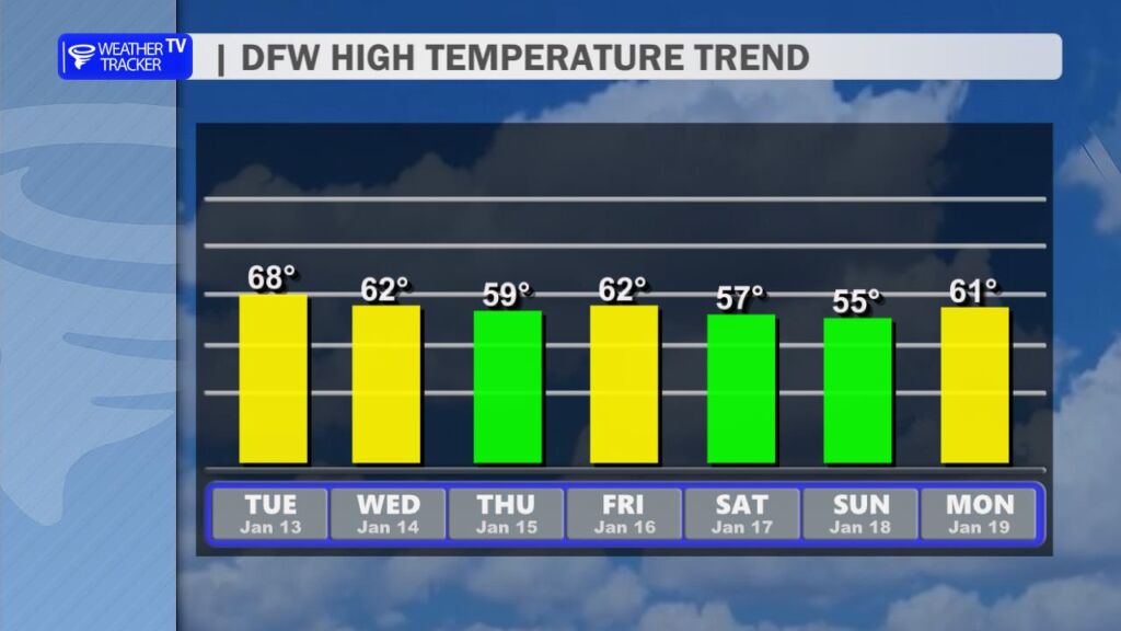
We’re kicking off the day with a pleasantly mild pattern across the region. Expect a nice mix of sunshine and clouds this afternoon, with thicker cloud cover building across our southern counties. A few isolated sprinkles can’t be ruled out down there, but most spots stay dry. High temperatures will climb into the 60s area-wide, boosted by a gentle southwest breeze – perfect for getting outside without needing a heavy coat.
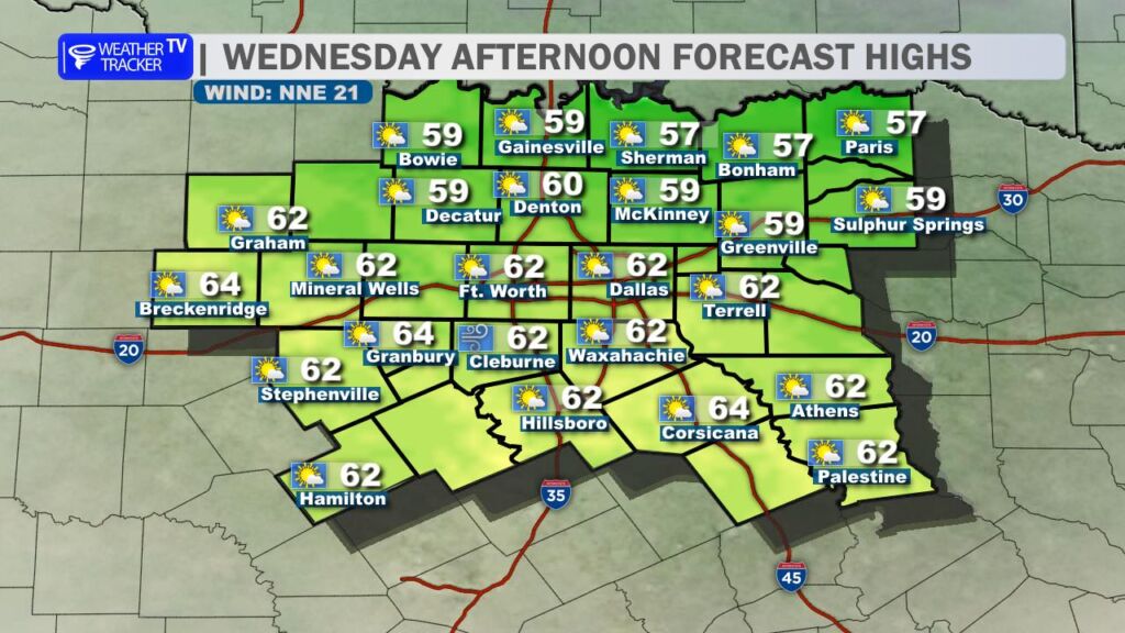
Turning to Wednesday: A gusty cold front pushes through early in the day, shifting winds to a brisk northerly direction with gusts over 30 mph possible (and potentially higher in spots). Highs will be a bit cooler, ranging from the 50s in some northern areas to the 60s farther south. This is a winter cold front, but it won’t deliver a deep chill – thanks to the dry air mass behind it, temperatures rebound fairly quickly.
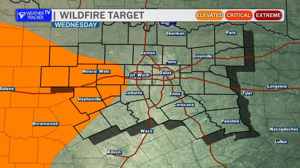
Those strong winds combined with dry, dormant grasses mean we’ll need to keep an eye on grass fire concerns. Conditions are ripe for fast-moving fires if any sparks occur, so avoid outdoor burning, and be cautious with equipment.
Into the extended forecast:
- Thursday looks cool but winds ease.
- Temperatures rebound into the low 60s by Friday, but another weak cold front arrives.
- Highs nudge back down into the 50s for Saturday and Sunday.
Overall, the pattern stays predominantly dry through the next 7-10 days – no major rainmakers on the horizon just yet. That said, longer-range signals (9-12 days out) are hinting at some potential precipitation chances as we head deeper into mid-to-late January. We’ll monitor that closely for any shifts toward more active weather. -William