Happy Sunday, North Texas!
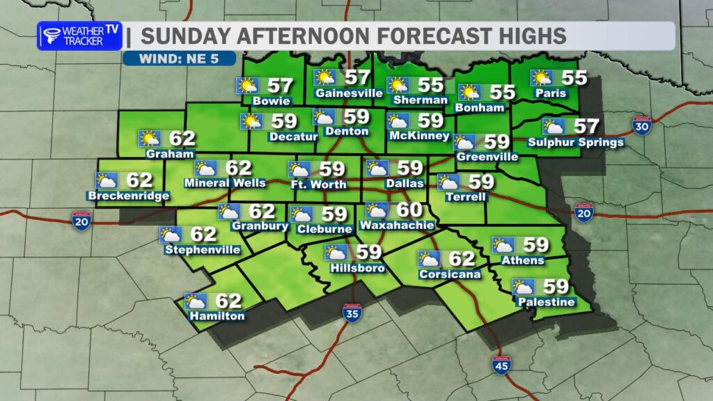
We’re enjoying a classic cool but seasonal January day across the region today. Highs are climbing into the upper 50s to low 60s (think around 58–60° in the Dallas-Fort Worth Metroplex), feeling comfortable for mid-January with light northerly breeze. A stream of high clouds is filtering across the sky.
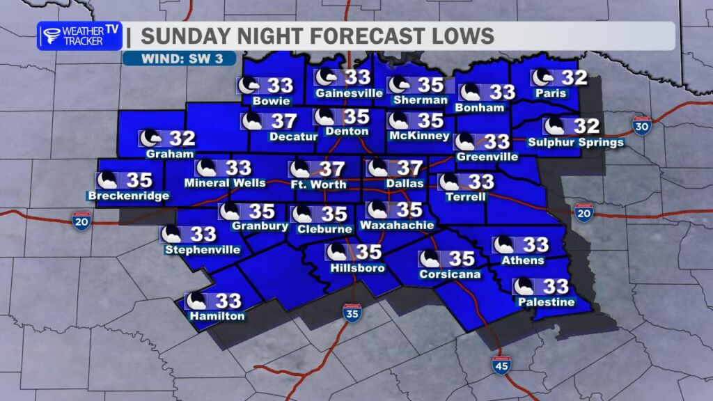
As the sun sets, temperatures will drop quickly. Expect a chilly night ahead with lows falling into the mid-30s across the Metroplex, while more rural and outlying areas could dip close to or even touch the freezing mark. A light southerly wind will gradually return overnight under fair to partly cloudy skies, helping set the stage for tomorrow.
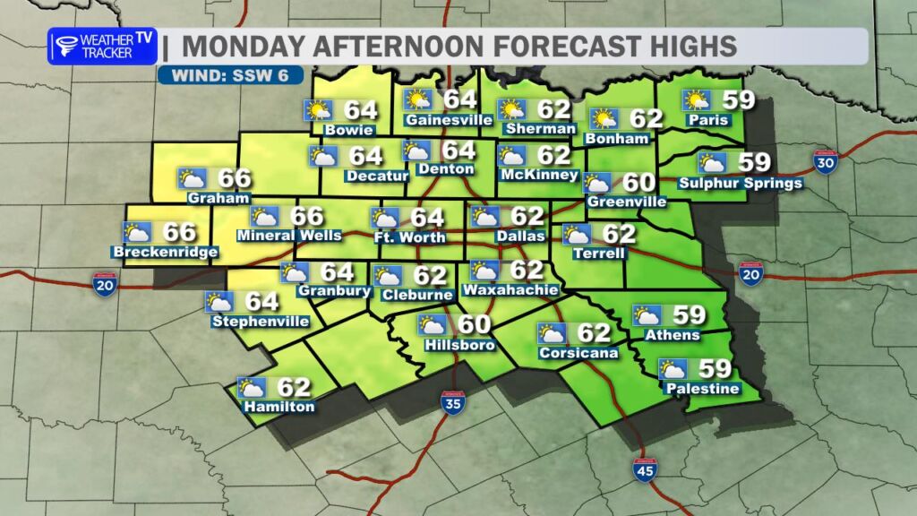
Monday looks very similar – back to work with the same pattern of high clouds lingering overhead and light southerly winds. Daytime highs should be a notch milder, reaching the low to mid-60s, staying pleasantly above average for this time of year.
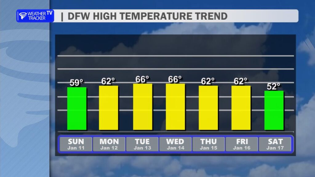
The rest of the work week continues the trend: mostly dry conditions with temperatures trending slightly warmer than seasonal normals, generally in the low to mid-60s during the afternoons. No major warm-up or cold snap is on the horizon, just steady, comfortable January weather.
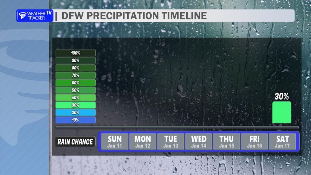
Looking further ahead, the latest data shows the dry stretch persisting through most of the week. That potential rain chance late Friday into Saturday is trending less promising this morning – precipitation probabilities have dropped, so it could stay mostly dry with only a slim shot of showers. We’ll keep an eye on any updates as the models refine.
Have a great Sunday! -William