Happy Friday, North Texas!
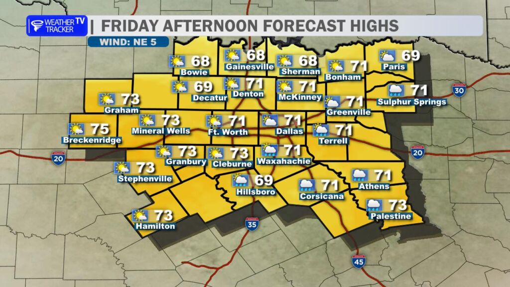
We’ll enjoying one more mild, almost spring-like afternoon today before a classic cold front sweeps through later this evening and tonight. Daytime highs will climb into the upper 60s to low 70s across much of the region (think Dallas-Fort Worth area pushing toward 68-71°), with plenty of sunshine mixing in some clouds.
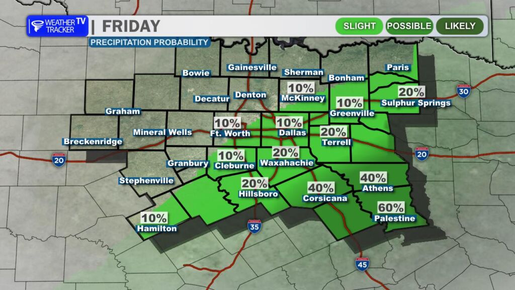
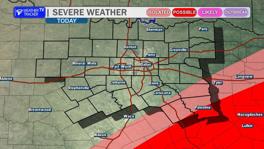
As the front approaches from the north and pushes into our southeastern counties this evening, a few scattered thunderstorms could fire up right ahead of it. While widespread severe weather isn’t expected, a couple of these storms could turn marginally severe – watch for brief gusty winds up to 60 mph and small hail around quarter size. The main threat window is late afternoon through early evening.
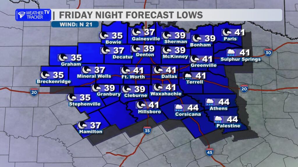
Behind the front, expect gusty north winds to really kick up overnight – gusts over 30-40 mph are likely for several hours, making it feel even chillier. Lows will drop into the 30s and 40s by Saturday morning, a noticeable cooldown from recent days.
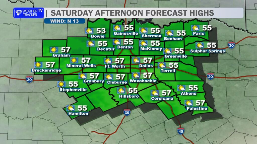
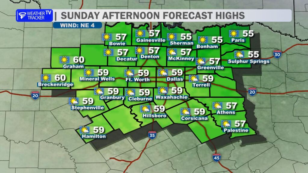
The weekend looks much cooler and more typical for January, with highs only reaching the mid-50s both Saturday and Sunday under mostly sunny skies. Winds lighten up nicely, staying out of the north but much gentler.
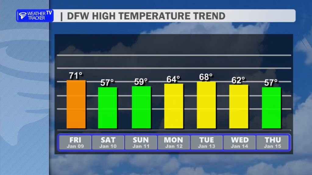
Looking ahead, temperatures will gradually rebound next week. Expect highs climbing back into the 60s next week. Another cold front arrives next Wednesday. The forecast stays dry overall – no meaningful rain chances in sight, which unfortunately continues our ongoing drought concerns in parts of North Texas.
Have a great Friday, everyone! -William