Good Tuesday morning, North Texas!
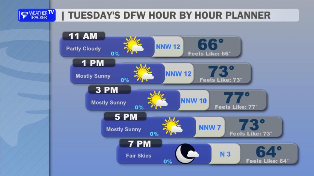
What a fantastic way to kick off the new year – we’re still riding that unseasonably warm wave across the Dallas-Fort Worth Metroplex and beyond. With a weak cold front easing through the region today, expect a light northwest breeze to help sweep away some of that lingering humidity, making it feel even more comfortable outdoors.
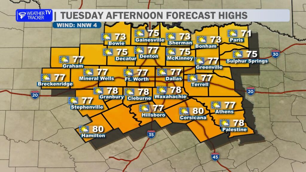
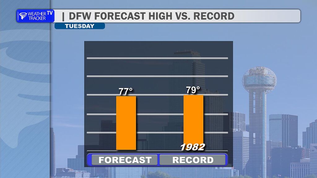
Skies will stay partly cloudy at times, but plenty of sunshine will push afternoon temperatures into the mid to upper 70s for most spots. My forecast high today is right around 77° – that’s close to the daily record of 79°, which was set back on January 6, 1982. We’re definitely in record-challenging territory, so enjoy this spring-like feel while it lasts.
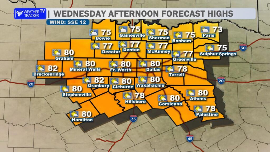
Wednesday shapes up very similar: partly to mostly cloudy skies as a southeast wind starts to redevelop ahead of the next weather system moving in from the west. Highs will again climb well into the upper 70s (potentially flirting with 78° in the Metroplex), keeping things mild and breezy.
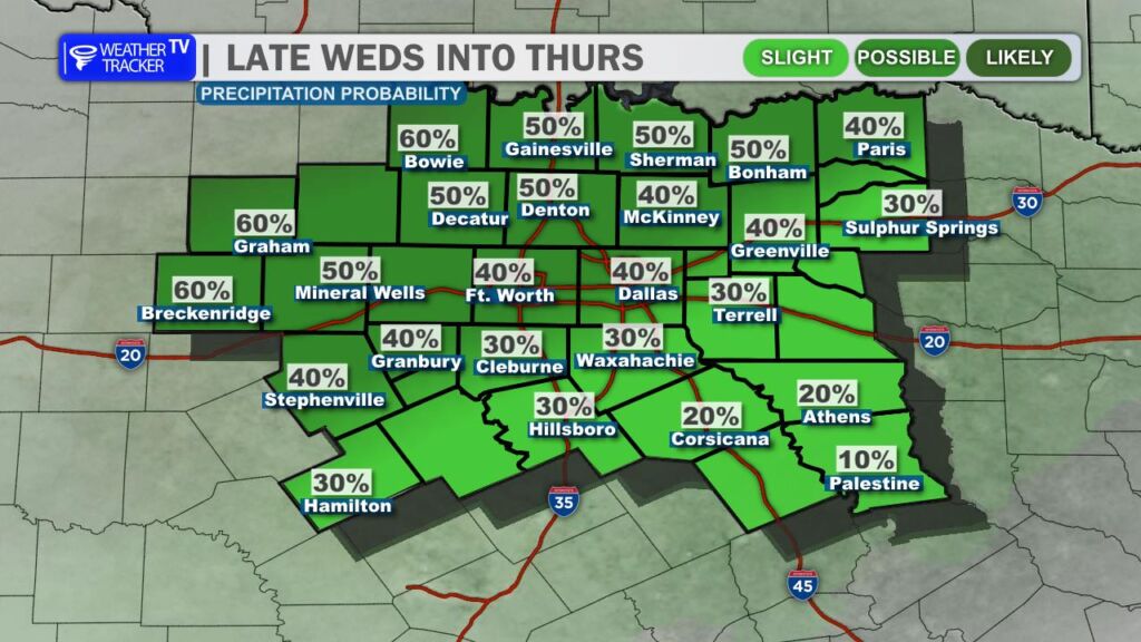
The bigger change arrives late Wednesday night into Thursday, as that storm system brings our next shot at measurable rain. The best chances look to stay north of I-20, with scattered showers possible (maybe a few rumbles of thunder in spots). Rainfall should remain on the light side overall – think 0.10″ to 0.25″ in most areas, though a few lucky (or unlucky, depending on your plans) spots could pick up a bit more locally. South of I-20, many places may stay mostly dry.
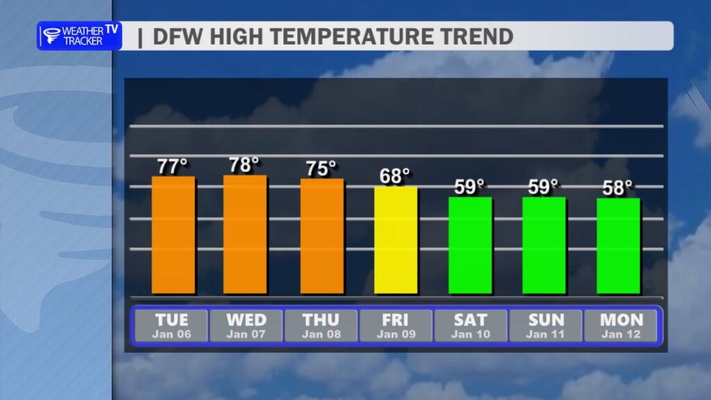
By Friday, the cold front sweeps through and finally ushers in a more typical winter feel. Highs drop noticeably into the mid to upper 60s initially, then cooler still over the weekend and into early next week – expect afternoon temperatures mostly in the 50s and lower 60s. Overnight lows will dip into the 30s and 40s, so grab those jackets and light layers.
This cooldown should stick around for a good stretch, with 50s dominating highs into much of next week. No major storms or deep freezes on the horizon yet – just a refreshing return to more seasonal conditions after this unusually toasty start to January.