Good Monday morning, North Texas!
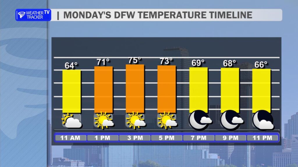
We’re kicking off the week with a classic North Texas winter scene: low gray cloud cover hanging around this morning, along with some patchy fog in spots across the region. Visibility might be a bit reduced early on, so take it easy on the roads if you’re heading out.
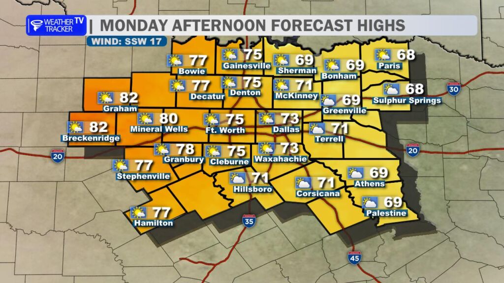
The good news? Things improve quickly as we move into the afternoon. Skies will gradually clear to partly sunny conditions, and temperatures are staging a nice rebound. Expect widespread highs in the 70s across the Metroplex, with some spots – especially out in the Big Country (think Graham, Breckenridge and Mineral Wells) – pushing into the low to mid 80s. It’ll feel almost spring-like for early January.
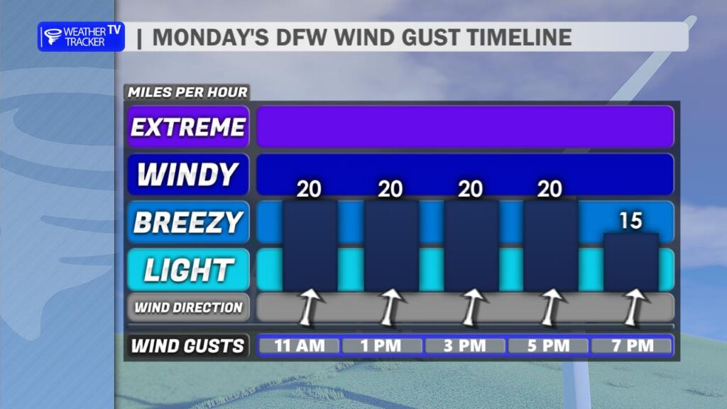
Winds will be noticeable this afternoon, with gusts easily topping 25 mph (and potentially higher in open areas), so hold onto your hats if you’re outside.
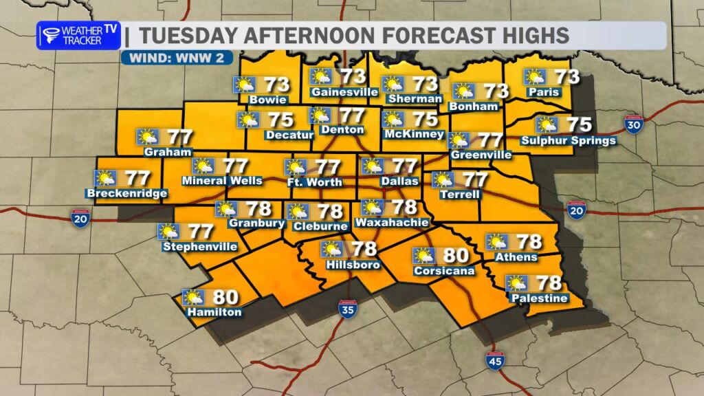
Looking ahead, the mild pattern sticks around for Tuesday. Mostly sunny skies, lighter winds, and highs once again climbing into the 70s area-wide. A very comfortable day to get things done outdoors.

The first real chance for rain returns on Thursday, as a weather system moves in. We’re tracking scattered showers and the possibility of a few rumbles of thunder, mainly focused from the Metroplex northward toward the Red River Valley. Farther south and west, chances look lower at this point. Rainfall should stay on the light side – most areas picking up 0.10 to 0.25 inches, with no severe weather expected.
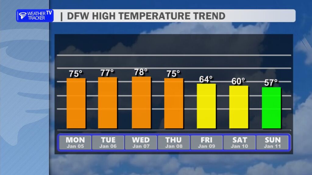
After this stretch of unseasonably mild temperatures, a cool-down arrives heading into the weekend. Highs will drop back into the 60s for Friday through Sunday, feeling more typical for January.
Have a great Monday, everyone -William