Happy Friday, North Texas!
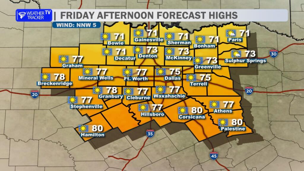
We’re kicking off the weekend with another beautifully warm afternoon – expect plenty of sunshine and highs climbing into the mid-70s (around 74-75° in most spots). A weak cold front will slide through this afternoon into the evening, bringing a shift to a fresh northerly breeze, but it won’t feel dramatic during daylight hours.
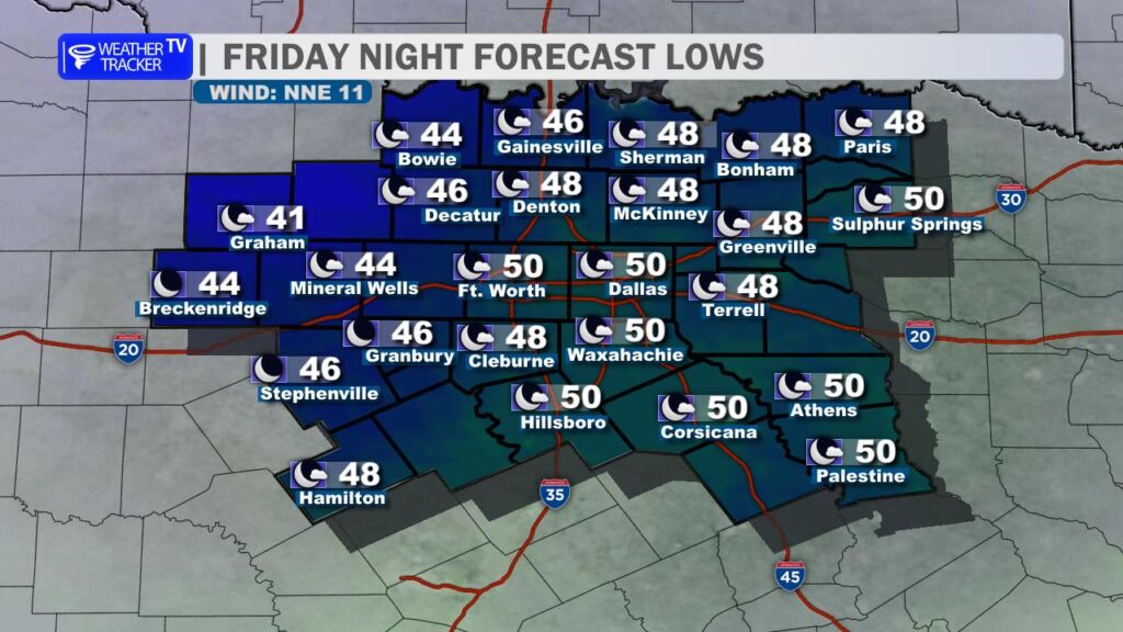
Tonight cools things down noticeably – lows will settle into the upper 40s to around 50°. It’ll feel chilly but not bitter, with mostly clear skies to start the evening.
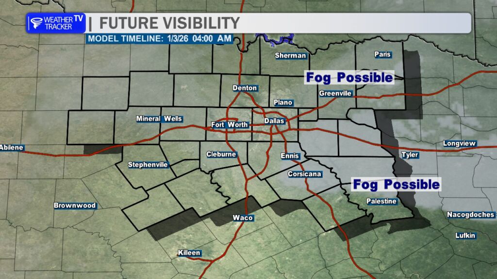
Saturday morning could bring a foggy start, especially from the I-35 corridor eastward (think DFW metroplex and points toward East Texas). Low grey clouds and patchy fog are likely in those spots, so take it easy on the roads if you’re heading out early.

Once the sun burns through, skies clear up nicely on Saturday with comfortable highs in the upper 60s (around 68°). A light north wind will keep things crisp and refreshing.
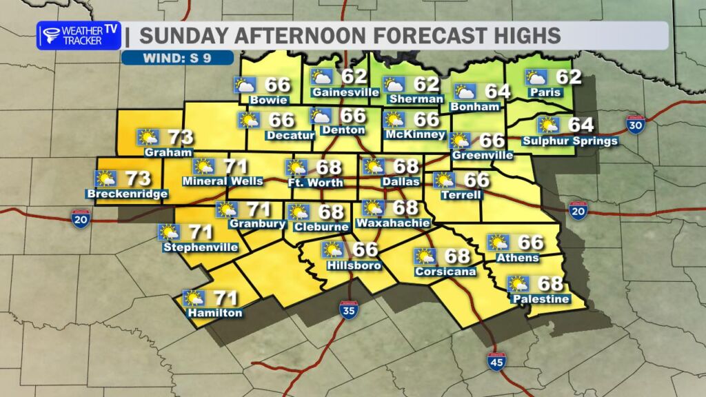
Sunday stays pleasant too – mostly sunny, highs again in the upper 60s (near 67°), perfect for getting outside to enjoy the weekend.
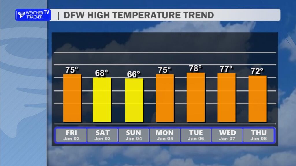
Looking ahead, a nice warming trend takes hold starting Monday. Expect highs jumping back into the mid-70s Monday, then climbing toward the upper 70s (possibly near 78°) by Tuesday. It’ll feel more like spring than early January.
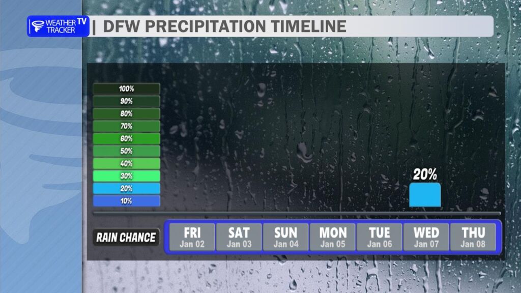
The latest model data still points to our next shot at rain and possible thunderstorms arriving Wednesday into Wednesday night. The better chances look to favor areas from the I-35 corridor eastward, with the highest probabilities overnight Wednesday. Right now it’s looking like a decent but not overwhelming setup – keep an eye on updates as we get closer, since timing can shift.
Have a fantastic Friday and a great weekend, everyone. -William