Here’s a look at our Friday evening commute in the DFW Metroplex.

Here’s a look at our Friday evening commute in the DFW Metroplex.

Here’s a look at Live Temperatures across North Texas, MesoScan Radar and the Updated Forecast Map.
DFW THIS AFTERNOON Sunny. Highs in the mid 80s. Southwest winds 5 to 10 mph. -William


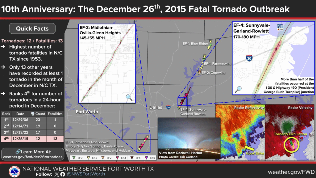
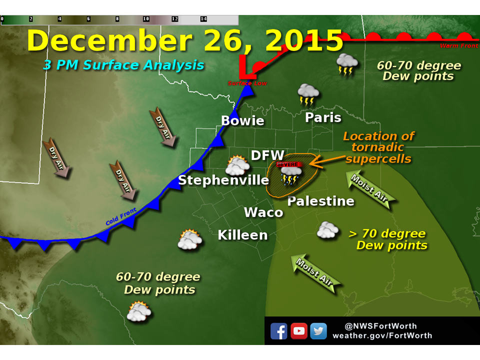
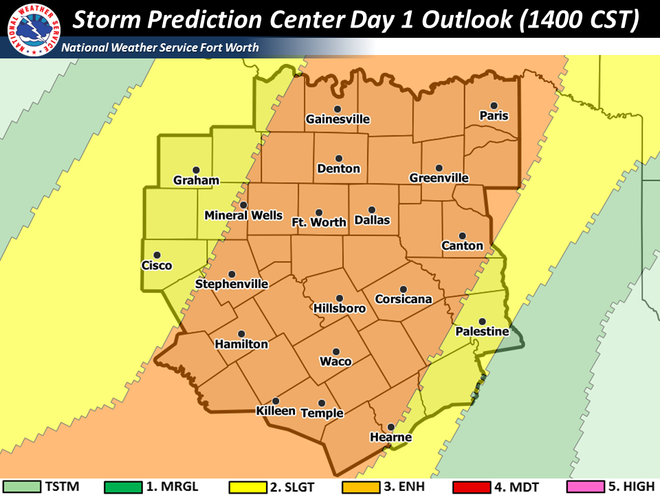
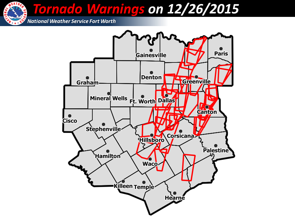
On December 26, 2015, a powerful storm system unleashed a rare December tornado outbreak across North and Central Texas, catching many residents off guard during the post-holiday period. The National Weather Service confirmed 12 tornadoes in the region within a 24-hour timeframe, impacting eight counties in the DFW metroplex and beyond.
The outbreak ranks as the deadliest tornado event in North Texas since 1953 (and specifically since the 1957 Dallas tornado in some local records), claiming 13 lives and injuring hundreds more. It also stands out historically as one of the most significant December tornado events in the area, with tornadoes recorded in December in North Texas in only about 13 other years since reliable records began.
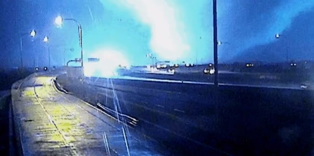
The most devastating twister was a violent EF-4 wedge tornado that carved a 13-mile path from Sunnyvale through Garland and Rowlett in Dallas and Rockwall counties. With peak winds estimated at 180 mph and a maximum width of 550 yards, it crossed Interstate 30 near the President George Bush Turnpike, where many of the fatalities occurred—several victims were in vehicles that were lifted and thrown from the highway. The tornado destroyed or severely damaged hundreds of homes and businesses, leaving widespread devastation in suburban neighborhoods.
Here are some striking views of the destruction in Rowlett and Garland:
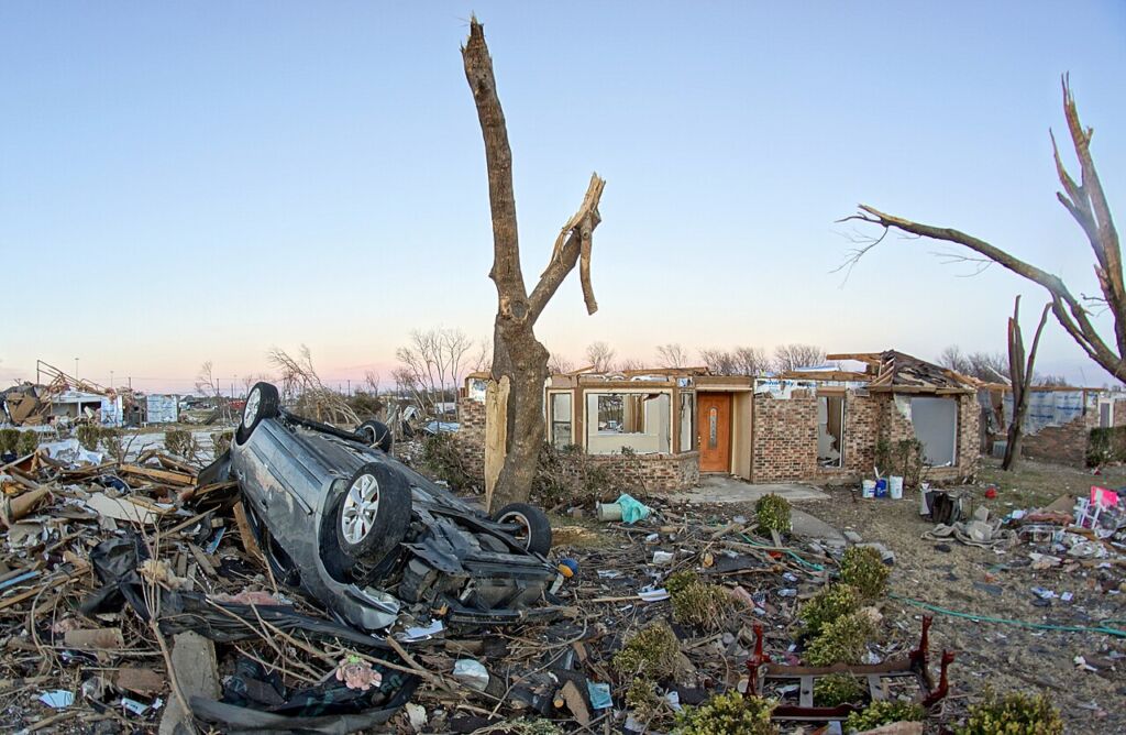
These images capture the scale of the damage, with homes reduced to slabs and debris scattered across communities.
Other notable tornadoes included an EF-3 that tore through Ovilla and Glenn Heights (destroying homes, churches, and injuring dozens) and an EF-2 in Copeville that claimed additional lives.
The outbreak ranks #4 (or sometimes noted as #3 in some analyses) for the number of confirmed tornadoes in a 24-hour period in North Texas during December, highlighting how unusual and intense the event was for winter.
This tragedy underscored the unpredictability of severe weather even in the off-season, prompting renewed focus on warning systems and preparedness in the DFW area. Recovery efforts rebuilt much of the affected neighborhoods, but the event remains a somber reminder of nature’s power.
Here is a look at Actual Lows from around North Texas this morning.

Actual Lows from around the Dallas – Fort Worth Metroplex this morning.

Here’s a look at our Friday planner for the DFW Metroplex.

Good Friday morning, North Texas! I hope everyone had a wonderful Christmas. As we wrap up the holiday week, we’re still basking in an impressive December heat wave that’s made this feel more like spring than winter.

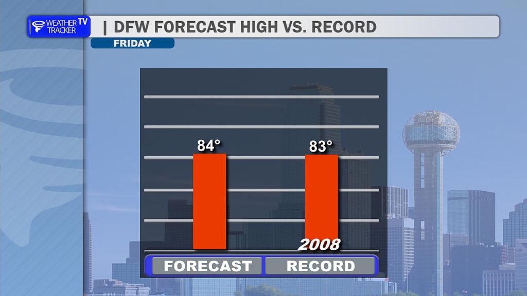
Today (December 26, 2025), expect partly cloudy skies with a light southwest breeze keeping things comfortable. Highs will climb into the mid-80s – my forecast calls for around 84° across much of the DFW Metroplex. That’s right on the edge of tying or breaking the daily record high of 83° set back in 2008.
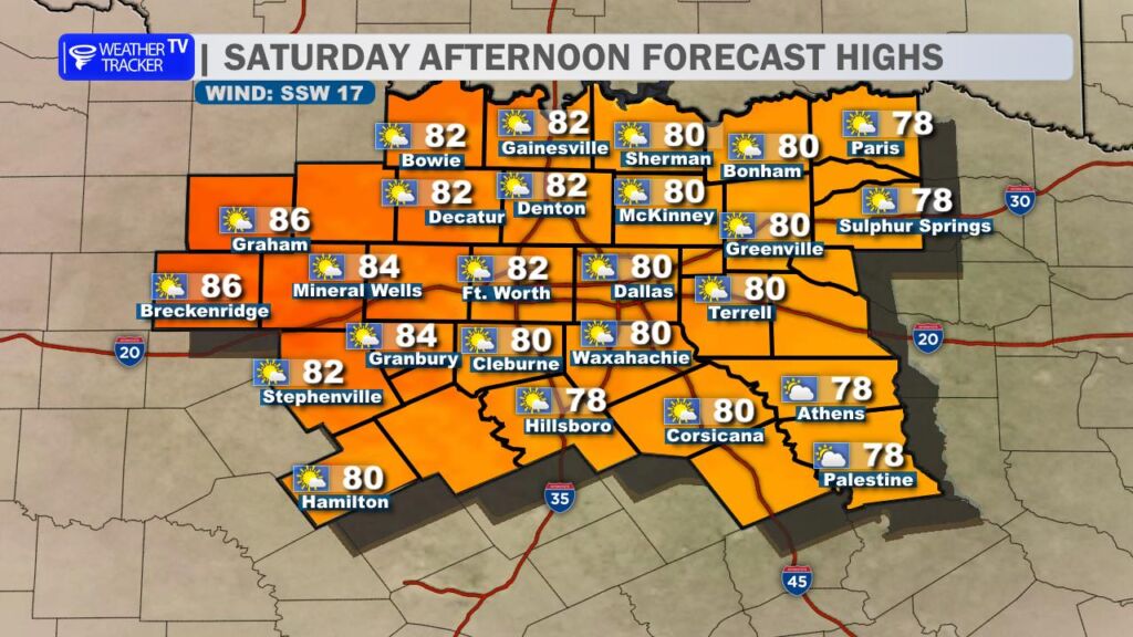
Saturday looks similar – more record heat possible with highs again pushing into the low to mid-80s under mostly sunny skies. However, increasing cloud cover could creep in from the east, potentially holding temperatures in the upper 70s for our eastern counties (think Sulphur Springs, Athens and Palestine).
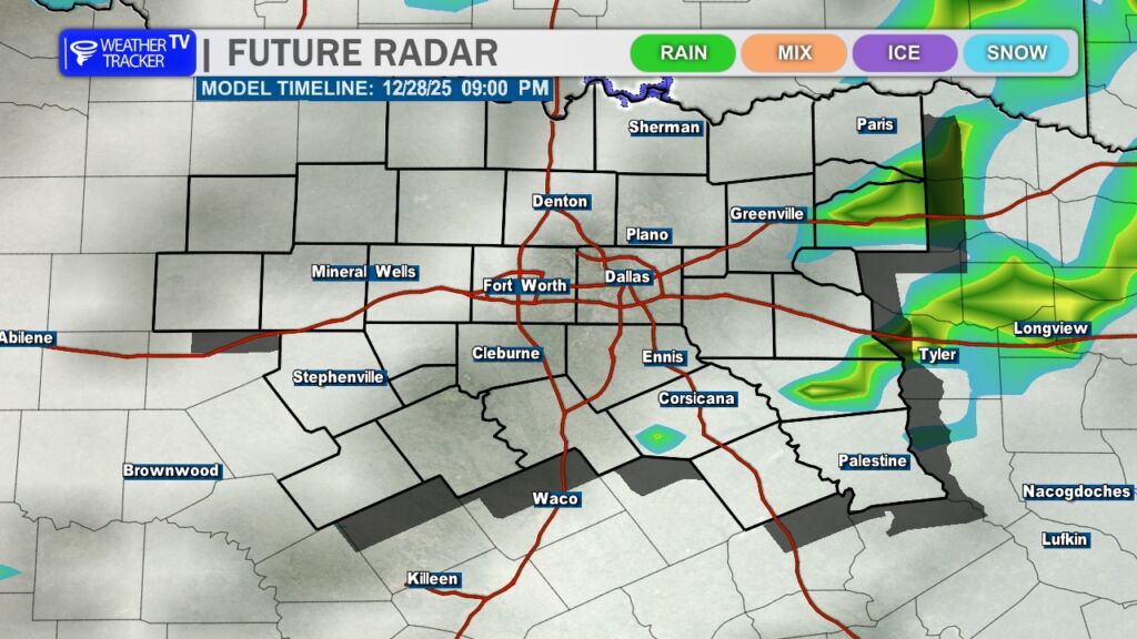
The big change arrives late Sunday as a strong Arctic cold front sweeps through. Expect howling northerly winds gusting strong, along with a few scattered showers and possible thunderstorms, especially near and ahead of the front. Rain chances are highest southeast of the Metroplex.
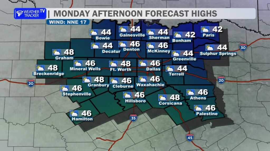
This front will deliver a dramatic cooldown – Monday’s highs will struggle to reach the upper 40s with brisk northerly winds making it feel even chillier. Bundle up!
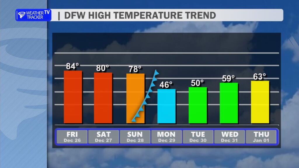
After that sharp drop, temperatures will gradually rebound as we head into the final days of 2025. Expect highs climbing back into the 50s and eventually the 60s by mid-next week, bringing us more typical late-December conditions.
Get ready for that winter wake-up call. Have a great Friday! -William

DFW TODAY…Sunny. Highs in the lower 80s. Southwest winds 5 to 10 mph. -William


Here’s a look at our Friday morning commute in the DFW Metroplex.

Here’s a look at MesoScan Radar and Live Temperatures across North Texas.
DFW TODAY Sunny. Highs in the lower 80s. Southwest winds 5 to 10 mph.
Here’s a look at our Thursday late evening planner for the DFW Metroplex.
