Good Monday morning, North Texas!
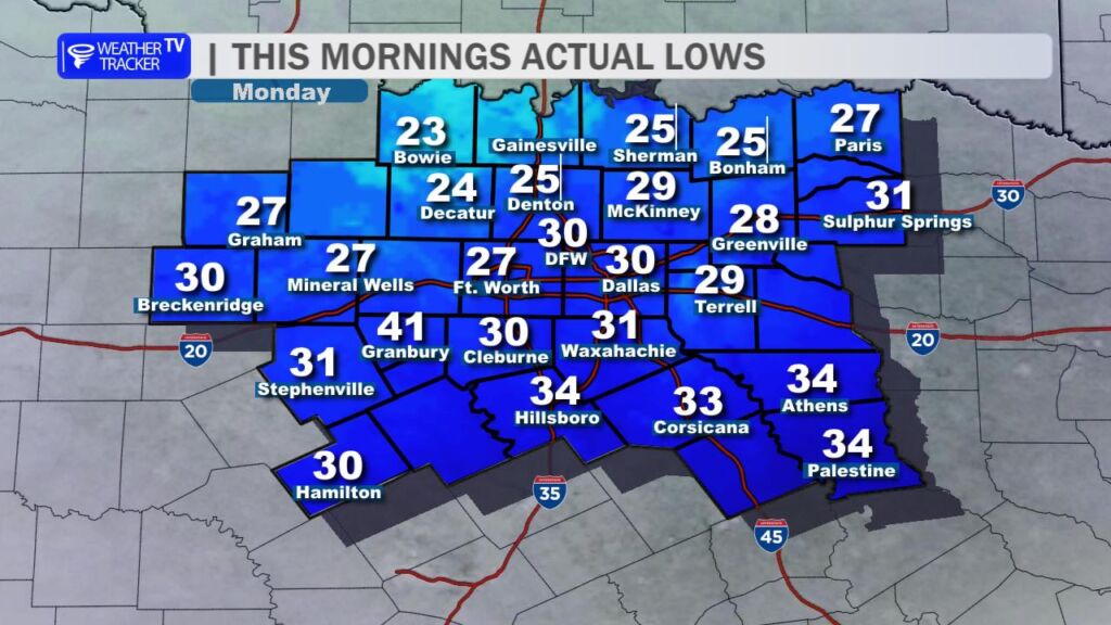
What a sharp contrast after that unseasonably warm Christmas weekend – we’ve got a classic post-frontal chill in the air today, December 29, 2025. Most folks woke up to crisp temperatures in the 20s and low 30s.
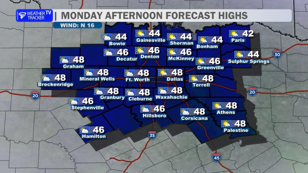
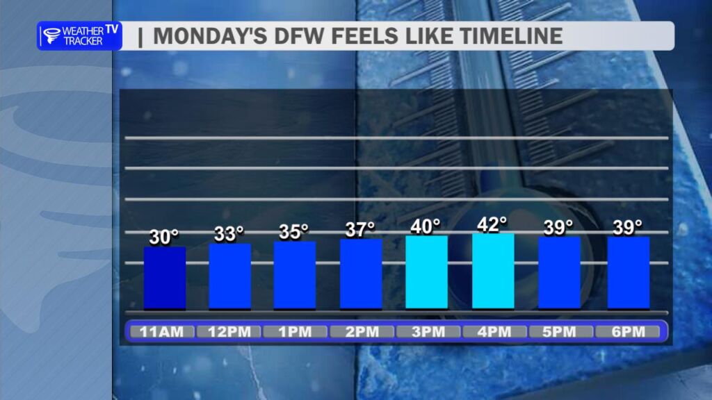
Temperatures will stay on the chilly side through the afternoon, topping out in the mid to upper 40s around Dallas-Fort Worth. A lingering north breeze (gusts still noticeable) will keep wind chills in the 30s for much of the day, so bundle up if you’re heading out. Expect increasing cloud cover as the day progresses, but no precipitation locally.
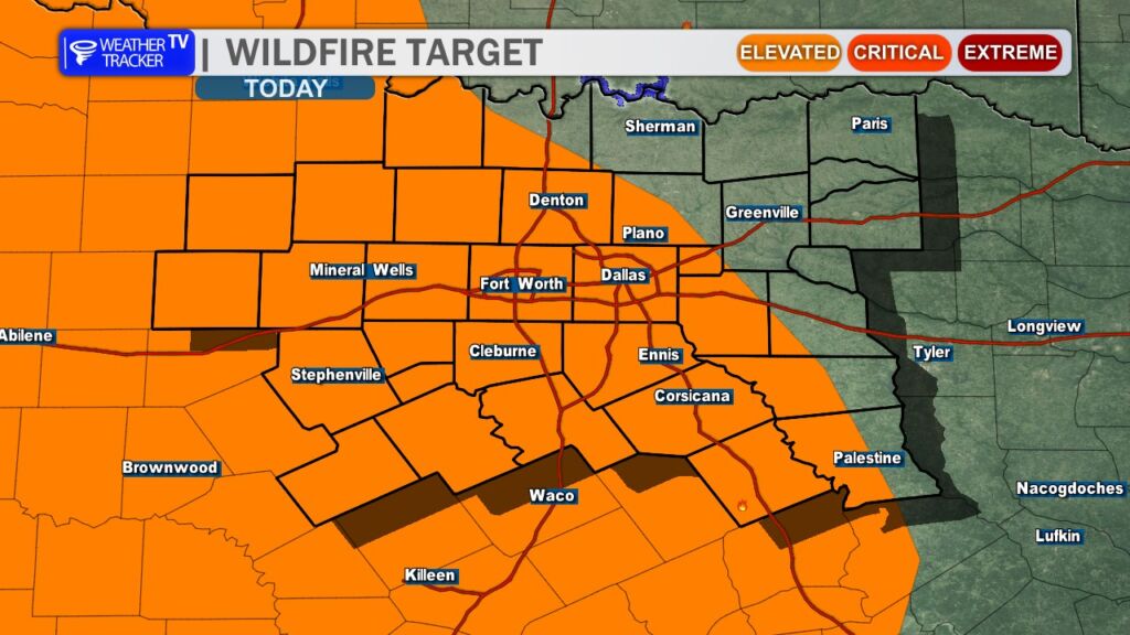
Speaking of dry… with low humidity, brisk winds, and all the winter-killed/dormant vegetation out there (think brittle grasses and brush), elevated grass and wildfire danger is in play across much of the region today. Outdoor burning is strongly discouraged until conditions improve – better safe than sorry with these tinder-dry fuels.
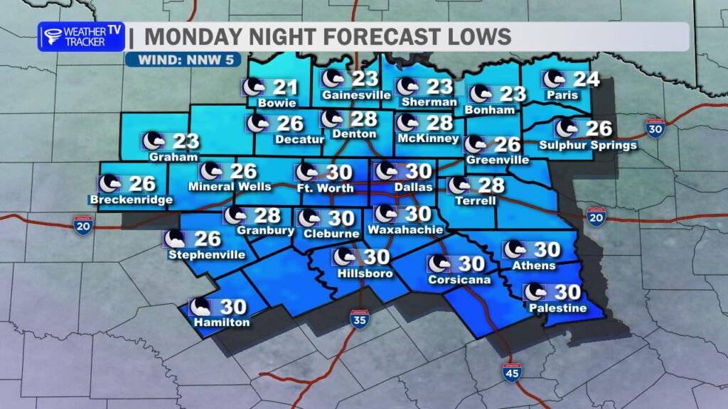
Another cold night is on tap tonight, with lows dropping below freezing everywhere across North Texas. Expect the coldest spots north of DFW – especially along and near the Red River Valley – to dip into the low to mid 20s.
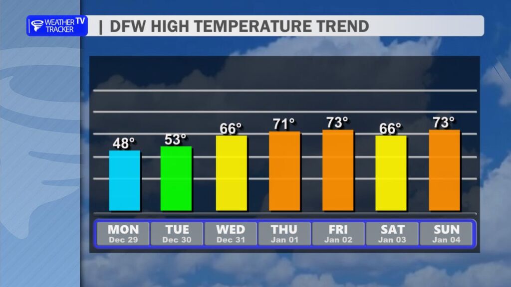
The pattern shifts quickly from here. A warm-up gets underway tomorrow (Tuesday), with highs rebounding nicely into the low to mid 50s. By New Year’s Day (Thursday), we’re looking at a much more comfortable climb to near 70 – perfect for ringing in 2026 without the heavy coats.
Stay warm out there today, North Texas – layers are your friend. -William