After a stretch of record-setting holiday warmth that felt more like spring than late December, winter is making a dramatic return to North Texas today, December 28, 2025.
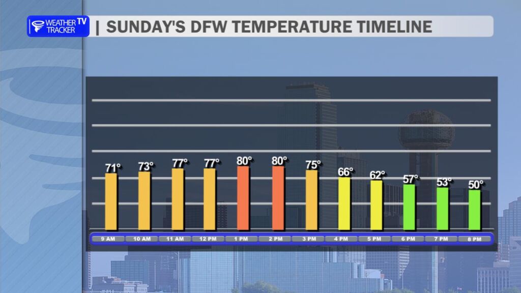
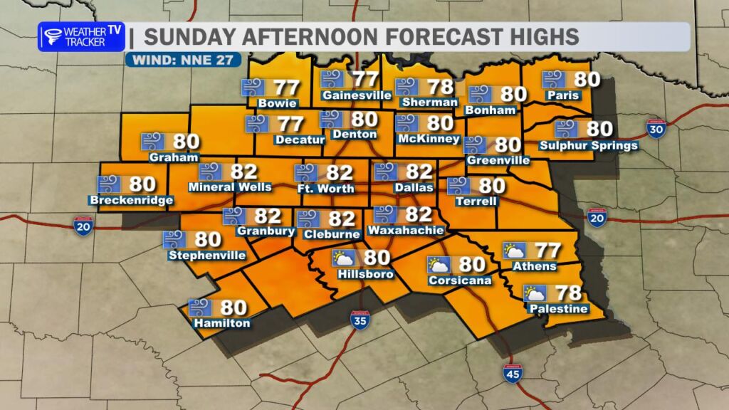
I’m tracking a strong cold front sweeping southward across the region this afternoon and evening, bringing a sharp and noticeable change. Before the front arrives, expect one last taste of unseasonable heat: temperatures will climb into the upper 70s to low 80s under mostly sunny to partly cloudy skies, with breezy conditions adding to the mild feel.
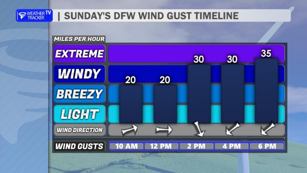
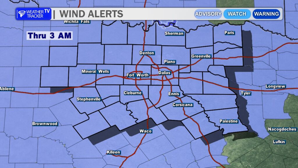
You’ll know exactly when the front passes through – winds will abruptly shift to the north, strengthening rapidly with sustained speeds of 25-35 mph and gusts exceeding 35-45 mph in many spots. In the the Metroplex the cold front passage is expected between 2 pm and 4 pm. This has prompted a Wind Advisory for all of North Texas, in effect through the early morning hours (around 3 AM or later in some areas). Secure loose outdoor items, be cautious on the roads (especially high-profile vehicles), and watch for blowing dust or debris.
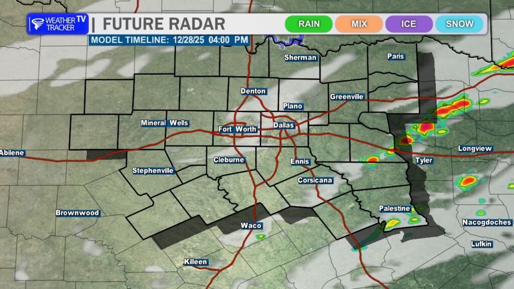
A few isolated showers or thunderstorms are possible near and just ahead of the front, mainly confined to eastern and southeastern counties. The overall probability remains low (around 10-20%), and any rain would likely be light – only trace amounts expected.
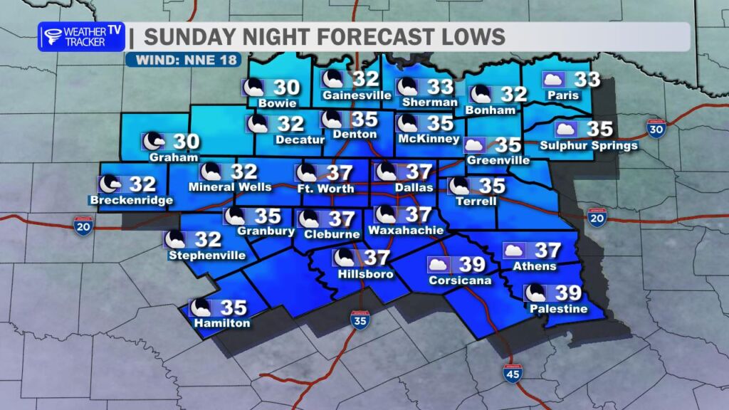
Behind the front, temperatures will plummet quickly. Tonight will turn sharply colder, with most of North Texas dropping into the mid-to-upper 30s by morning. Freezing temperatures are possible along the Red River Valley and in sheltered northern spots. Add in the gusty north winds, and wind chills could feel like the 20s by sunrise – bundle up if you’re heading out early!
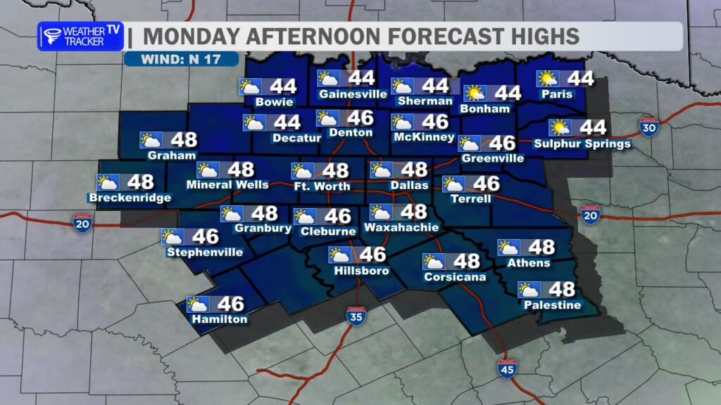
Monday looks blustery and chilly, with highs struggling to reach the mid-to-upper 40s. The north wind will remain brisk (though lighter than tonight), making it feel even colder – plan for layers and a windproof jacket.
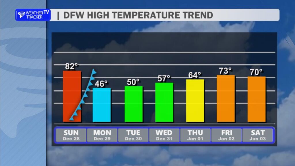
The deep chill won’t last long. Temperatures will gradually rebound through the week, climbing back into the 50s by midweek and reaching the 60s for highs around New Year’s Day. We’ll ease back toward more seasonable (but still mild) conditions to close out 2025 and welcome 2026.