Good Friday morning, North Texas! I hope everyone had a wonderful Christmas. As we wrap up the holiday week, we’re still basking in an impressive December heat wave that’s made this feel more like spring than winter.

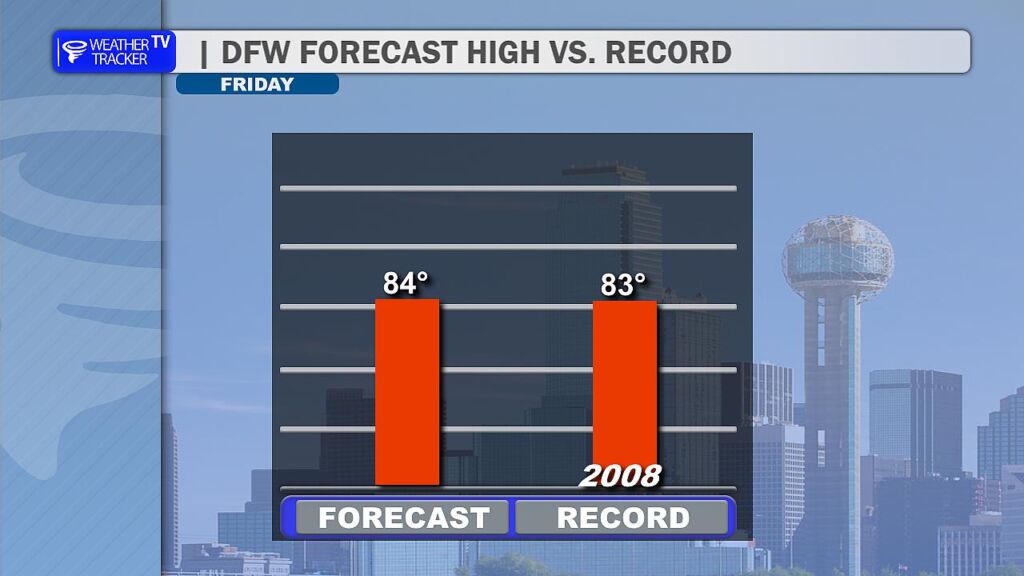
Today (December 26, 2025), expect partly cloudy skies with a light southwest breeze keeping things comfortable. Highs will climb into the mid-80s – my forecast calls for around 84° across much of the DFW Metroplex. That’s right on the edge of tying or breaking the daily record high of 83° set back in 2008.
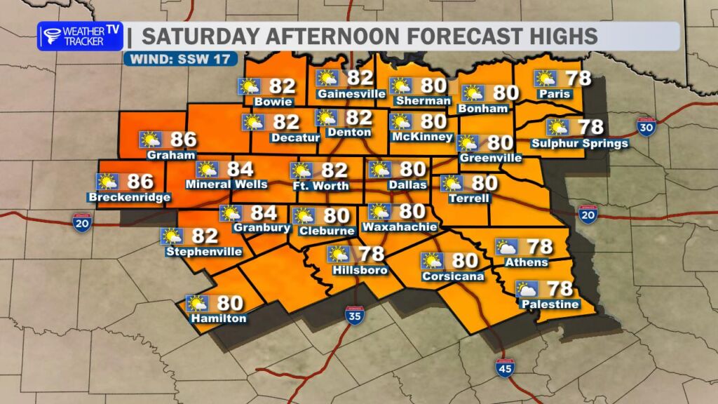
Saturday looks similar – more record heat possible with highs again pushing into the low to mid-80s under mostly sunny skies. However, increasing cloud cover could creep in from the east, potentially holding temperatures in the upper 70s for our eastern counties (think Sulphur Springs, Athens and Palestine).
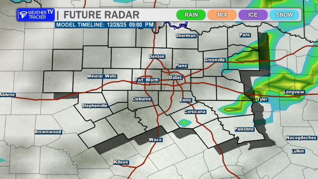
The big change arrives late Sunday as a strong Arctic cold front sweeps through. Expect howling northerly winds gusting strong, along with a few scattered showers and possible thunderstorms, especially near and ahead of the front. Rain chances are highest southeast of the Metroplex.
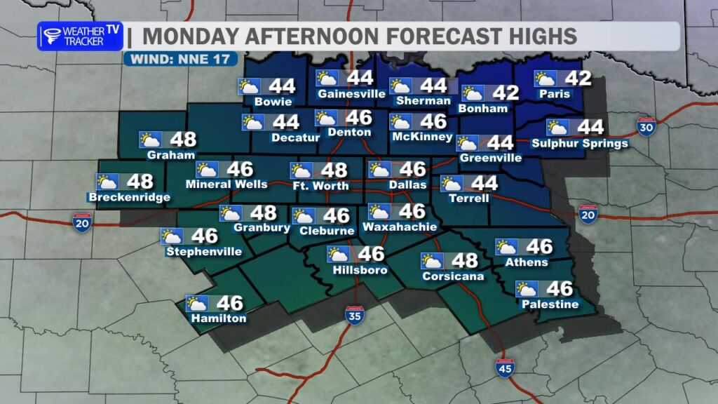
This front will deliver a dramatic cooldown – Monday’s highs will struggle to reach the upper 40s with brisk northerly winds making it feel even chillier. Bundle up!
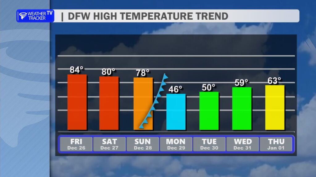
After that sharp drop, temperatures will gradually rebound as we head into the final days of 2025. Expect highs climbing back into the 50s and eventually the 60s by mid-next week, bringing us more typical late-December conditions.
Get ready for that winter wake-up call. Have a great Friday! -William