Merry Christmas Eve, North Texas! 🎄
What a way to kick off the holiday – we’ve started the morning with plenty of clouds and even some patchy fog hanging around, especially west of the Dallas-Fort Worth metroplex area.

As we head through the afternoon, those clouds should gradually thin out, letting more sunshine break through. Get ready for some seriously toasty weather: highs are climbing back into the 80s across most of the region – well above our usual late-December norms (which typically hover in the mid-50s). Feels more like a warm spring day than Christmas Eve!
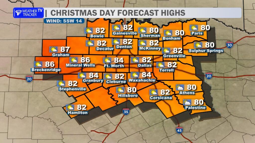
And the warmth isn’t going anywhere tomorrow – Christmas Day looks nearly identical. We’re tracking a forecast high right around 78–82° (depending on the exact spot in the metroplex), which puts us in striking distance of the all-time record high for December 25 at DFW (82° set back in 2021). If we hit or top that, it’ll go down as the warmest Christmas on record.
The mild, dry pattern holds strong through Saturday, with more highs in the low to mid-80s and plenty of sunshine – perfect for outdoor holiday activities, post Christmas shopping, or just enjoying the unseasonably beautiful weather.
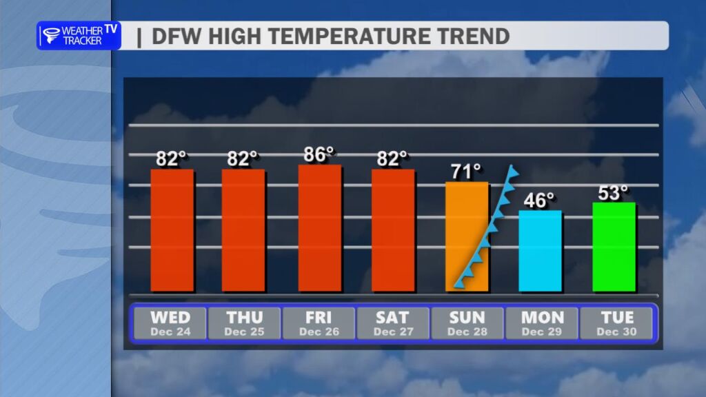
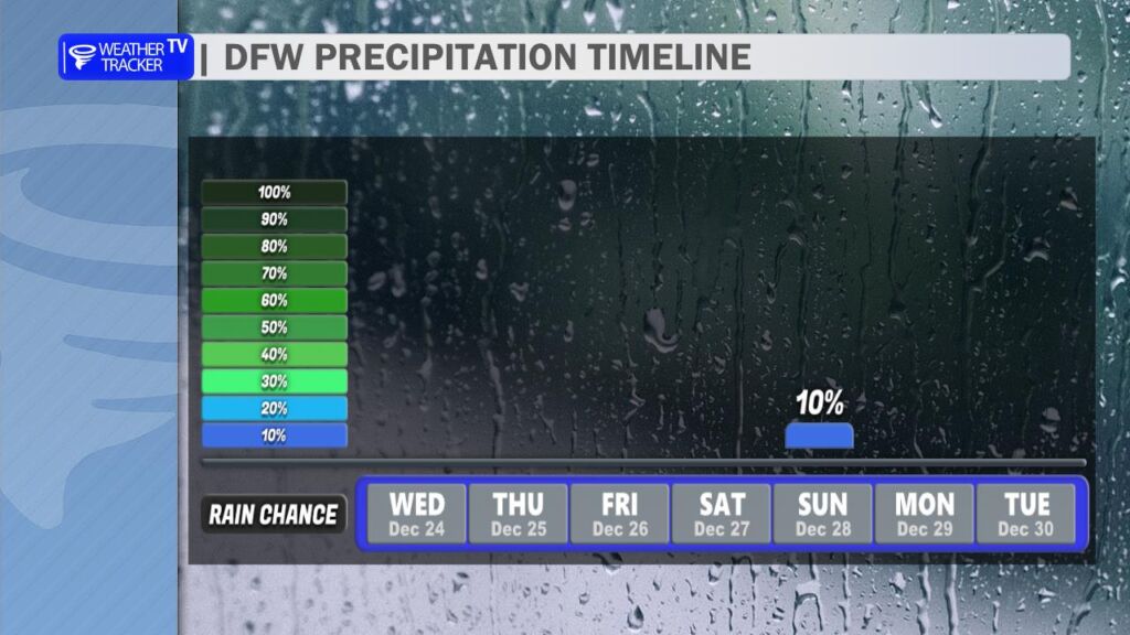
Then comes the big change: a strong cold front barrels through on Sunday. Expect a few scattered showers and maybe even an isolated thunderstorm or two as it moves across North Texas. Behind it, much cooler air rushes in – highs will tumble into the 40s by Monday, with lows potentially dipping into the 30s. It’s a classic Texas temperature rollercoaster!
Merry Christmas and Happy Holidays to you and yours. -William