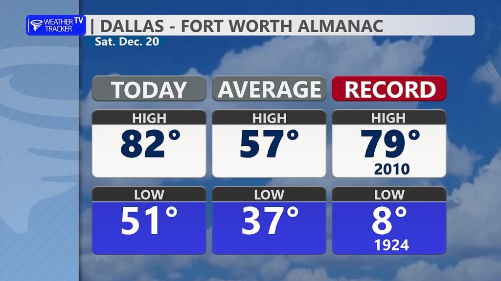
Today at Dallas/Fort Worth International Airport, the official high temperature soared to a remarkable 82°, shattering the previous daily record of 79° set back in 2010. This unseasonably warm afternoon felt more like early fall – or even late spring – than the heart of winter, just days before the official start of the season.
For context, the climatological normal (or average) high temperature for December 20, based on the 1991–2020 period used by the National Weather Service, hovers around 57–58° in the Dallas-Fort Worth area. That makes today’s reading a staggering 25 degrees above average – a significant departure that highlights how erratic North Texas weather can be.
While Dallas winters are generally mild compared to much of the country, with occasional freezes and rare snow, spells of summer-like warmth aren’t unheard of. In fact, record highs in the 80s have occurred in past Decembers during similar warm intrusions.
Of course, North Texas being North Texas, enjoy it while it lasts – a cold front sweeps through tonight and knocks Sunday’s highs down into the 60s.