Good Thursday morning, North Texas!
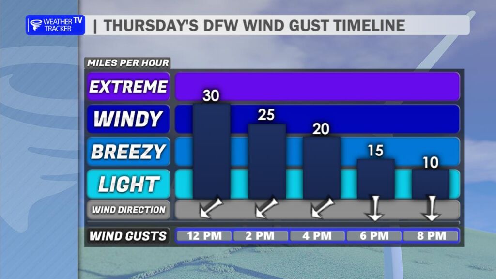
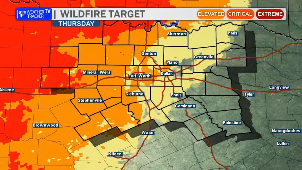
A windy cold front is sweeping through the region today. While it won’t deliver a significant surge of colder air, it will shift our winds to the north with gusts up to around 30 mph through early afternoon. As humidity levels drop sharply behind the front, fire danger will be elevated – especially across our western counties – through sunset. Please be extra cautious with any outdoor burning or activities that could spark a fire.
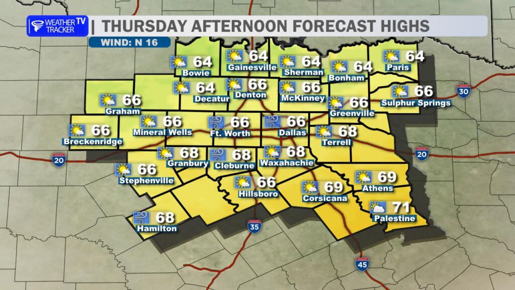
Despite the breeze, temperatures will still climb comfortably into the 60s this afternoon.
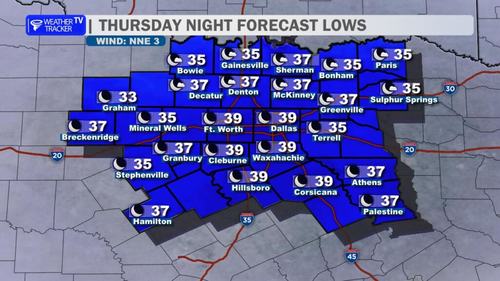
Tonight, the winds will quickly calm down under clear skies, setting the stage for excellent radiational cooling. Overnight lows will dip into the 30s area-wide, with a few locations along the Red River possibly flirting with the freezing mark.
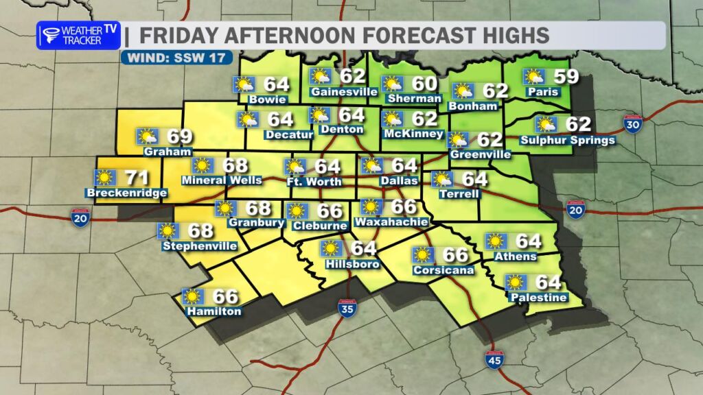
Friday looks pleasant but a touch cooler, with highs again in the 60s under mostly sunny skies. Southerly winds will begin to return, signaling the start of a warming trend.
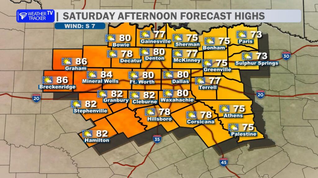
The weekend brings a big warm-up! Saturday will feel downright spring-like, with high temperatures soaring into the 70s and some spots pushing 80.
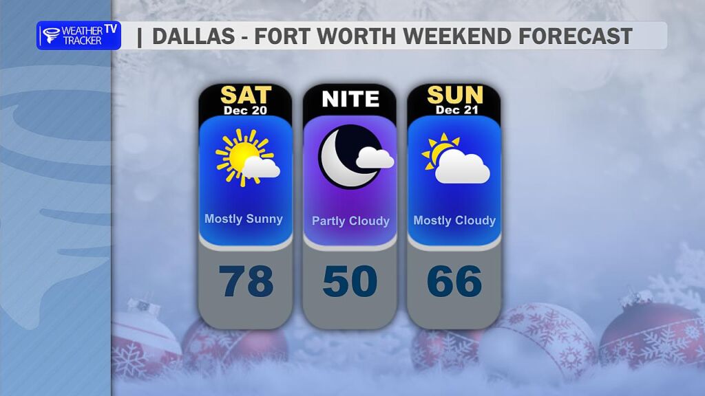
A weaker cold front slips through Saturday night into Sunday, which will knock Sunday’s highs back down into the 60s – but it won’t be anything dramatic.

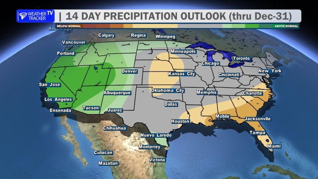
Looking ahead to Christmas week, another substantial warm-up is on tap, pushing highs back into the 70s. The forecast remains completely dry through the holiday, so no worries about rain impacting your plans.