Good Sunday morning, North Texas!

We kicked off the day with a decidedly chilly bite in the air, courtesy of yesterday’s strong cold front that swept through the region. Sunrise temperatures dipped into the upper 20s to mid-30s across much of the area, feeling even colder with lingering breezes from the north.
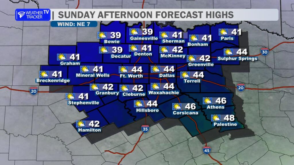
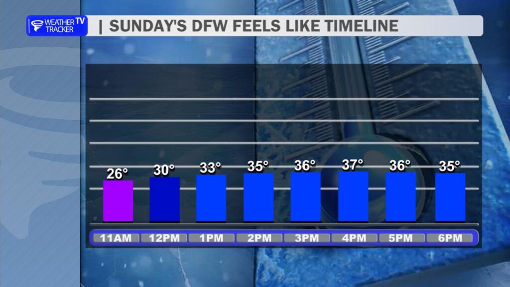
This afternoon, we’ll stay on the chilly side – highs will struggle to climb much the lower 40s. A persistent brisk north wind around 10-20 mph (with occasional gusts higher) will keep wind chills anchored in the 30s for most of the day, so bundle up if you’re heading out for any errands, or holiday shopping.
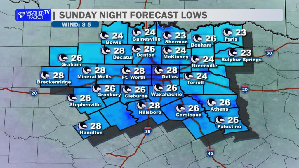
Tonight promises to be the coldest so far this season, with clear skies and calming winds allowing temperatures to plunge into the low to mid-20s region-wide. Some spots in the northern and rural areas could even flirt with the upper teens. Protect sensitive plants, pets, and pipes – it’s going to feel like full-on winter out there.
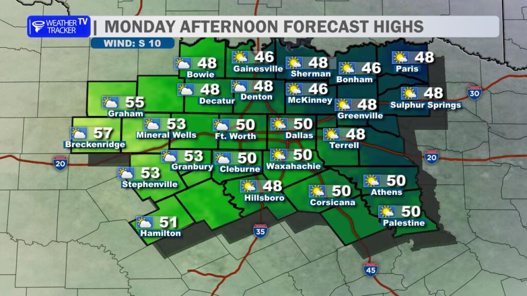
Monday starts off frigid again with morning lows in the 20s to low 30s, but we’ll rebound a bit under partly to mostly cloudy skies, with afternoon highs nudging toward the upper 40s to around 50° – still below average, but it’s improvement.
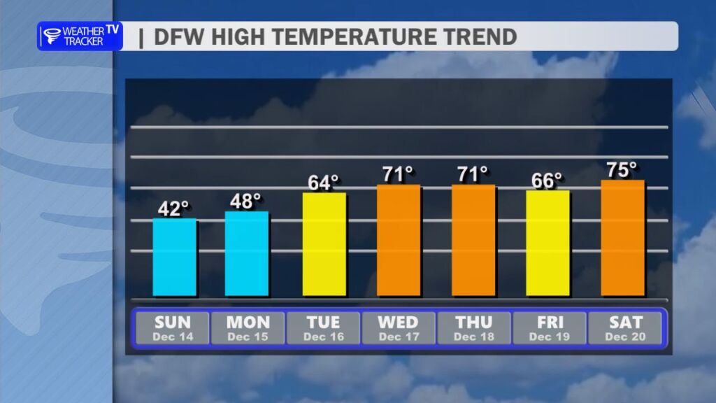
A quick warm-up is on the horizon. Temperatures will surge starting Tuesday, climbing into the 60s, and reaching near or even into the low 70s by Wednesday and Thursday. It’ll feel much more seasonal (or even a touch mild) by mid-week.
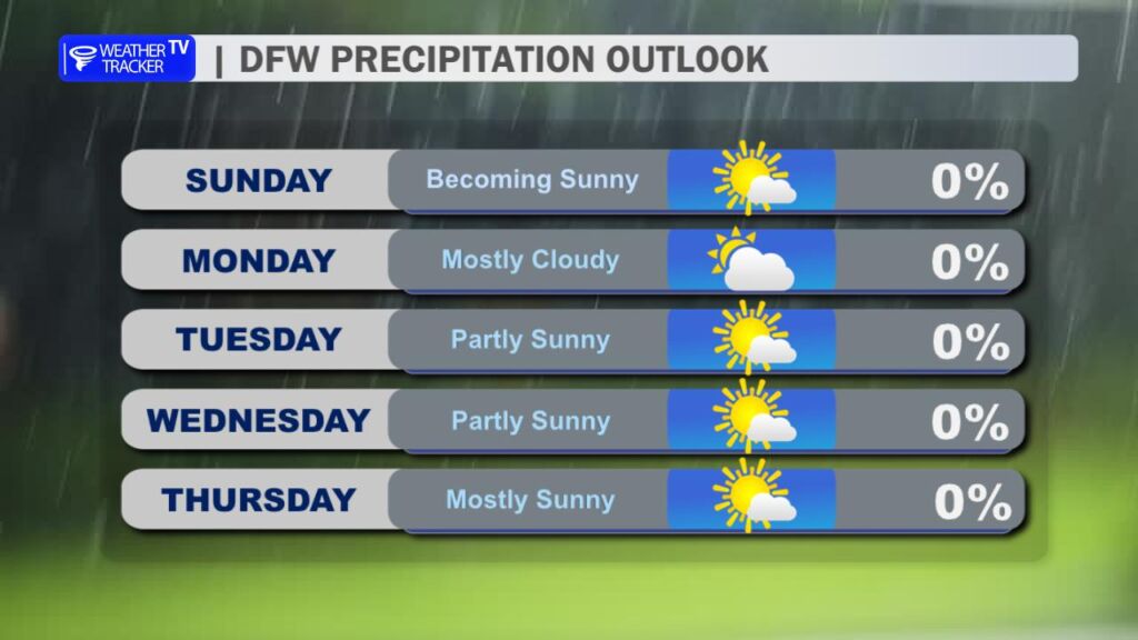
Looking ahead, the overall pattern remains dry – no significant rain chances in sight for the foreseeable future. We’ll continue monitoring for any shifts, but enjoy the sunshine in December.
Stay warm today, North Texas – spring-like temperatures return soon. -William