Good Tuesday morning, North Texas.
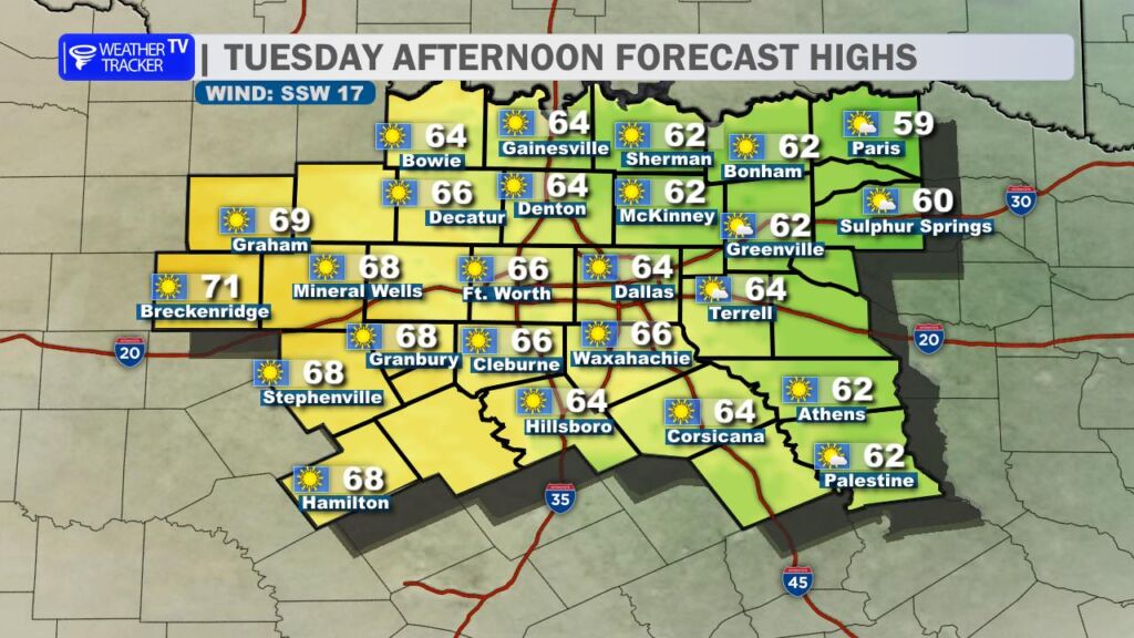
After a chilly start, today feels like North Texas flipped the switch to “pleasant mode.” We’re trading the bite of the last few mornings for abundant sunshine and downright mild air. Highs this afternoon will climb into the mid-to-upper 60s for most of North Texas, with low 70s very possible across western North Texas (looking at you, Breckenridge and Graham). Light south winds will make it feel even nicer – perfect weather for lunch outside or finally washing the car without freezing your hands off.
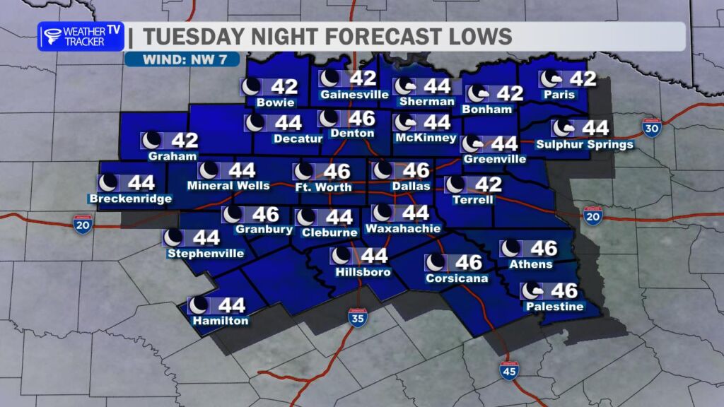
Tonight stays quieter and noticeably less frigid than recent nights. Lows will only dip into the mid-40s in the metroplex with low 40s out in the northwestern counties. No frost worries for most of us.
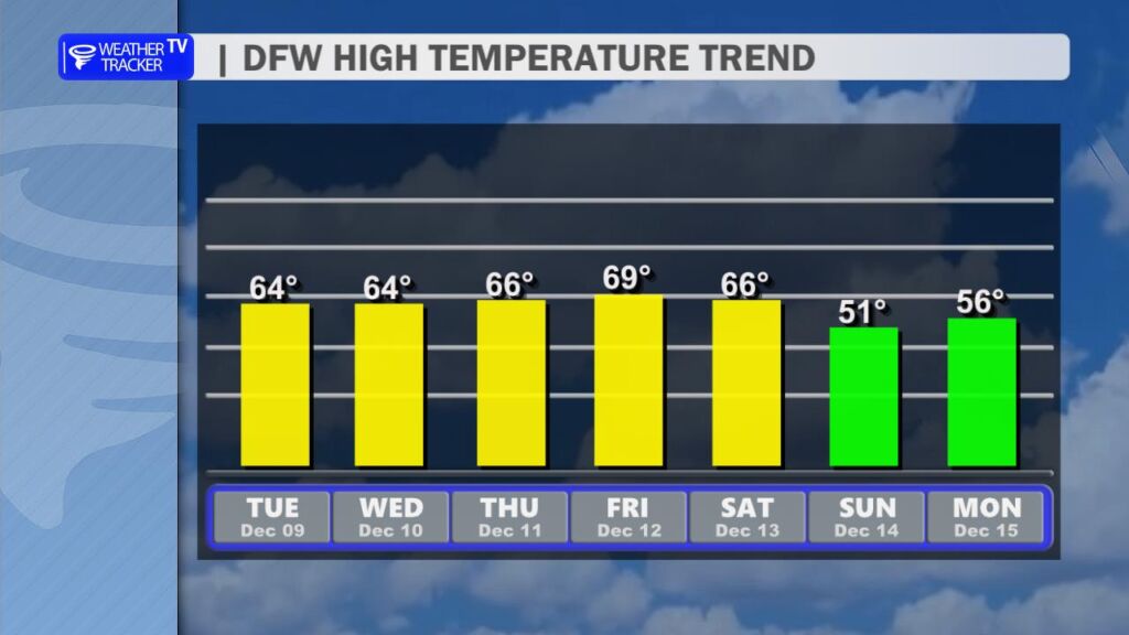
That mild theme sticks around the rest of the workweek. Expect mostly sunny to partly cloudy skies Wednesday through Friday with highs holding steady in the 60s each afternoon.
The big change arrives this weekend. A strong cold front barrels through late Saturday or Saturday night, flipping the script in a hurry. Sunday will feel like a totally different season: highs will struggle to get out of the 40s across much of North Texas, with lower 50s as far south as Waco. Morning lows Sunday could even flirt with freezing north and west of DFW.
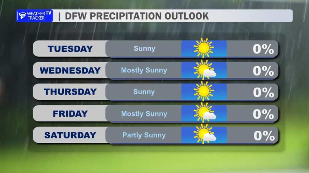
Right now, the forecast is dry behind the front, but we’re watching the potential for a few sprinkles or light showers near the boundary Sunday into early Monday, especially southeast of DFW. Confidence is still low, but we may need to add low-end rain chances in future updates.
Bottom line: Enjoy the gorgeous midweek gift – because winter is reminding us it’s just getting started come Sunday.
Have a great day, North Texas! -William