Good Monday morning, North Texas!

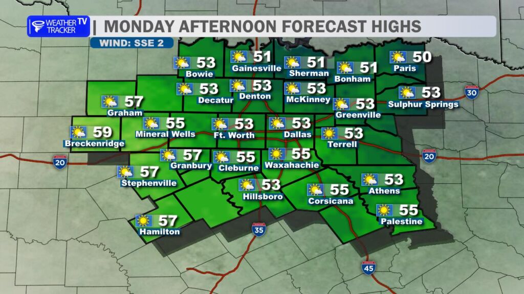
After a frosty start to the day (many of us woke up to temperatures in the 20s and low 30s), we’ll see plenty of sunshine this afternoon, but it’s going to stay on the chilly side. Highs will only struggle into the low to mid-50s area-wide, so keep the jacket handy if you’re heading out.
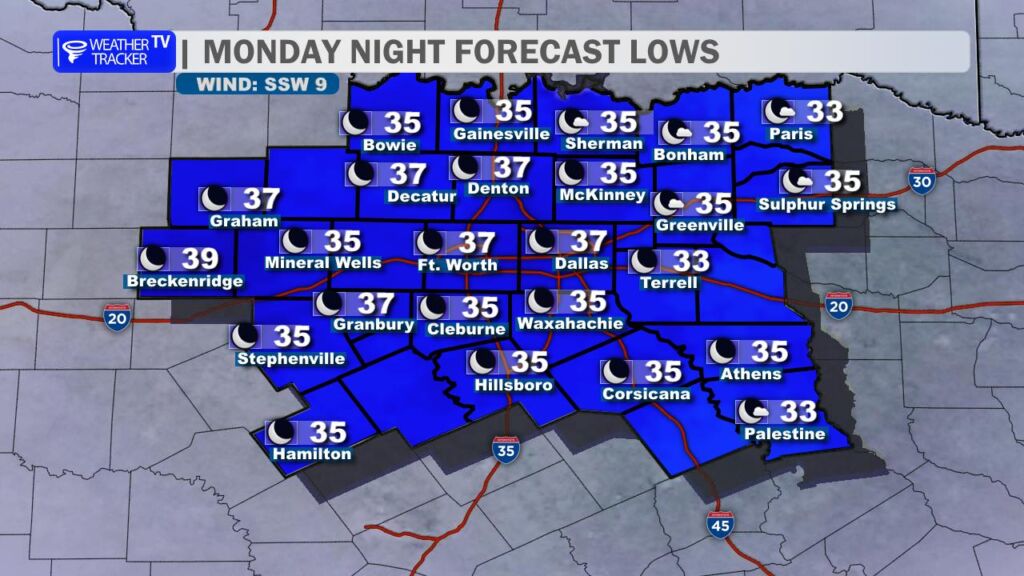
Tonight won’t be quite as cold as recent nights. Lows will settle into the mid-30s for most of the region, with the Metroplex and points south staying just above freezing. No widespread frost worries for the majority, though a few colder pockets north and west could dip close to 32°.
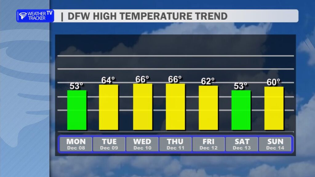
The workweek ahead looks very calm and pleasant. Tuesday through Friday will feature mostly sunny to sunny skies each day with a steady warm-up. By mid-to-late week we’ll be back in the 60s (some spots could even touch the upper 60s Thursday and Friday). Perfect December weather for getting outside or knocking out those holiday errands.
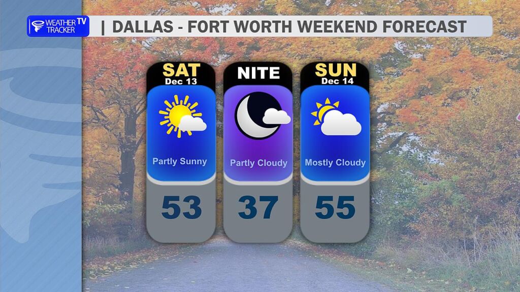
Our next cold front slides in Friday night into early Saturday, dropping highs this weekend back into the 50s with a noticeable chill in the air again. The good news? Right now the front looks to come through dry – no rain to mess up your weekend plans.
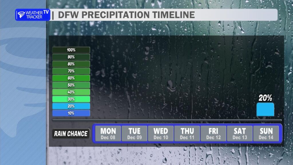
Looking even farther out, there are some early hints that a few showers could try to develop late Sunday into Monday as moisture returns behind the front, but confidence is very low and a lot can change between now and then. We’ll keep you posted as the models get closer.
In short: Bundle up today, enjoy the quiet and seasonably cool week ahead, and we’ll watch that potential late-weekend shower chance as it gets closer. -William