Good morning, North Texas. If you stepped outside today, you already know it’s a raw, chilly, and damp one out there. Scattered light rain showers and drizzle have been sliding across the region since the pre-dawn hours, leaving roads damp and the air feeling colder than the thermometer suggests. The good news? This isn’t a big rainmaker – most of the showers will continue to taper off through the late morning and early afternoon. By midday, many spots will transition to just occasional drizzle under a stubbornly cloudy sky.
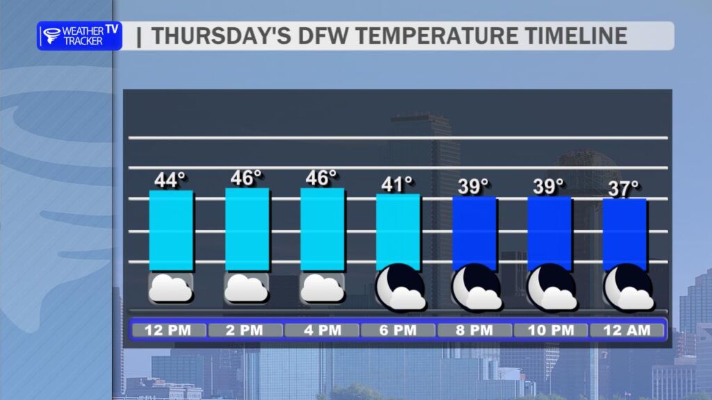
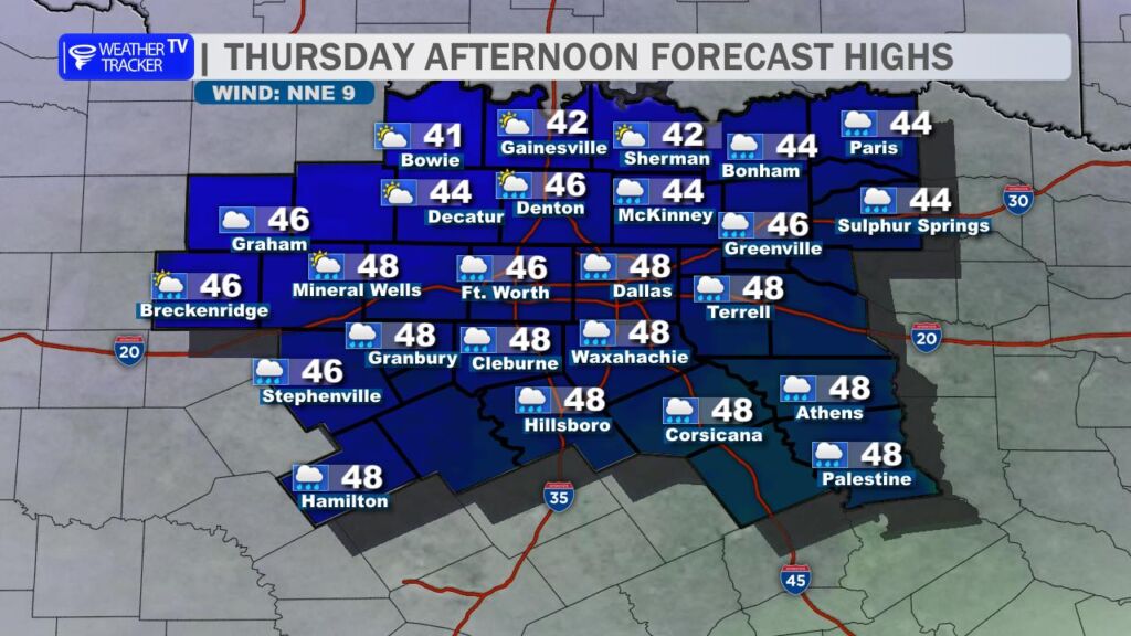
Expect high temperatures to stay locked in the mid-to-upper 40s all day – about 15–20 degrees below average for early December. With the dampness and a brisk north wind at times, it’ll feel more like the upper 30s when you’re out and about. Keep the heavy coat, umbrella, and maybe even a scarf handy if you have outdoor plans.
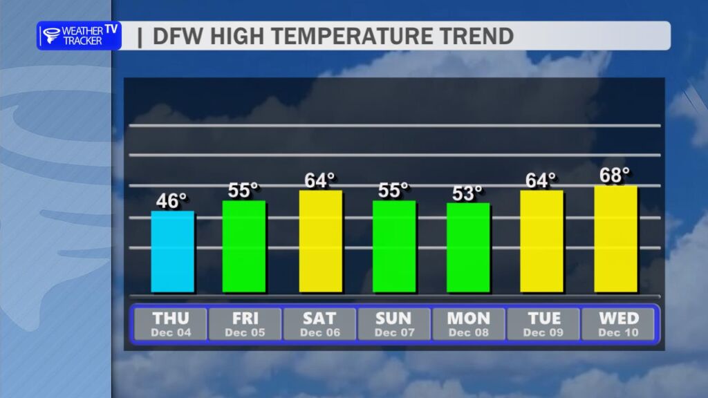
The mood brightens heading into the weekend:
- Friday: The clouds will thin out a bit. The chill eases, though – highs climb back into the middle 50s, which will feel much more comfortable.
- Saturday: A nice reward after the gloomy stretch! Sunshine returns in full force, and temperatures rebound solidly into the low-to-mid 60s. A perfect day for college football watch parties, holiday shopping, or finally getting those outdoor Christmas lights up.
- Sunday into Monday: Our next cold front slips through Sunday morning. It’s not a powerhouse, but it will shave temperatures back down. Highs both Sunday and Monday will top out in the middle 50s under a partly to mostly sunny sky.
- Middle of next week: We bounce right back. 60s return by Tuesday and Wednesday with lots of sunshine.

Rain chances? After today’s dreary drizzle finally exits, the forecast looks bone-dry for at least the next 10–12 days. No big storms, no washouts – just a classic early-winter pattern of mild days, occasional chilly shots, and plenty of sunshine in between.