North Texas Weather Alert: Big Changes Coming Today
Buckle up, North Texas – a Blue Norther cold front is barreling into the Southern Plains and will push through North Texas late this afternoon and evening (Saturday, November 29, 2025). What starts as a mild, breezy day will flip dramatically once this cold front passes through.
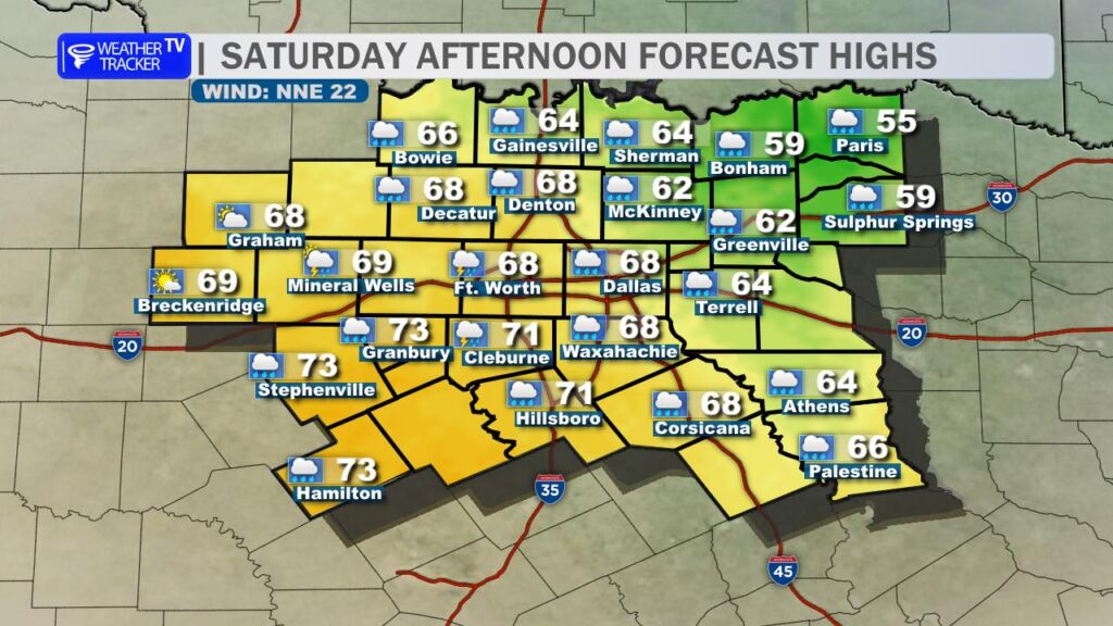
This afternoon (before the front):
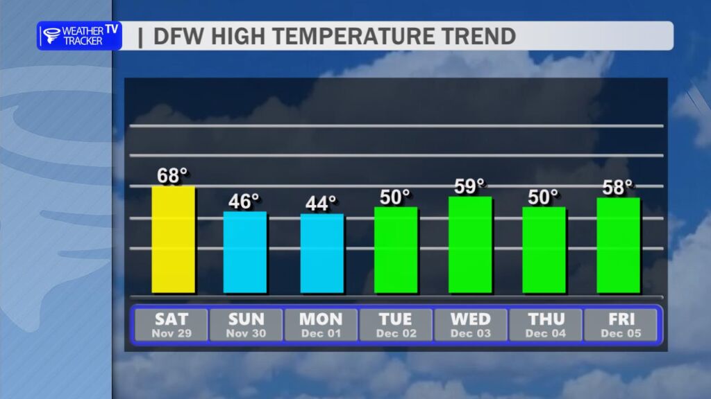
- Temperatures climbing into the upper 60s to low 70s
- Breezy south winds 15–25 mph, with gusts near 30 mph
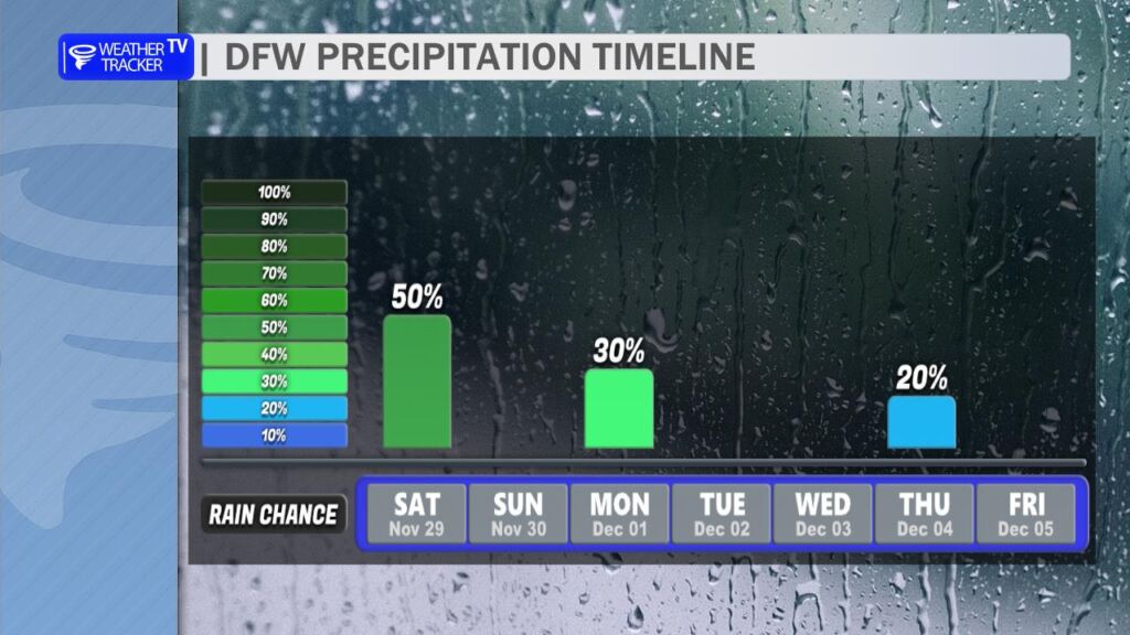
- A narrow, fast-moving line of thunderstorms is expected to fire up right along and just ahead of the cold front as it surges southeastward

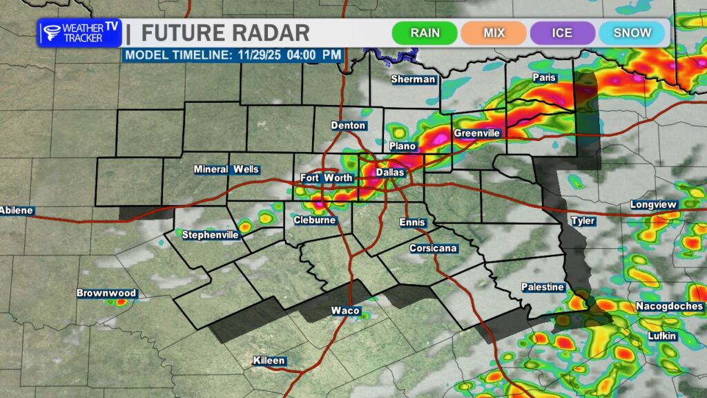
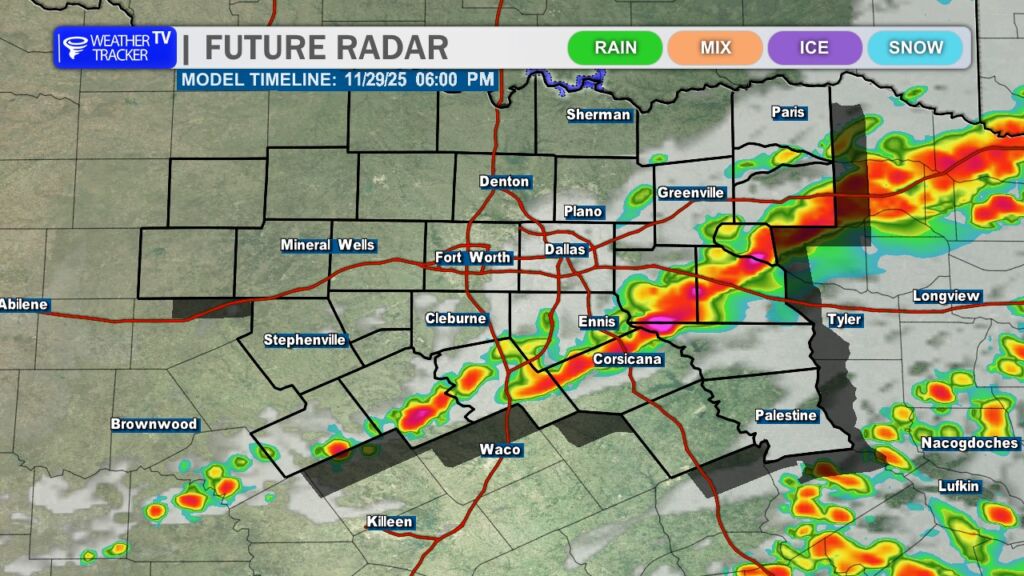
While most of the storms should stay sub-severe, an isolated severe thunderstorm cannot be ruled out. The primary threats from any stronger cell would be:
- Quarter-size hail (1 inch)
- Damaging wind gusts up to 60 mph
The bigger story, though, is what happens behind the front.
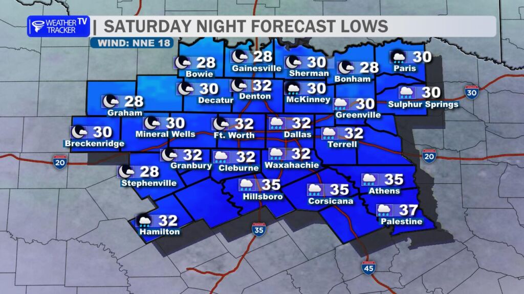
Tonight through Sunday morning:
- Temperatures will plummet 30°+ overnight behind the front
- Widespread freezing temperatures are likely across North Texas – especially near and North of I-20.
- Strong northwest winds 20–30 mph will make it feel even colder
- Wind chills drop into the teens (12–18°) by sunrise Sunday
Looking forward:
- Sunday & Monday highs only in the low-to-mid 40s
- Morning lows Monday in the upper 20s to low-to-mid 30s
- Wind chills Monday morning may still be in the teens and 20s
Monday update:
Another quick-moving system brings a chance of light rain or drizzle Monday afternoon/evening. Right now, temperatures look marginal but should stay warm enough for plain rain across most of the area. The only exception may be far northeast counties near the Red River (Lamar, Fannin, Delta) where a few sleet pellets could briefly mix in. No travel impacts or accumulations are expected at this time.
Bottom line: Enjoy the mild air while it lasts this morning and early afternoon, because by tonight we’re flipping the switch to full-on winter mode for the next several days. Time to pull out the heavy coats, and bring in the sensitive plants.
Stay weather-aware and we’ll keep you updated if anything changes with the severe or wintry potential.