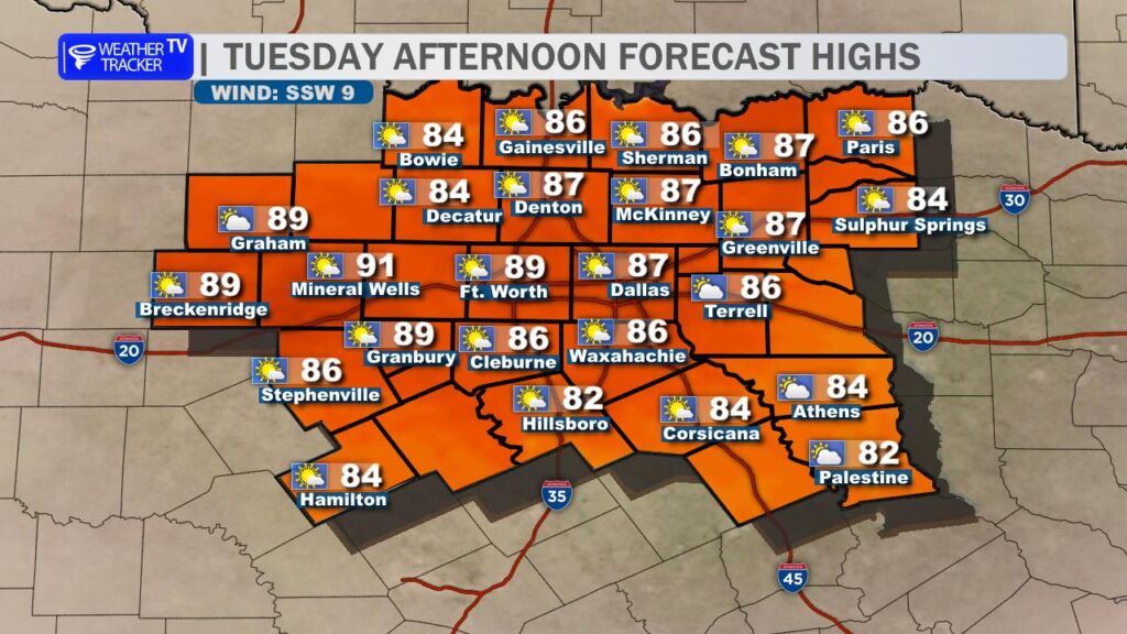
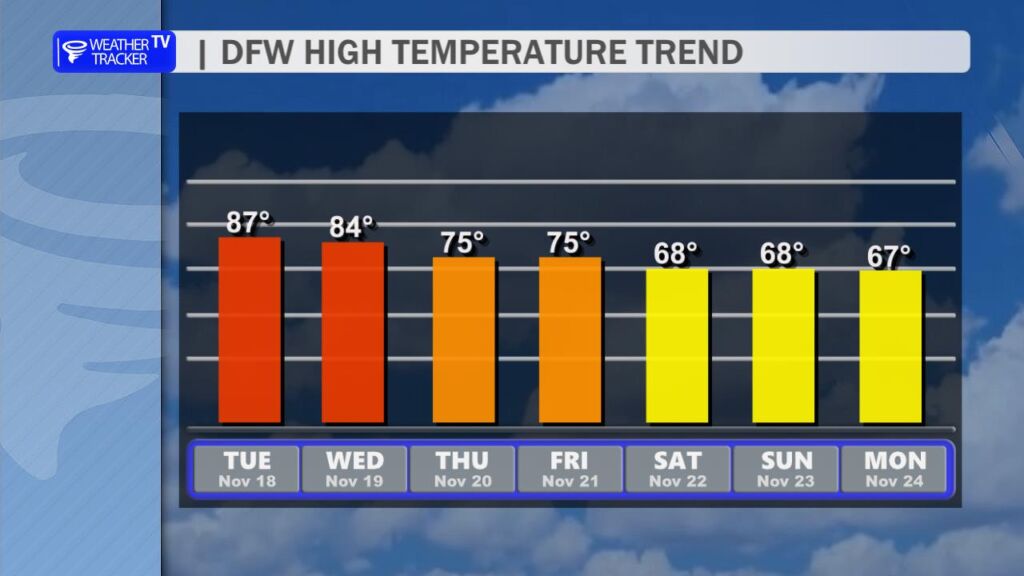
Today (Tuesday): Get ready to break out the shorts and t-shirts one more time – it’s going to be HOT across North Texas!
We’re expecting a high around 87° in the Dallas-Fort Worth Metroplex this afternoon, which would easily smash the old record high of 83° set way back in 1973. Some spots west and northwest of DFW – especially out in the Big Country will flirt with or even touch the low 90s. Yes, you read that right… 90s in mid-November!

Enjoy it while it lasts, because this summer-like warmth is on borrowed time.
Big Changes Coming Mid-Week:
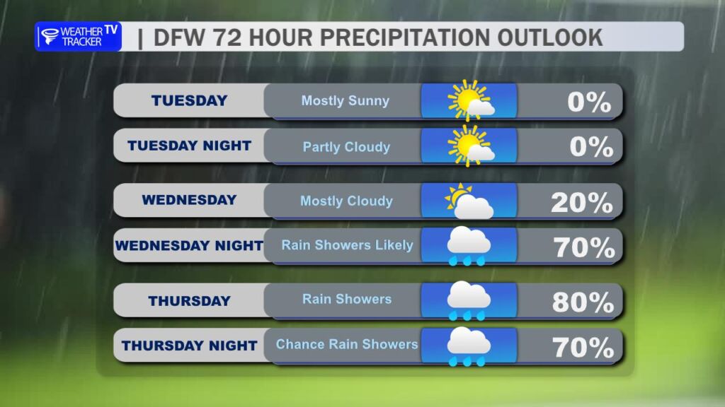
A strong upper-level storm system dives into the region late Wednesday into Thursday, bringing a dramatic pattern shift.
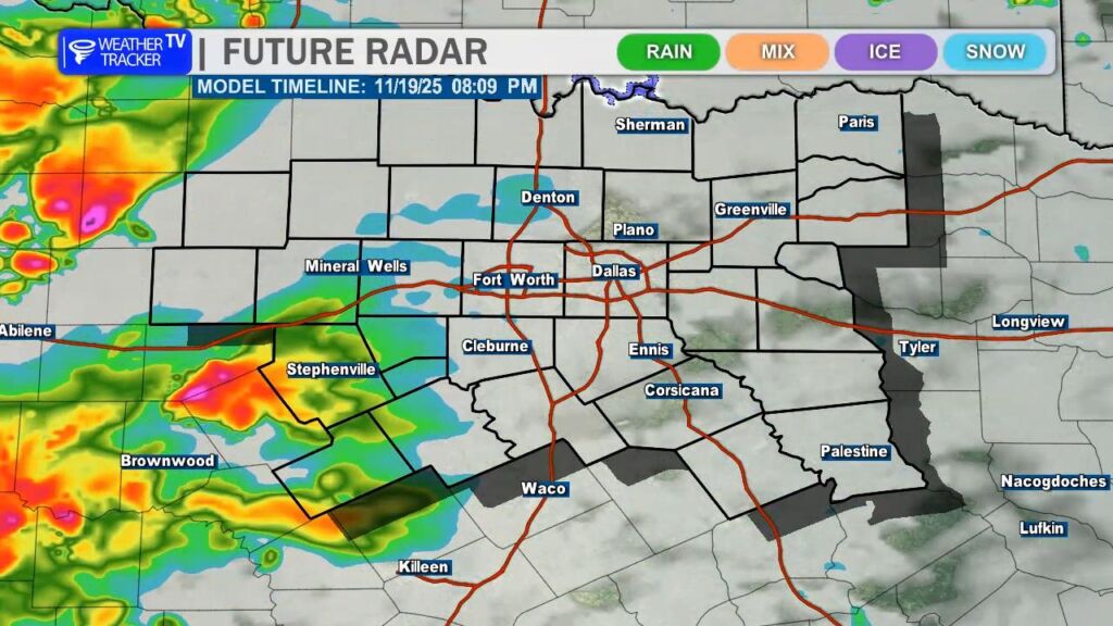
- Wednesday evening (mainly west of I-35): A narrow window exists for severe thunderstorms to develop across our western counties (think areas like Graham, Mineral Wells, Stephenville, and points westward). The main threats with any discrete supercells that form will be large hail and damaging wind gusts. These storms will be moving in quickly from West Texas.
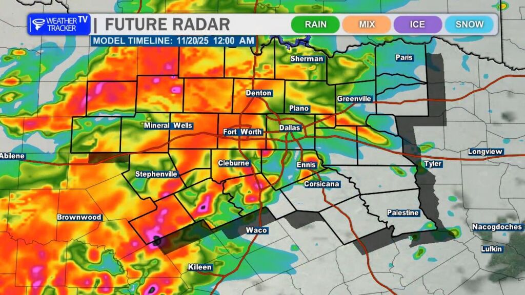
- Wednesday night into early Thursday: The individual storms are expected to merge into a larger complex/line of storms that sweeps east across the entire region overnight. Heavy rain and gusty winds will be possible with this line.
- Thursday: Additional rounds of showers and thunderstorms are likely through the day as the main upper low moves overhead. Rainfall rates could be high at times, and localized flooding will become an increasing concern, especially in areas that pick up repeated rounds of heavy rain or where storms train over the same locations.
Rainfall totals through Thursday night look to range from 1–3 inches area-wide, with isolated higher amounts (4+ inches) possible where the heaviest bands set up.
Bottom line: Soak up the record heat today, stay weather-aware Wednesday evening (especially west), and prepare for a soggy, windy, and cooler Thursday. Fall is finally making a forceful comeback.
You must be logged in to post a comment.