Issued: Saturday, November 15, 2025 – 10:03 AM CST
Today: Late-Summer Heat Returns
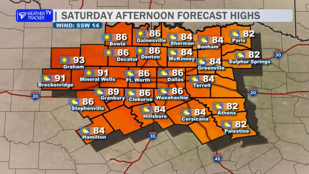
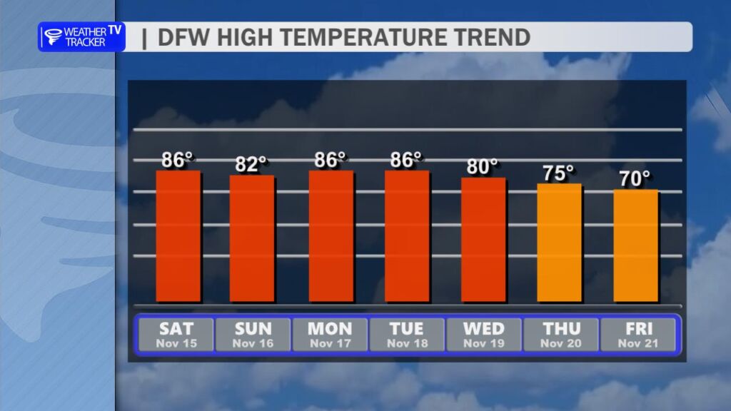
Get ready for a very warm and quiet Saturday across North Texas. After a mild start, temperatures will climb quickly under mostly sunny skies.
- DFW Metroplex: Highs in the mid 80s
- Big Country & Western Counties (Mineral Wells, Graham, Breckenridge): Upper 80s to low 90s possible
- Winds: South/southwest at 5–15 mph
- Humidity: Moderate, but dew points in the 60s will make it feel a bit muggy by afternoon
Bottom line: Feels more like late September than mid-November. Perfect for outdoor plans.
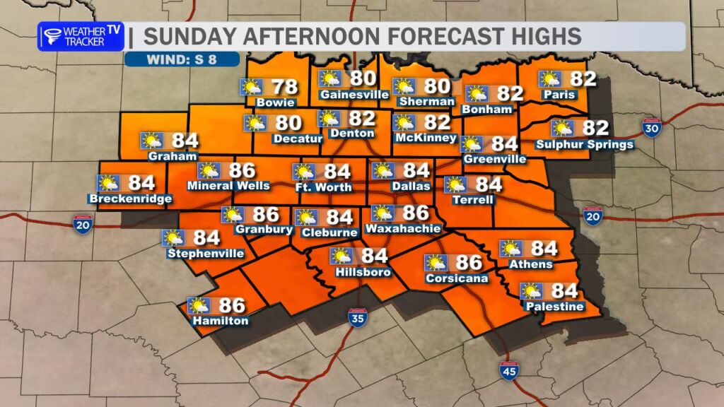
Sunday: Slightly Less Warm
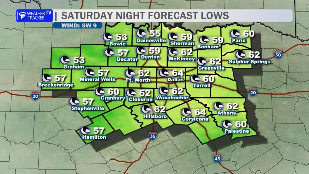
A weak wind shift line (essentially a subtle cold front) will drift into North Texas late Saturday night into Sunday morning.
What to expect:
- Morning lows in the upper 50s to low 60s
- Highs drop 3–6° from Saturday (upper 70s to low-mid 80s)
- Winds shift to the north/northeast at 10–15 mph
- Still dry and mostly sunny
Not an actual chilldown, but enough to take the edge off the heat.
Mid-Week Storm Threat Brewing
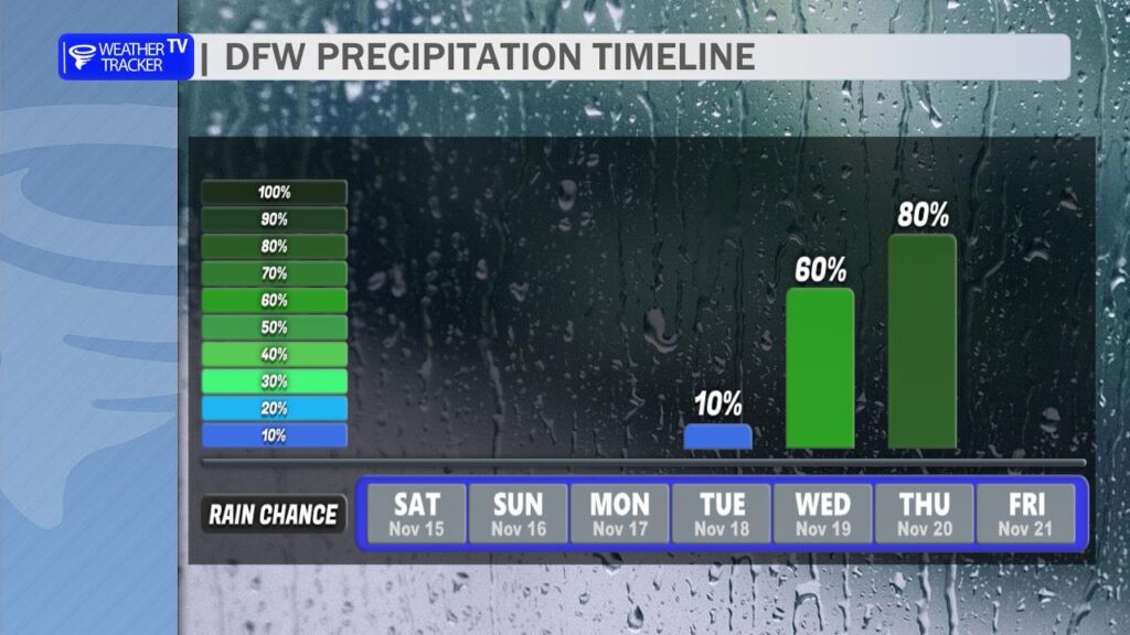
The quiet pattern won’t last forever. The latest model guidance (GFS, Euro, HRRR) continues to highlight a potent storm system arriving Wednesday into Thursday (Nov 19–20).
Key Concerns:
- Severe Weather Potential: Instability + strong wind shear could support organized storms, including:
- Large hail
- Damaging wind gusts
- Isolated tornadoes (still low confidence on coverage)
- Heavy Rain & Flooding: Widespread 1–3 inches possible, with locally higher totals (4″+) in slow-moving cells
- Timing: Main window looks Wednesday afternoon through Thursday
Confidence is increasing, but details (exact track, intensity) will sharpen over the next 48–72 hours.
Pro Tip: If you’ve got travel or outdoor plans mid-week, stay weather-aware. We’ll have hour-by-hour updates starting Monday as the threat evolves. Enjoy the bonus summer weekend while it lasts, North Texas! ☀️
You must be logged in to post a comment.