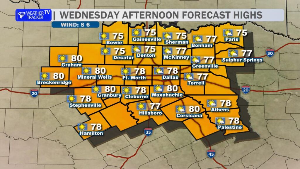
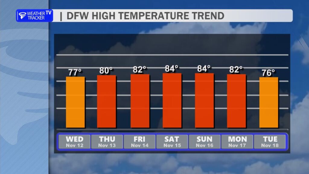
Temperature Rebound Underway
After a brief dip into cooler conditions, North Texas is firmly back in a warm pattern this week. High temperatures will climb steadily, reaching the low-to-mid 80s by Thursday and holding there through the weekend. Daytime highs on Thursday and Friday should peak between 80–84° across the Dallas-Fort Worth Metroplex, with suburbs like Denton, Frisco, and Plano seeing similar values. Overnight lows will remain mild, bottoming out in the upper 50s to low 60s.
Wind Gusts on the Horizon
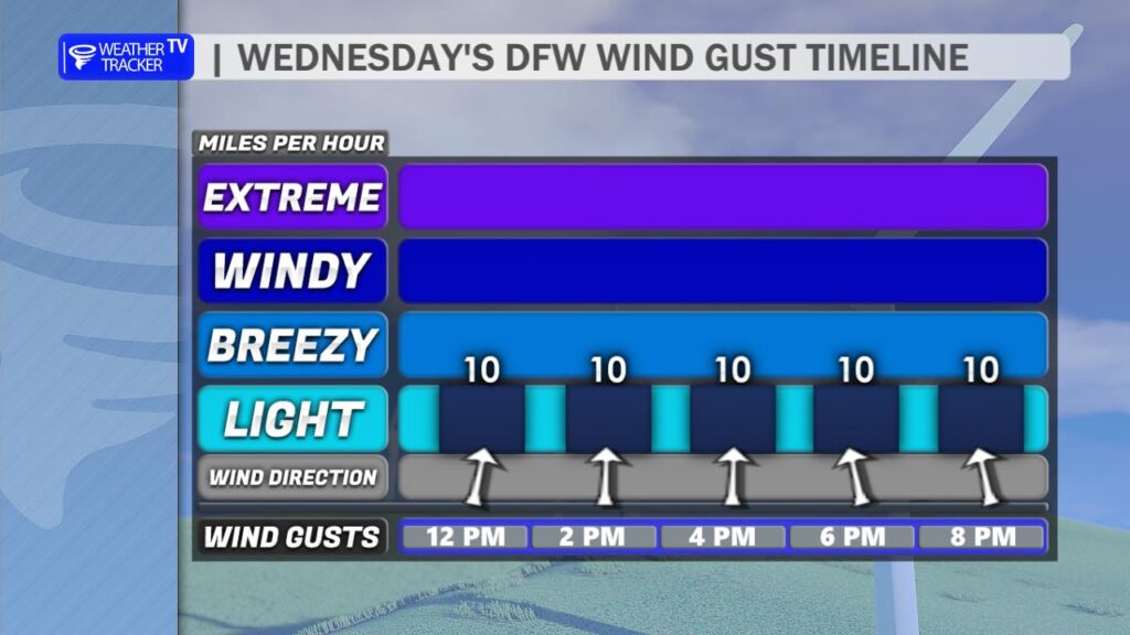
Today features light and variable winds, with gusts generally below 10 mph. However, a subtle pattern shift begins Thursday as high pressure slides eastward. This will usher in a south-to-southwest breeze by late week, with sustained speeds of 10–15 mph and occasional gusts to 20–25 mph on Friday and Saturday. The returning southerly flow will not only reinforce the warm-up but also import slightly higher humidity, pushing dew points into the mid-60s by the weekend.
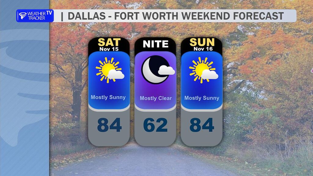
Weekend Forecast: Dry and Warm
Initial concerns about weekend rain have evaporated. An upper-level storm system previously progged to bring showers has lifted farther north, tracking across the Central Plains and Upper Midwest instead. As a result, rain chances for Saturday and Sunday have dropped to near zero. Expect mostly sunny to partly cloudy skies, with high temperatures 83–85° both days. The combination of warmth, breezy conditions, and low rain probability makes for ideal outdoor plans.
Next Weather Maker: Tuesday–Wednesday
The first legitimate rain chance in over a week arrives early next week. A slow-moving upper-level trough will dig into the Southern Plains, with its associated surface low taking a favorable track across Oklahoma and North Texas. Scattered showers and thunderstorms are likely Tuesday afternoon into Wednesday morning, with the best coverage along and east of I-35. Rainfall totals look modest for now – generally 0.25–0.75 inches across the region – but isolated higher amounts are possible where storms train. Severe weather risk appears low at this range, though a few stronger cells could produce gusty winds and small hail Tuesday evening.
You must be logged in to post a comment.