Monday, November 10, 2025 | 10:29 AM CST
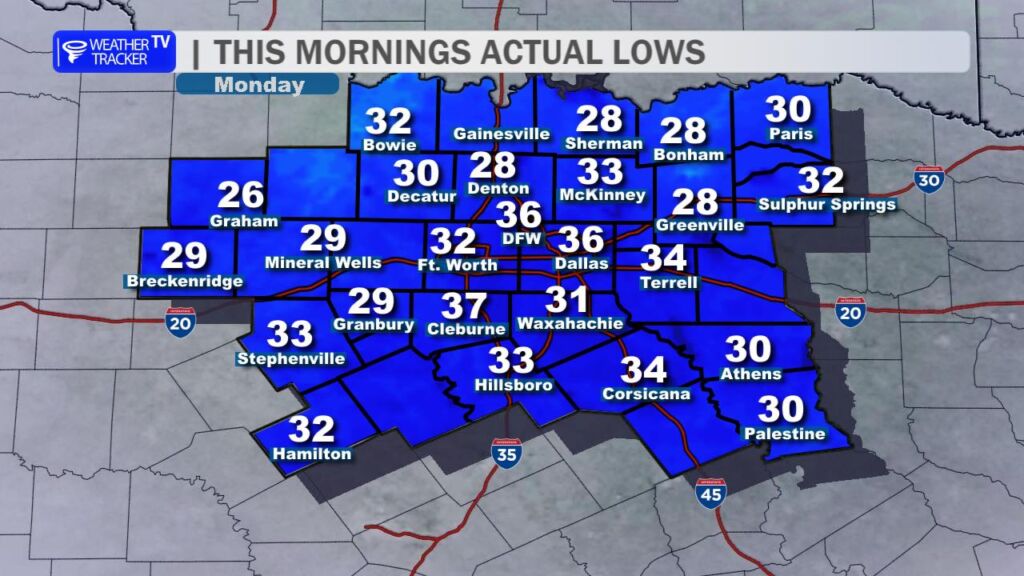
This Morning’s First Freeze
Parts of North Texas woke up to their official first freeze of the season. Dozens of locations around North Texas dipped to 32 ° or lower, with several more rural spots in the upper 20s. At DFW Airport, the thermometer bottomed out at 36 ° just before sunrise – marking the coldest reading since early April. Patchy frost was widespread on car windshields, rooftops, and grassy areas, especially where the wind went calm overnight.
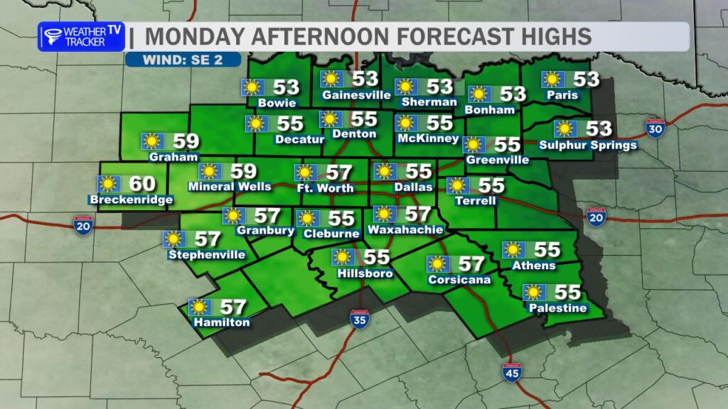
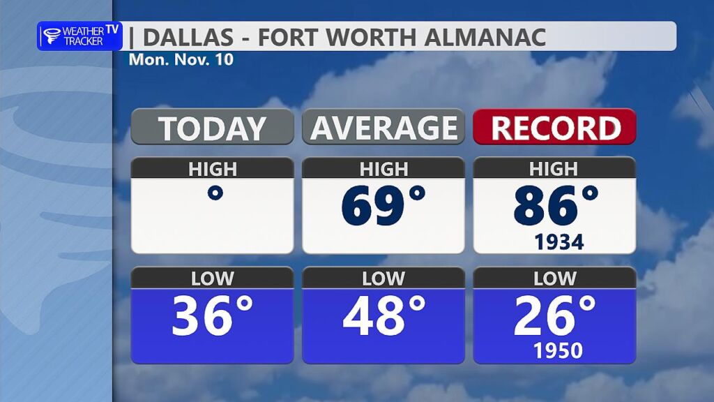
Today’s Chilly but Sunny Afternoon
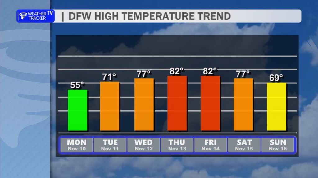
High pressure is firmly in control, delivering wall-to-wall sunshine and crystal-clear skies. Despite the abundant November sun, temperatures are struggling to climb. Expect afternoon highs only in the mid-to-upper 50s across most of the region – about 10–12 ° below average for this date. Light northerly breezes will make it feel a few degrees cooler in open areas.
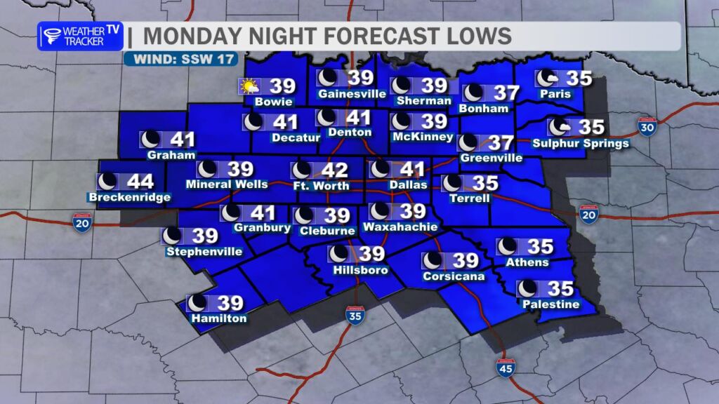
Tonight: Not Quite as Cold
Clear skies and light winds continue overnight, but a slightly milder air-mass will keep lows mainly in the upper 30s to low 40s in the Metroplex (mid-30s possible in the typical cold spots northwest of Fort Worth). Frost should be much less widespread than this morning.
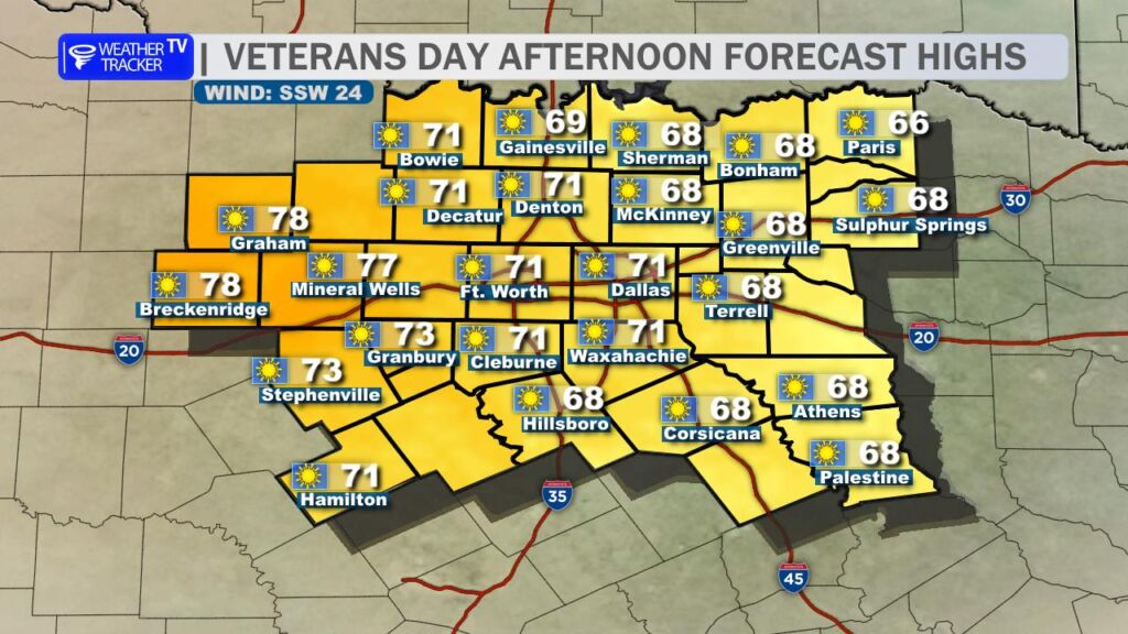
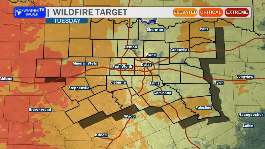
Tuesday: Windy Warm-Up Begins
A strong southwesterly flow develops ahead of an approaching trough, pumping warmer air back into Texas. Highs rebound into the low-to-mid 70s, but gusty winds 20–35 mph will make it feel spring-like despite the calendar saying November. Elevated to near-critical fire weather conditions are likely west of I-35 where relative humidity drops into the 20–30 % range and dry grasses remain abundant. Outdoor burning is strongly discouraged from late morning through sunset.
Wednesday–Friday: Summer Encore
The warm sector deepens, with high temperatures pushing well into the 80s both Thursday and Friday – potentially flirting with near records. Morning lows will only drop into the 60s by Thursday night. Enjoy it while it lasts – this will feel more like early October than mid-November.
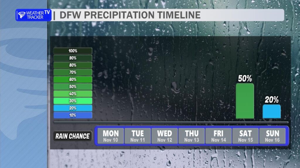
Weekend: Rain Chances on the Rise
A potent upper-level trough and associated cold front are progged to swing through Saturday night into Sunday. Forecast confidence is increasing for widespread showers and embedded thunderstorms, with some models hinting at 1–2 inches of rain across North Texas. Severe potential appears low for now, but a few strong storms can’t be ruled out along the front. Much cooler air spills in behind the system for early next week – highs likely back in the 60s to start next week.
Bottom Line
Bundle up one more time today, then get ready for a dramatic warm-up that’ll have you reaching for short sleeves by midweek. Keep the umbrella handy for the weekend – our next decent rain chance in quite a while looks to finally materialize.