If you’re a fan of shorts and sunshine, get outside this afternoon and soak it up, because Mother Nature is about to slam the door on summer-like weather. A powerful Fall cold front – the strongest of the season so far – barrels into North Texas this evening, ushering in the coldest air we’ve seen since last February. For many, this means the first freeze of the season is on deck.
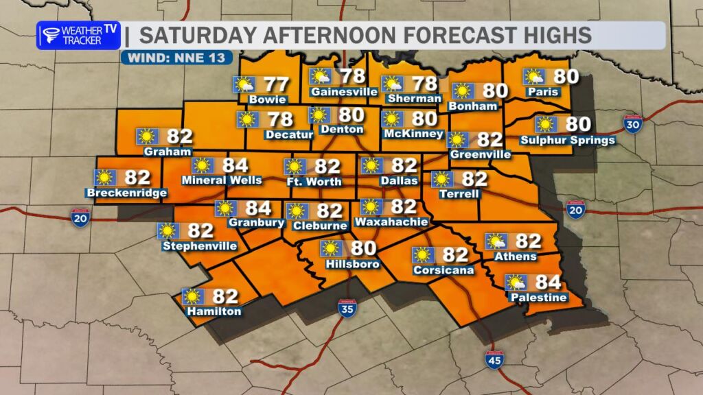
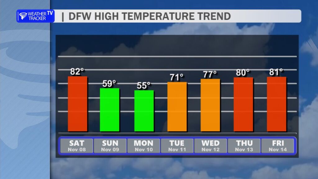
Saturday (Today): The DFW Metroplex enjoys one last taste of early-fall warmth. Highs climb into the lower 80s under a mix of sun and high clouds. It’ll feel downright pleasant – perfect for football watch parties, yard work, or a late-season patio lunch. But don’t get too comfortable.
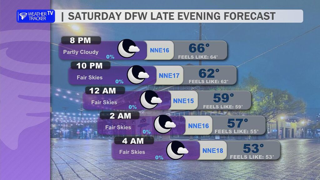
Tonight – The Switch Flips: The cold front crashes through between 6 PM and 10 PM. As it passes, winds whip around to the north at 15-25 mph with gusts over 35 mph. Temperatures will plummet 20° in just a few hours. By midnight, many areas will drop from the 70s into the 50s. Heads up if you’re making plans to be out late.
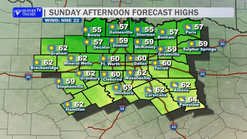
Sunday: Wake up to a completely different weather. Chilly and blustery – highs struggle to reach 60° across the Metroplex, with wind chills in the 40s most of the day. North winds keep jackets zipped and leaves flying. It’ll feel more like December than early November.
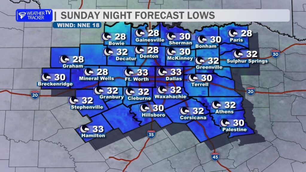
Monday Morning – First Freeze Alert: Widespread frost is a lock, but a hard freeze (28° or lower for several hours) is likely across most of North Texas, including the western and northern DFW suburbs (Denton, McKinney, Little Elm, Frisco, Plano, etc.). Even the urban core of Dallas-Fort Worth will flirt with 32° before sunrise. Protect sensitive plants, pets, and pipes! Lows range from 28° in the colder spots to 33-35° inside the Metroplex.
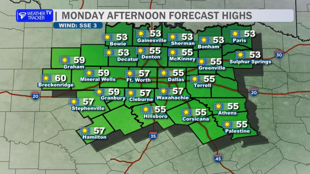
Monday Afternoon: Still chilly – highs only in the mid-50s under plenty of sunshine. It’ll be a crisp, beautiful Fall day, but you’ll need layers.
Next Week – The Rebound: Good news: the chill doesn’t last forever. A warming trend kicks in Tuesday and accelerates through the week. By Wednesday and Thursday, highs return to the 70s, with lower 80s possible again by next weekend – right back above normal for mid-November.
Rain Chances Returning? The extended models are finally hinting at a pattern shift. After weeks of dry conditions, decent rain chances could return by late next weekend (Nov 15-16) as a storm system approaches from the west. It’s still a ways out, but the dry ground might finally get some relief.
Bottom Line: Get ready for a classic North Texas temperature roller coaster. Fall is officially here… and it brought its cold-weather friends. ❄️🍂