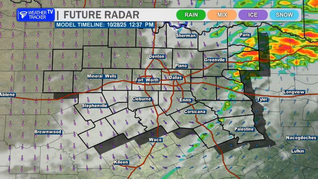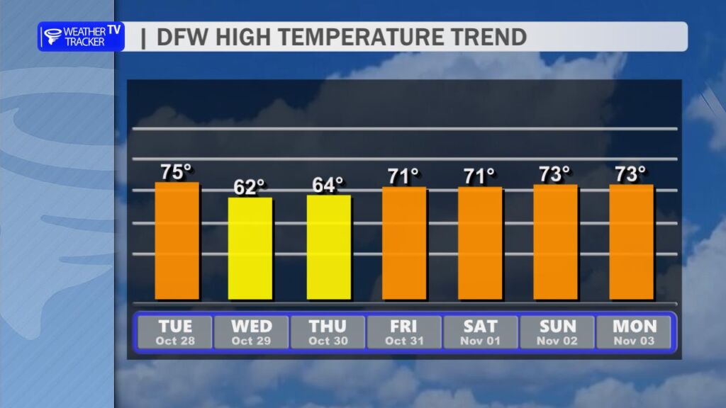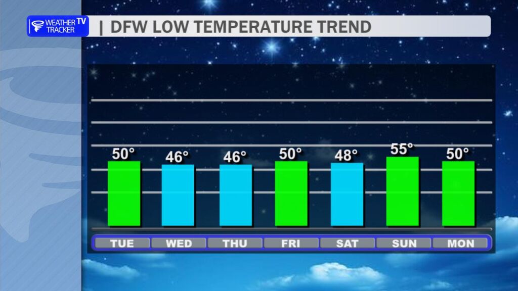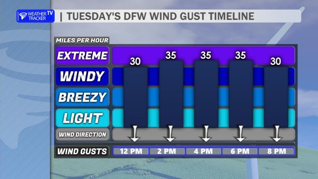
A cold front arrives in North Texas today, and you’ll notice it passing through your area as northerly winds pick up and gust between 35 and 45 mph. These gusty winds will linger into the evening and return even stronger on Wednesday, with peak gusts reaching 45 to 50 mph before easing by Thursday. A few showers are possible this afternoon in our eastern counties as the front moves through, though any rainfall will be minimal. Temperatures will trend cooler behind the front, with highs in the 60s over the next two days and morning lows dipping into the 40s; wind chills could feel like the 30s by Wednesday morning, so it may be time to briefly pull out the heavier winter coat. Conditions will warm up again heading into the weekend, with highs rebounding into the 70s.