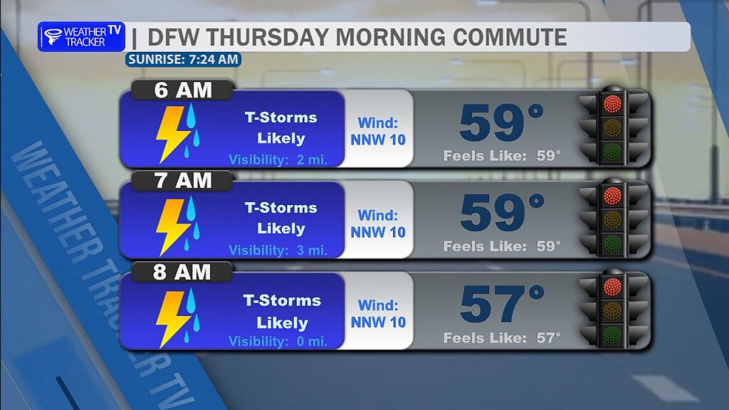
From William Cole: A Flash Flood Warning has been issued in the Weather Tracker TV DFW coverage area for Collin, Dallas, Hunt, Kaufman, Rockwall & Tarrant Counties in North Texas until 8:00 AM.
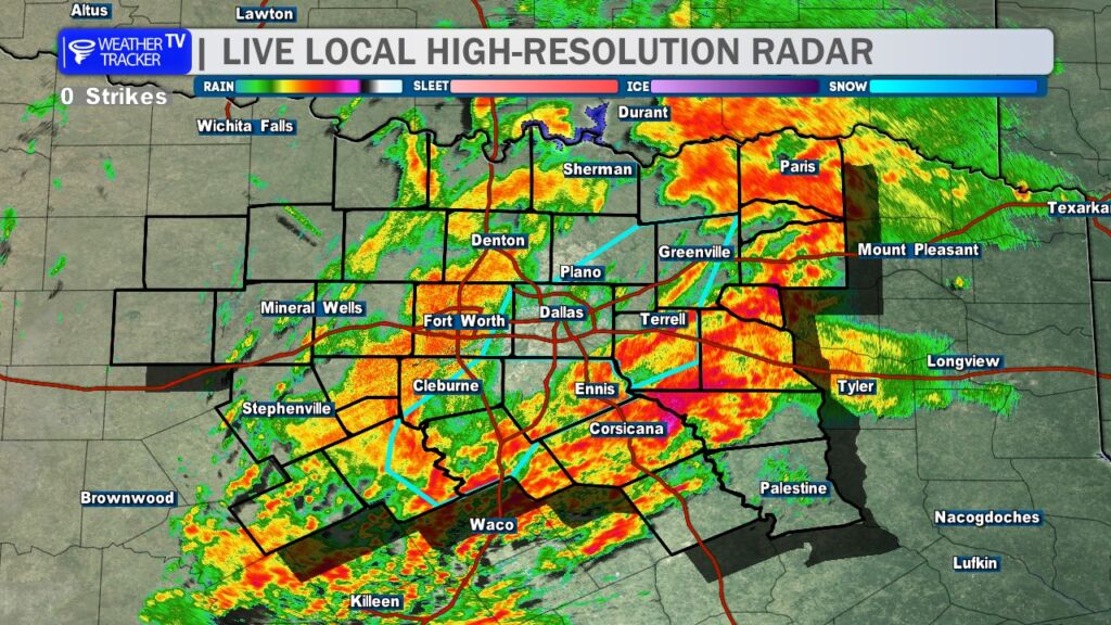
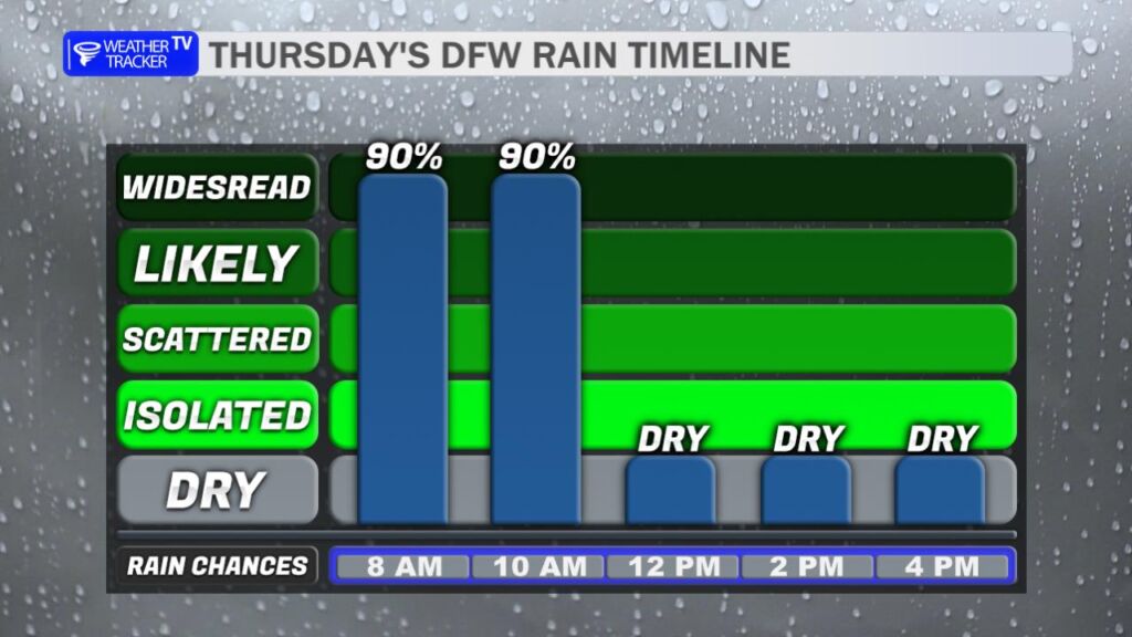
At 450 AM , Social media reports indicate several roads remain flooded across the eastern Metroplex early this morning. Doppler radar indicated T-Storms producing heavy rain moving back into the warned area. Radar estimates between 2 and 5 inches of rain have fallen since Wednesday evening. Any additional heavy rain may quickly lead to flash flooding.
Remember if you see water across a roadway do not drive through it. Turn Around Don’t Drown.
Stay with William Cole and Weather Tracker TV Dallas – Fort Worth for continuing coverage, online, on our app and on TV. Let’s stay safe together.