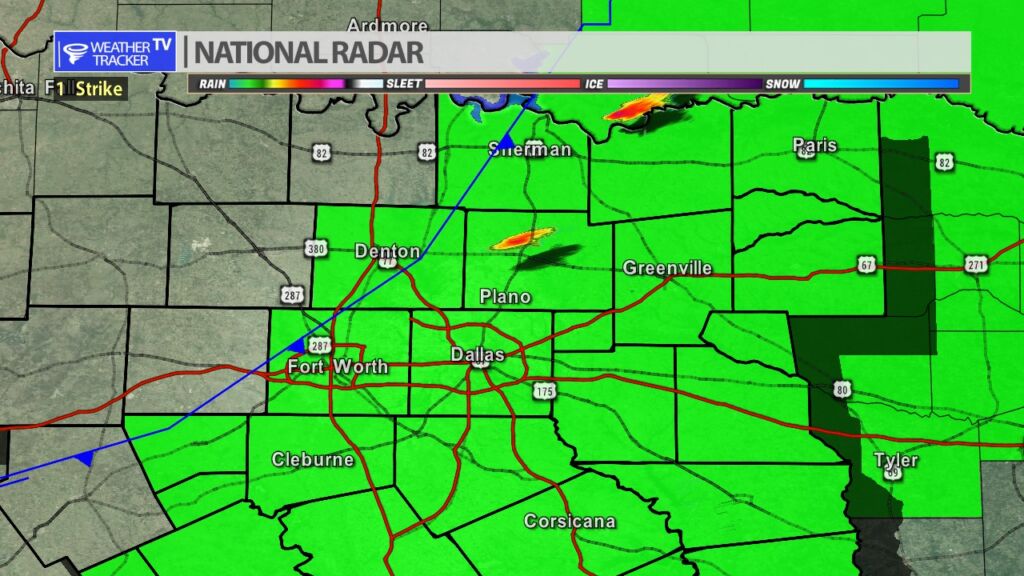
From William Cole: A Severe T-Storm Warning has been issued in the Weather Tracker TV DFW coverage area for Collin & Hunt Counties in North Texas until 8:00 PM.
At 705 PM , a severe T-Storm was located near Merit, or 16 miles northwest of Greenville, moving east at 20 mph.
Hometowns Impacted: Greenville, Princeton, Farmersville, Wolfe City, Celeste, Merit, Greenville City Lakes, Blue Ridge, Neylandville, Kellogg, Frognot, Kingston, Altoga, Floyd, Westminster, And Lavon Lake.
Primary Threats: 60 Mph Wind Gusts And Half Dollar Size Hail.
Stay with William Cole and Weather Tracker TV Dallas – Fort Worth for continuing coverage, online, on our app and on TV. Let’s stay safe together.