


Watching one last shower in our southeastern counties this morning. Expect a dry afternoon across North Texas.
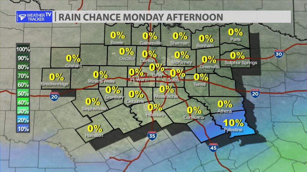
The lingering morning showers in the Metroplex have tapered off. Expect clearing skies and a hot afternoon with a high around 90.

William’s North Texas Hazardous Weather Forecast for Monday:
Scattered T-Storms are expected to continue developing along and ahead of a cold front moving through the region today.

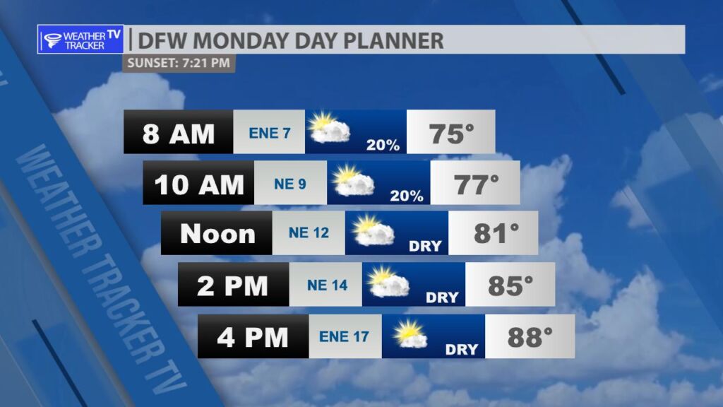
DFW today Mostly cloudy with a 20 percent chance of showers and T-Storms this morning, then mostly sunny this afternoon. Not as warm with highs in the upper 80s. Northeast winds 5 to 10 mph. -William
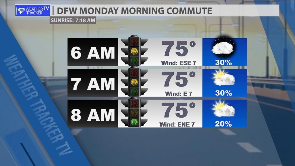
Good morning! A few scattered showers or T-Storms are possible during the early portion of the morning commute. That activity tapers off and shift southeast.
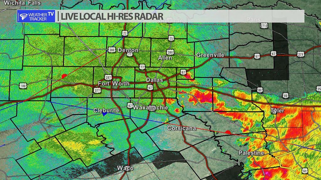

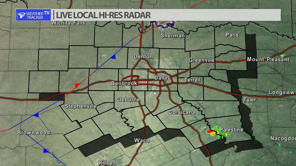
From William Cole: A strong T-Storm will impact portions of southeastern Anderson County through 415 AM
At 349 AM , Live Radar was tracking a strong T-Storm near Elkhart, or 10 miles southeast of Palestine, moving southeast at 45 mph.
Wind Gusts Up To 50 Mph And Pea Size Hail. Gusty Winds Could Knock Down Tree Limbs And Blow Around Unsecured Objects. Minor Damage To Outdoor Objects Is Possible.
Stay with William Cole and Weather Tracker TV Dallas – Fort Worth for continuing coverage, online, on our app and on TV. Let’s stay safe together.
From William Cole: Strong T-Storms will impact portions of eastern Freestone and Anderson Counties through 345 AM
At 318 AM , Live Radar was tracking strong T-Storms along a line extending from near Reese to 10 miles northeast of Palestine to 9 miles east of Fairfield Lake to Fairfield Lake State Park. Movement was southeast at 35 mph.
Wind Gusts Up To 50 Mph And Pea Size Hail. Gusty Winds Could Knock Down Tree Limbs And Blow Around Unsecured Objects. Minor Damage To Outdoor Objects Is Possible.
Stay with William Cole and Weather Tracker TV Dallas – Fort Worth for continuing coverage, online, on our app and on TV. Let’s stay safe together.
From William Cole: A strong T-Storm will impact portions of southeastern Henderson and northeastern Anderson Counties through 330 AM
At 255 AM , Live Radar was tracking a strong T-Storm 10 miles west of Frankston, or 13 miles southeast of Athens, moving southeast at 25 mph.
Winds In Excess Of 40 Mph And Half Inch Hail. Gusty Winds Could Knock Down Tree Limbs And Blow Around Unsecured Objects. Minor Damage To Outdoor Objects Is Possible.
Stay with William Cole and Weather Tracker TV Dallas – Fort Worth for continuing coverage, online, on our app and on TV. Let’s stay safe together.