
DFW today Sunny. Highs in the lower 90s. Northeast winds 5 to 10 mph. -William
DFW today Sunny. Highs in the lower 90s. Northeast winds 5 to 10 mph. -William
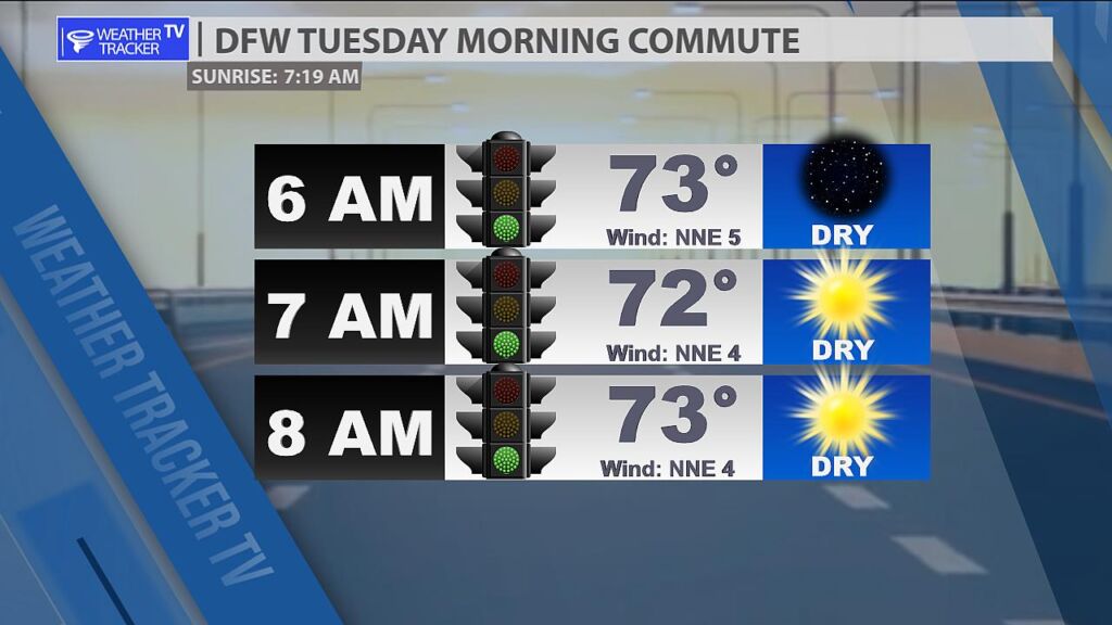
Good morning- it’s a warm and quiet start to our Tuesday morning commute with Metroplex temperatures in the 70s.

Here’s a look at Local Radar and Live Temperatures across North Texas.
DFW the rest of tonight: Mostly clear. Lows in the upper 60s. Northeast winds around 5 mph.


William’s North Texas Hazardous Weather Forecast this Evening:
Isolated storms will continue through evening mainly south of I-20. Lightning and gusty winds will be the main threats.
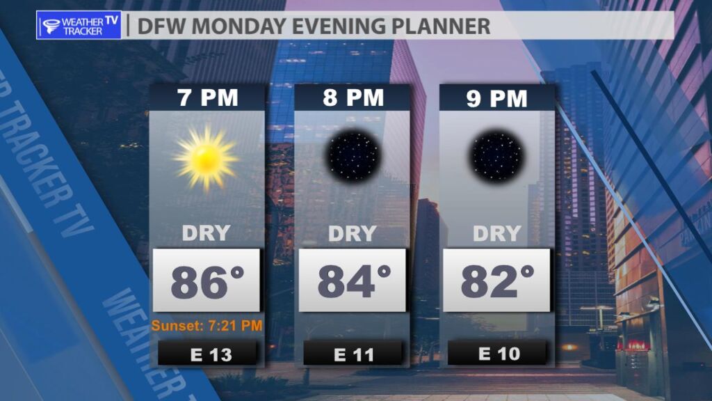
A very warm but pleasant evening on tap for the Metroplex. Temperatures in the 80s with an east breeze.
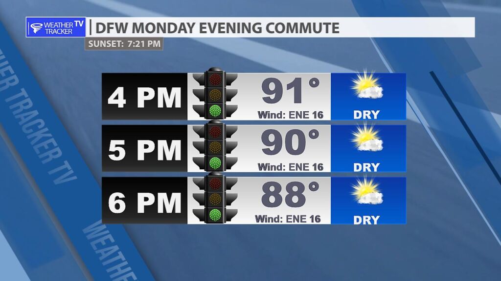
Hot for our Monday evening commute in the Metroplex with temperatures slowly easing back from the lower 90s.
DFW tonight Mostly clear. Lows in the upper 60s. Northeast winds 5 to 10 mph. -William


From William Cole: A Air Quality Alert has been issued for the following counties in North Texas until Tuesday September 26. Collin, Dallas, Denton, Ellis, Henderson, Hunt, Johnson, Kaufman, Parker, Rockwall, Tarrant & Wise.
OZONE ACTION DAY The Texas Commission on Environmental Quality (TCEQ) has issued an Ozone Action Day for the Dallas-Fort Worth area for Tuesday, September 26, 2023. Atmospheric conditions are expected to be favorable for producing high levels of ozone air pollution in the Dallas-Fort Worth area on Tuesday. You can help prevent ozone pollution by sharing a ride, walking, riding a bicycle, taking your lunch to work, avoiding drive-through lanes, conserving energy, and keeping your vehicle properly tuned. For more information on ozone: Ozone: The Facts (www.tceq.texas.gov/goto/ozonefacts) Air North Texas: (www.airnorthtexas.org) EPA Air Now (www.airnow.gov/index.cfm?action.local_state&STATEID=45&TAB=0) Take care of Texas (www.takecareoftexas.org) North Central Texas Council of Governments Air Quality (www.nctcog.org/trans/air/index.asp)
Stay with William Cole and Weather Tracker TV Dallas – Fort Worth for continuing coverage online, on our free mobile app and on TV thru Roku, Apple and Amazon Fire TV.

Here’s a look at Live Temperatures across North Texas, Local Radar and the Updated Forecast Map.
DFW this afternoon Sunny. Not as warm with highs in the upper 80s. Northeast winds around 10 mph. -William


From the National Hurricane Center:
For the North Atlantic Caribbean Sea and the Gulf of Mexico:Active Systems:The National Hurricane Center is issuing advisories on TropicalStorm Philippe, located over the central tropical Atlantic.Southeastern Gulf of Mexico:A trough of low pressure is producing disorganized shower activityover portions of the southeastern Gulf of Mexico. Development, ifany, of this system is expected to be slow to occur over the nextday or two while it moves slowly westward. The disturbance isexpected to move into unfavorable environmental conditions by themiddle of the week, ending its chances for development.* Formation chance through 48 hours low 10 percent.* Formation chance through 7 days low 10 percent.Eastern Tropical Atlantic (AL91):An area of low pressure located several hundred miles southwest ofthe Cabo Verde Islands continues to produce disorganized showersand T-Storms. Environmental conditions are forecast to beconducive for additional development, and a tropical depression islikely to form within the next few days as the system moveswest-northwestward across the central tropical Atlantic.* Formation chance through 48 hours low 30 percent.* Formation chance through 7 days high 80 percent.Forecaster Cangialosi/Konarik