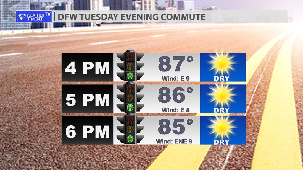
Warm and humid for our DFW Wednesday evening commute. It will be dry with temperatures in the mid 80s.
Warm and humid for our DFW Wednesday evening commute. It will be dry with temperatures in the mid 80s.
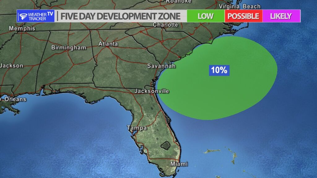
The National Hurricane Center is highlighting an area just off the Carolina coast as a possible tropical development zone over the next few days. Some data is initially indicating a weak tropical storm may form.

A few showers have developed in our southeastern counties Anderson and Freestone – down around the Palestine area. T-Storms are ongoing out in the Big County, but those are moving southeast and should stay just west of our western counties.

Here’s a look at Live Temperatures across North Texas, Local Radar and the Updated Forecast Map.
DFW this afternoon Partly sunny with a 20 percent chance of showers and T-Storms. Highs in the mid 80s. East winds 5 to 10 mph. -William


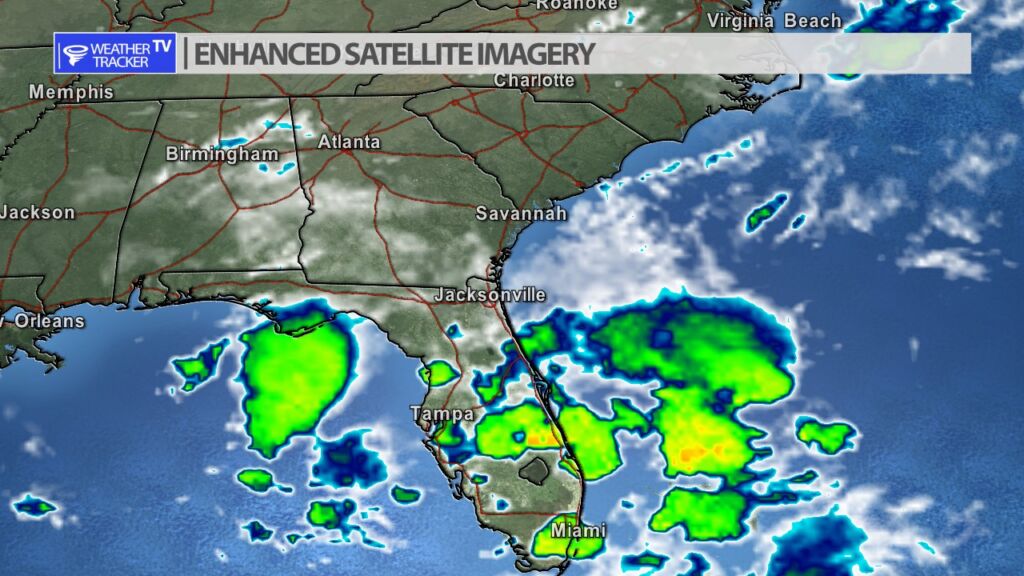
From the National Hurricane Center:
For the North Atlantic Caribbean Sea and the Gulf of Mexico:Tropical cyclone formation is not expected during the next 7 days.Forecaster Reinhart


William’s North Texas Hazardous Weather Forecast for Wednesday:
Showers and T-Storms will continue to push through North and Central Texas this morning with gusty winds, lightning, and heavy rainfall. This activity should diminish through the morning. Additional T-Storms are possible again late tonight mainly west of I-35.
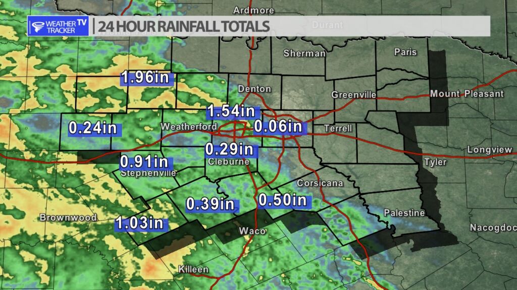
It was another active weather night in our western counties with a complex of storms moving in from West Texas. Rainfall totals were wide-ranging from .25″ to nearly 2″. The complex vaporized right over the Metroplex with parts of Tarrant County picking up over 1.50″. Dallas County – mostly missed out.

DFW today Mostly cloudy with a slight chance of showers and T-Storms this morning, then partly sunny with a chance of showers and T-Storms this afternoon. Highs in the lower 80s. East winds around 5 mph. Chance of rain 30 percent. -William