DFW tonight Partly cloudy in the evening, then mostly cloudy with a 40 percent chance of showers and T-Storms after midnight. Lows in the upper 60s. East winds 5 to 10 mph. -William

DFW tonight Partly cloudy in the evening, then mostly cloudy with a 40 percent chance of showers and T-Storms after midnight. Lows in the upper 60s. East winds 5 to 10 mph. -William

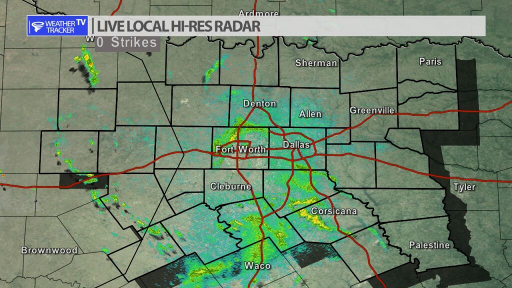
Here’s a look at Live Temperatures across North Texas, Local Radar and the Updated Forecast Map.
DFW this afternoon Mostly sunny. Highs in the mid 80s. Southeast winds 5 to 10 mph. -William


From the National Hurricane Center:
For the North Atlantic Caribbean Sea and the Gulf of Mexico:Tropical cyclone formation is not expected during the next 7 days.Forecaster Reinhart


William’s North Texas Hazardous Weather Forecast for Tuesday:
A complex of T-Storms is expected to move into our area from the west-northwest tonight into early Wednesday morning. A few storms may become strong to severe, primarily west of Highway 281, and contain damaging wind gusts, frequent lightning, heavy rain, and small hail.
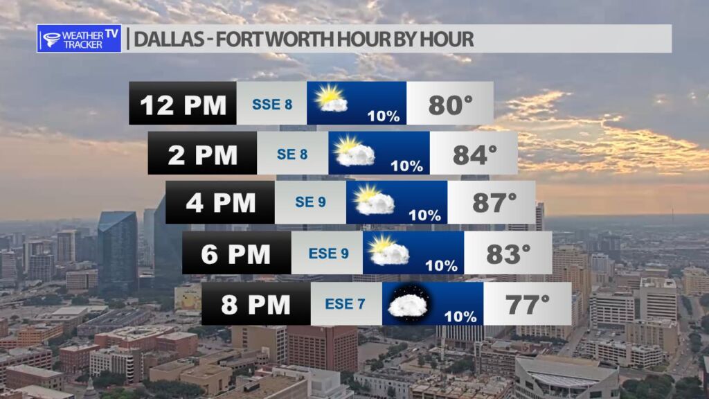
Expect a warm Tuesday afternoon in the Metroplex with a mix of sun and clouds. There is a very slim 10% chance of a stray T-Storm through the daylight hours.
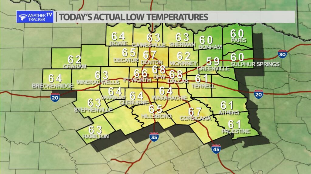
It was a cool to mild start across North Texas with actual lows this morning a mix of 60s. Greenville was the one cooler spot at 59.

DFW today Mostly sunny. Highs in the mid 80s. Southeast winds around 5 mph. -William
A few lingering light showers are all that is left from a complex of storms that moved through western parts of North Texas overnight. A few roadways in the Metroplex could be damp but most of this activity continues to dissipate.