
William’s North Texas Hazardous Weather Forecast this Evening:
No hazardous weather is expected at this time.
William’s North Texas Hazardous Weather Forecast this Evening:
No hazardous weather is expected at this time.

DFW tonight Clear. Lows in the lower 50s. Northwest winds 5 to 10 mph, becoming southeast after midnight. -William


Here’s a look at Live Temperatures across North Texas, Local Radar and the Updated Forecast Map.
DFW today Cloudy this morning, then becoming mostly sunny. Highs in the lower 70s. Northwest winds 5 to 10 mph. -William


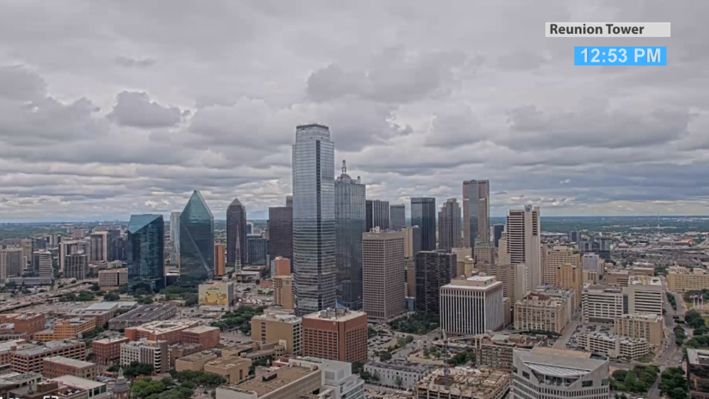
A lot of cloud cover is rolling back into Dallas. It almost looks like it’s about to rain but it’s a dry forecast through the afternoon. Clouds clear heading into the evening.

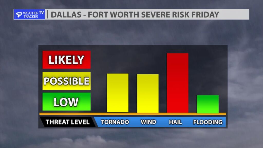
The risk of severe weather returns tomorrow (Friday) to North Texas. The threat of very large hail, damaging wind gusts and a few tornado warnings are in my forecast for tomorrow. The Storm Prediction Center is highlighting the I-35 corridor by late afternoon with an enhanced or more likely risk of severe weather. A broken line of supercells will develop near a front around 3 PM just west of I-35, and that activity will push east through the late afternoon and evening. The primary concern is very large hail – in excess of golf ball size. Plan ahead for your vehicle tomorrow and any outdoor lawn furniture etc. that could be damaged from large hail.
I’m tracking all of these details carefully and we’ll have more updates here on the mobile app and on the channel throughout the day, and of course live severe weather coverage on the channel tomorrow as needed.


William’s North Texas Hazardous Weather Forecast for Thursday:
No hazardous weather is expected at this time.

Much quieter weather today with morning clouds and a mix of afternoon sun and clouds. Metroplex highs around 70.