DFW Early Friday Afternoon Update

Texas Weather Tracker TV Alert

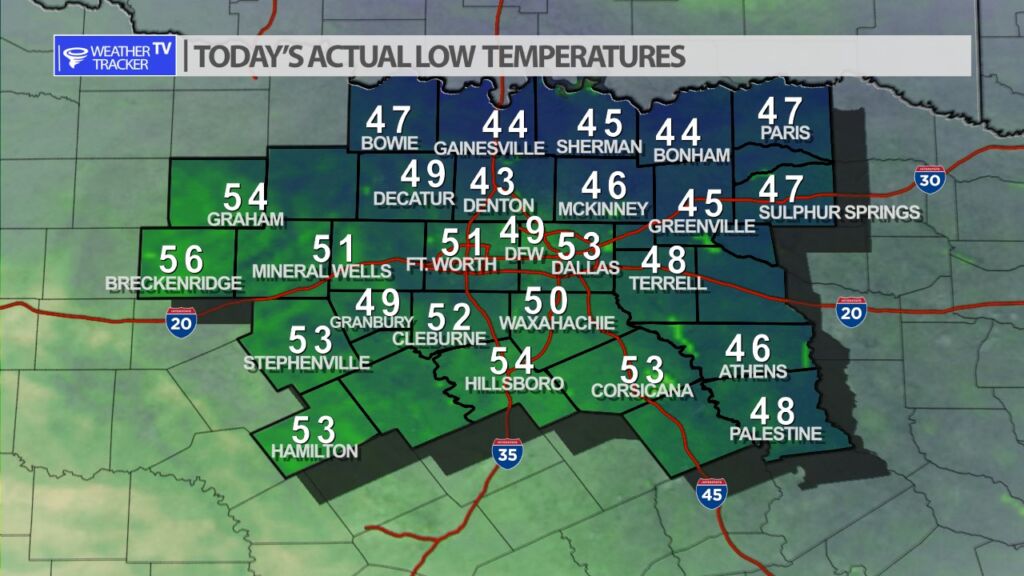
Here’s a look at Live Temperatures across North Texas, Local Radar and the Updated Forecast Map.

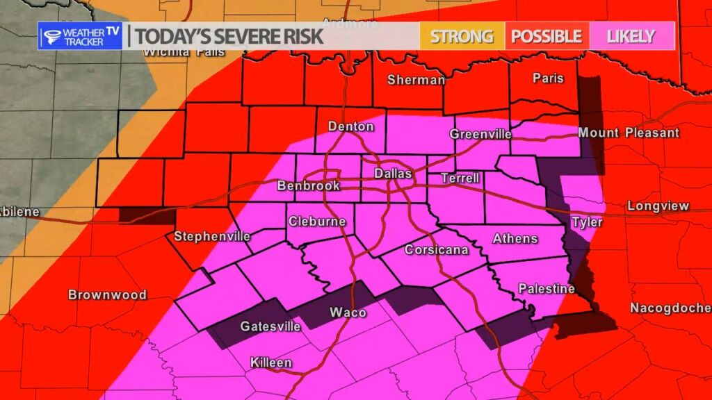
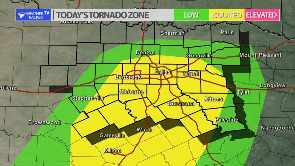
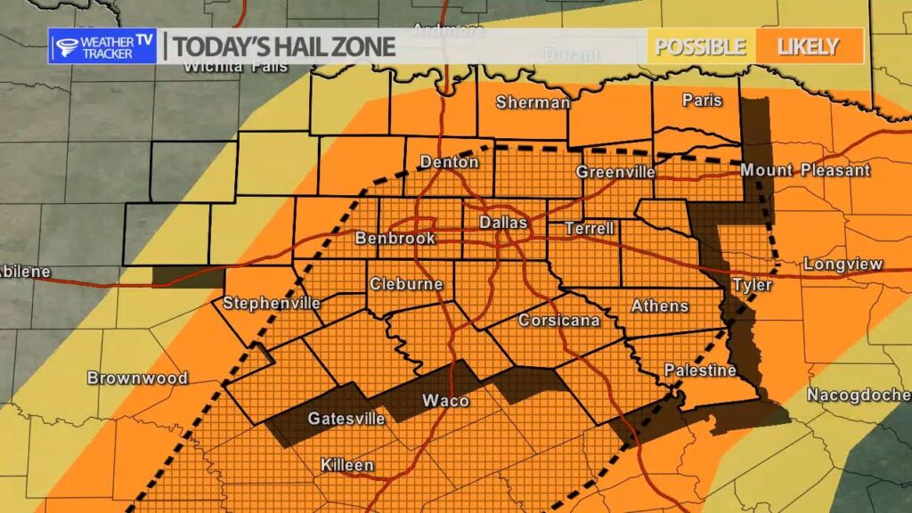
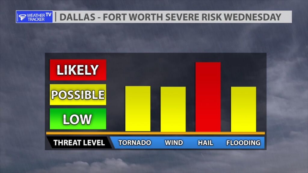
DFW this afternoon Showers with T-Storms likely. Some T-Storms may be severe. Locally heavy rainfall possible. Highs in the mid 70s. Temperatures falling into the upper 60s late. East winds 5 to 10 mph. Chance of rain 80 percent. -William

Texas Weather Tracker TV Alert

Texas Weather Tracker TV Alert

Severe Weather Likely Today

Heads Up! Another round of severe weather is likely for North Texas today. The concern is increasing for very large hail up to the size of tennis balls. Damaging wind gusts over 65 MPH are possible along with a few tornado warnings as well. Storms initially fire between 2 PM and 3 PM just west of Dallas – Fort Worth and push east through the late afternoon and evening. The evening commute in the Metroplex will be impacted by severe weather. Plan ahead – anything that could be damaged from very large hail – do your best to shelter it before the storms initiate. The activity will push east and south and exit our coverage area before midnight.

As always we will have live severe weather coverage on the channel with live video from our storm trackers in the field.

Tap to play Future Radar.

DFW Today

Expect a warm afternoon with increasing humidity. Severe weather is likely after 2 PM through the evening. Very large hail is the primary concern in the Metroplex.

Today’s North Texas Hazardous Weather Forecast

Texas Weather Tracker TV Alert

William’s North Texas Hazardous Weather Forecast for Friday:

Strong to severe T-Storms are expected this afternoon and evening across much of North and Central Texas as a cold front moves across the region. Large hail and damaging winds will be the main threats with these storm but a few tornadoes will also be possible.