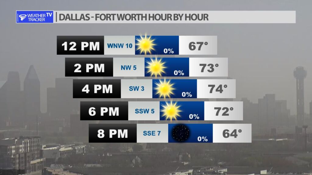
Expect a mild but dusty afternoon with a lighter west wind. Highs in the Metroplex will be in the 70s.
Expect a mild but dusty afternoon with a lighter west wind. Highs in the Metroplex will be in the 70s.
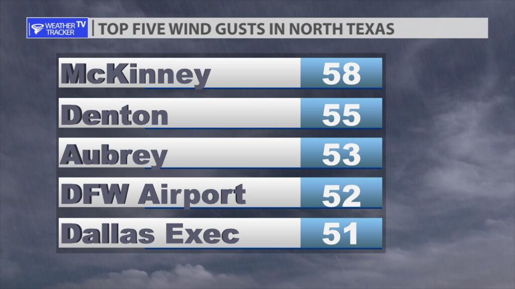
A skinny band of T-Storms moved across North Texas yesterday evening and overnight. Luckily, most of the line stayed below severe levels. Peak wind gusts in the Metroplex were over 50 MPH with McKinney recording a wind gust of 58 MPH.


William’s North Texas Hazardous Weather Forecast for Monday:
No hazardous weather is expected at this time.
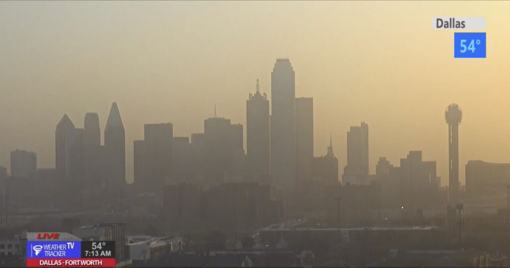
It’s a hazy and dusty start to our Monday. If you’re wondering why? West Texas had an all-out dust storm yesterday, and our surface winds in North Texas are blowing in from the west today. Suspended dust is being transported into the area on those westerly winds and dust will linger to some extent through most of the day.


DFW today Sunny. Highs in the mid 70s. West winds 10 to 15 mph, diminishing to 5 to 10 mph this afternoon. -William
DFW today Sunny. Highs in the mid 70s. West winds 10 to 15 mph, diminishing to 5 to 10 mph this afternoon. -William
We are starting our Monday off dry and breezy. The T-Storms from late yesterday evening and overnight have pushed off to the east of North Texas. In the DFW Metroplex temperatures are a mix of 50s.

Here’s a look at Local Radar and Live Temperatures across North Texas.
DFW tonight A chance of showers and T-Storms this evening, then showers and T-Storms after midnight. Breezy with lows around 50. South winds 15 to 25 mph, becoming southwest after midnight. Wind gusts up to 40 mph are possible. Chance of rain near 100 percent.
