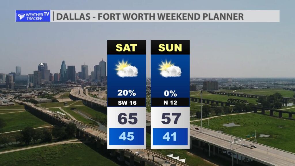
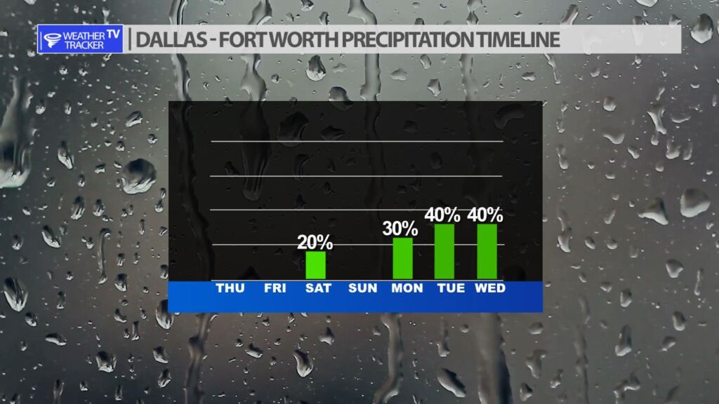
Clouds cover will increase on Saturday. A few showers and even a few rumbles of thunder will be possible – mainly south and east of DFW. Sunday cooler with a north wind behind a cold front.
Clouds cover will increase on Saturday. A few showers and even a few rumbles of thunder will be possible – mainly south and east of DFW. Sunday cooler with a north wind behind a cold front.
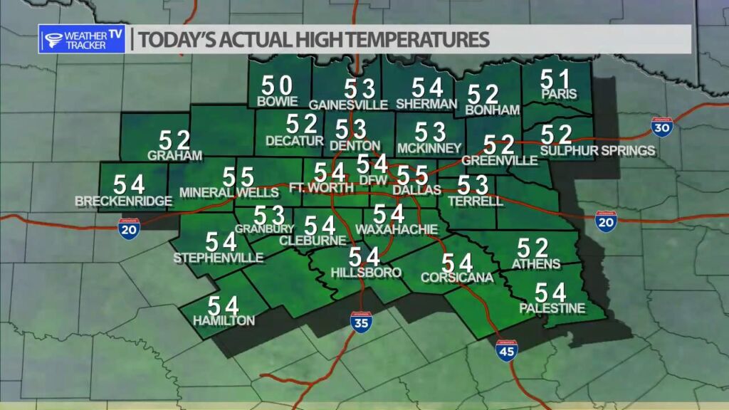
It was a cool but sunny afternoon across North Texas. Actual highs were a mix of low to mid 50s.
DFW tonight Clear. Lows in the mid 30s. Southwest winds 5 to 10 mph. -William


Here’s a look at Live Temperatures across North Texas, Local Radar and the Updated Forecast Map.
DFW this afternoon Sunny. Highs in the lower 50s. West winds 5 to 10 mph. -William


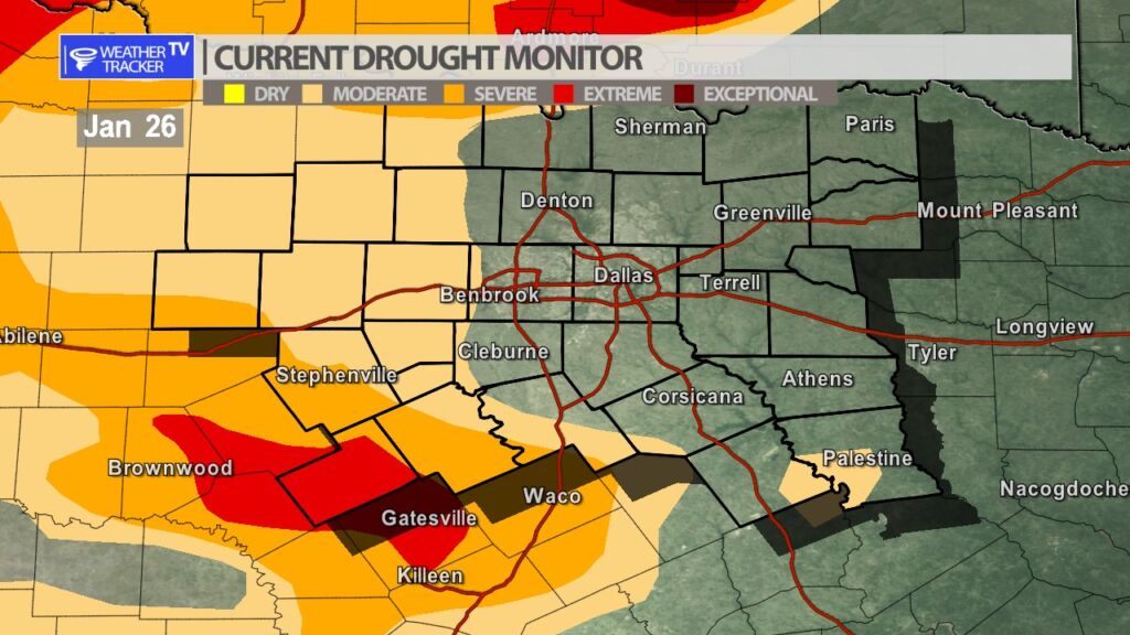
The updated Drought Monitor for this week remains steady. A large part of North Texas is drought free. Hamilton county to the southwest of Dallas – Fort Worth continues to be the area of concern with extreme drought conditions down there.
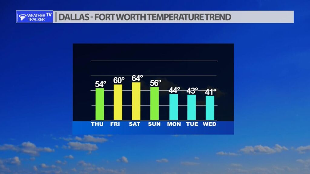
Temperatures will be milder heading into the first part of the weekend with 60s. A cold front arrives on Sunday and chills us back down for next week. A few showers and T-Storms are possible on Saturday ahead of that front – mainly south and east of Dallas – Fort Worth. However, a stronger slower storm system arrives for next week with chances of rain and with cold air in the area – some locations in the region may also see more wintry weather.
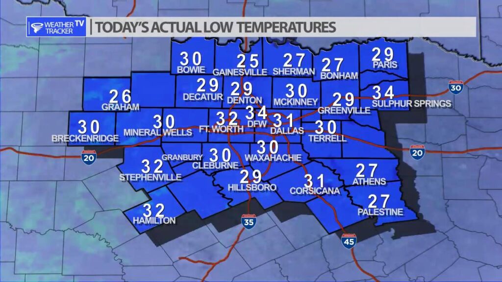
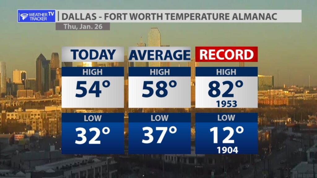
It was a cold start to the morning across North Texas with most locations at or below freezing. Officially at DFW we remained above freezing and that continues a streak of no freezing temperatures at our official reporting station for the month of January.


William’s North Texas Hazardous Weather Forecast for Thursday:
No hazardous weather is expected at this time.