11 PM | Winter Storm Watch until 9:00 AM Wednesday

Texas Weather Tracker TV Alert

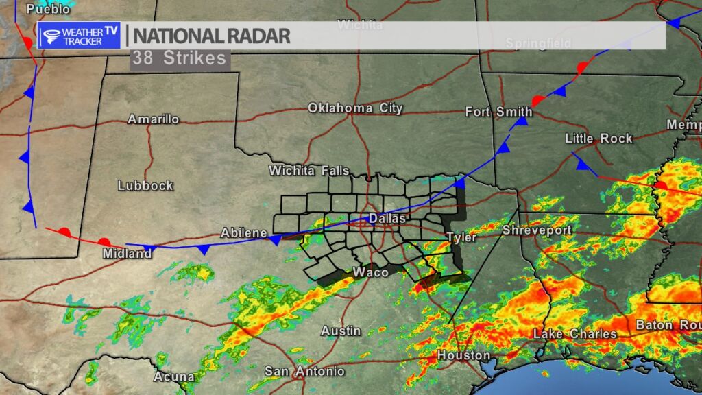
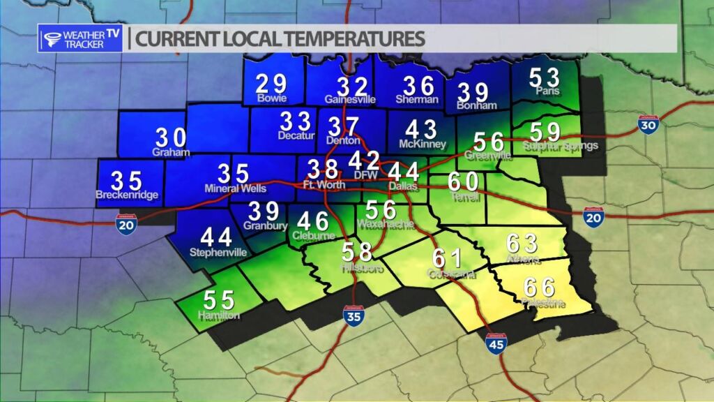
From William Cole: A Winter Storm Watch has been issued in the Weather Tracker TV DFW coverage area from 12:00 PM Monday until 9:00 AM Wednesday for Bosque, Collin, Cooke, Dallas, Delta, Denton, Ellis, Erath, Fannin, Grayson, Hamilton, Hill, Hood, Hopkins, Hunt, Jack, Johnson, Kaufman, Lamar, Montague, Navarro, Palo Pinto, Parker, Rockwall, Somervell, Stephens, Tarrant, Wise & Young Counties in North Texas.

Significant icing possible due to freezing rain. Total ice accumulations of one tenth to one quarter of an inch, particularly on elevated surfaces and bridges. Some sleet will be possible.

Stay with William Cole and Weather Tracker TV Dallas – Fort Worth for continuing coverage, online, on our app and on TV. Let’s stay safe together.

DFW Early Sunday Afternoon Update

Texas Weather Tracker TV Alert

Here’s a look at Live Temperatures across North Texas, Local Radar and the Updated Forecast Map.

DFW this afternoon Cloudy with a 30 percent chance of rain. Much cooler with highs in the lower 50s. Temperatures falling into the upper 30s late. North winds 10 to 15 mph. -William

Texas Weather Tracker TV Alert

Texas Weather Tracker TV Alert

Arctic Front Moving thru North Texas

An Arctic cold front continues to slice through North Texas this morning. A north wind and dropping temperatures can be expected behind the front. Scattered showers are ongoing ahead of the front. Areas of light drizzle and freezing drizzle may be possible behind the front. This is the beginning of a unsettled stretch of weather for the start of the work week. The latest data continues to trend this toward a higher impact situation with freezing drizzle and freezing rain being more likely Monday and Tuesday. We’ll have a complete update here on the mobile app and on the channel later in the day.

9:45 AM Temperatures