Winter Weather Advisory

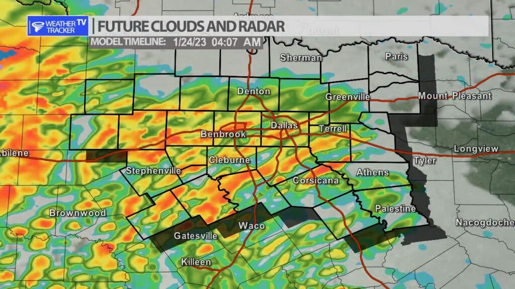
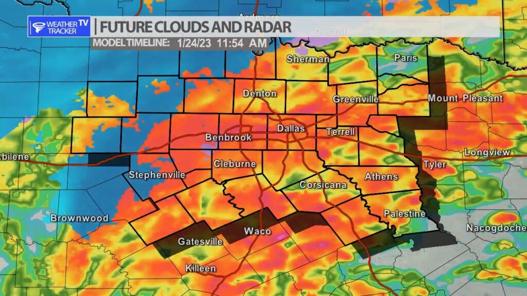
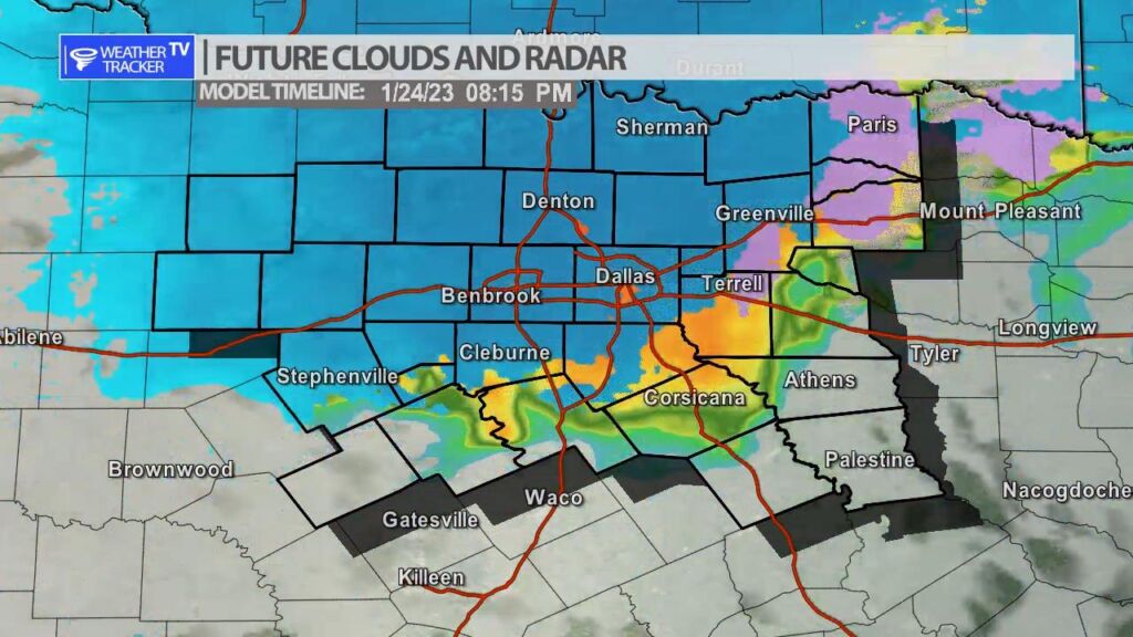
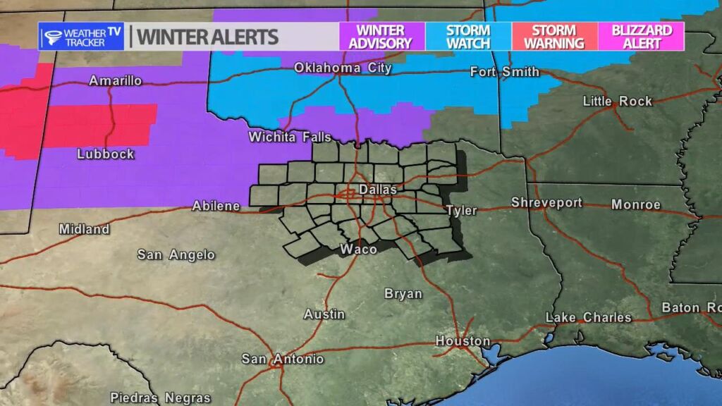
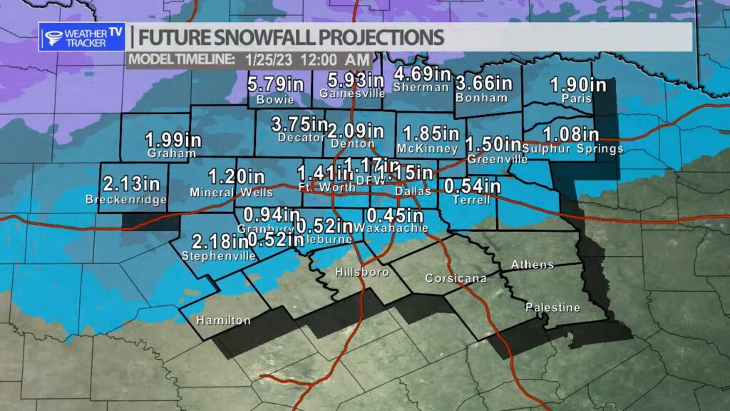
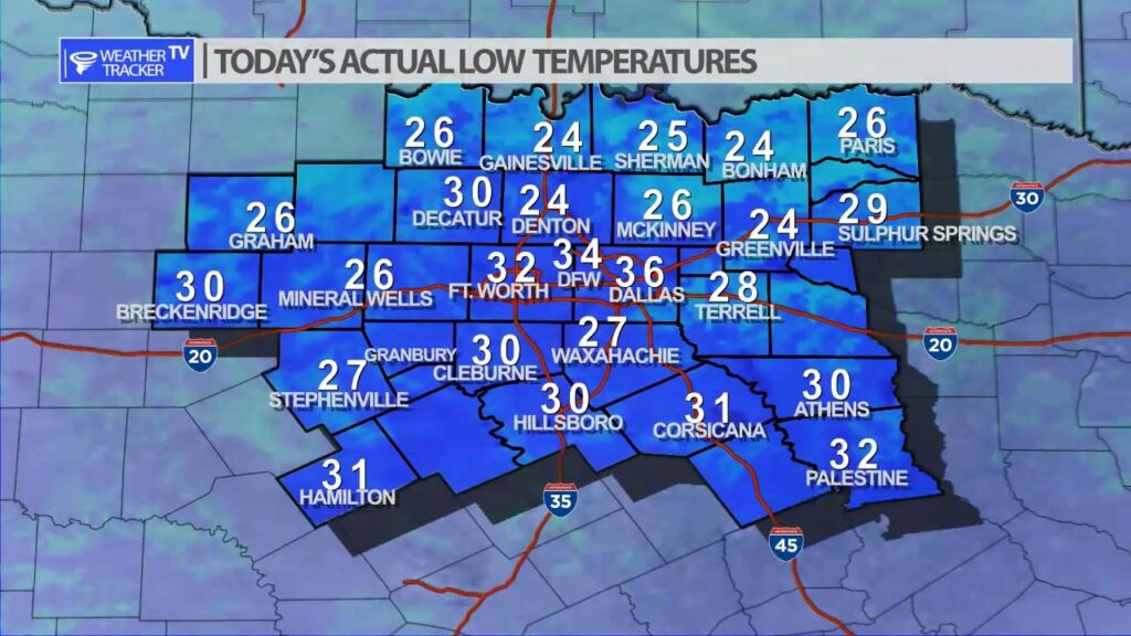
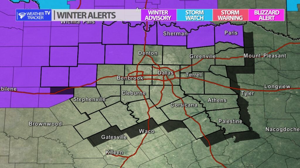
A Winter Weather Advisory has been issued for our Red River and western counties tomorrow. Rain will transition over to snow. Snow accumulations of 1 – 2″ will be possible with a few high totals also possible. Slick spots will be possible on bridges and overpasses.

11:31 AM | Winter Weather Advisory until 12:00 AM Wednesday

Texas Weather Tracker TV Alert

From William Cole: A Winter Weather Advisory has been issued in the Weather Tracker TV DFW coverage area from 12:00 PM Tuesday until 12:00 AM Wednesday for Cooke, Fannin, Grayson, Jack, Lamar, Montague, Palo Pinto, Stephens, Wise & Young Counties in North Texas.

Wet snow expected. Total snow accumulations of less than 3 inches are possible, mainly on elevated and grassy surfaces.

Stay with William Cole and Weather Tracker TV Dallas – Fort Worth for continuing coverage, online, on our app and on TV. Let’s stay safe together.

Rain and Snow Tomorrow

Enjoy the sunshine this afternoon because Tuesday will be a completely different day with widespread rain and even an opportunity of snow for some of us. The rain begins predawn so your Tuesday morning commute does look wet in the Metroplex. The rain continues through the day and begins to mix with snow to the northwest of Dallas – Fort Worth. By late afternoon the core of the system moves across North Texas and on the colder backside the opportunity of snow will increase for several hours through Tuesday evening before the system pulls away.

A few key takeaways: The air and ground temperatures remain above freezing – so the opportunity of accumulation and travel impacts will be minimal. However, elevated surfaces including the Mix-master and the High Five (635 & 75 Central) interchanges may develop a few slick spots.

Rain begins predawn Tuesday.
Rain mixes with snow northwest into the afternoon.
Snow will be more likely on the colder backside of the system Tuesday evening as it begins to pull away.
Winter weather alerts around the region. Currently none in North Texas.
** Keep in mind with snowfall projections the computer is not taking into account the air temperature is above freezing and the ground temperature is above freezing. The main takeaway from this is that if we were to see a light accumulation – the better opportunity would be near the Red River Valley.