
William’s North Texas Hazardous Weather Forecast this Evening:
No hazardous weather is expected at this time.
William’s North Texas Hazardous Weather Forecast this Evening:
No hazardous weather is expected at this time.

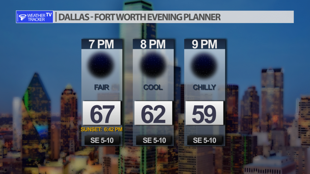
Expect a dry and fair Wednesday evening with temperatures easing down after sunset.
DFW tonight Clear. Lows in the upper 40s. East winds around 5 mph. -William


Here’s a look at Live Temperatures across North Texas, Local Radar and the Updated Forecast Map.
DFW this afternoon Sunny. Highs in the lower 70s. East winds around 5 mph. -William


From the National Hurricane Center:
For the North Atlantic Caribbean Sea and the Gulf of Mexico:Southwestern Atlantic:A trough of low pressure stretching from the central Caribbeannorthward to the southwestern Atlantic continues to produce a broadarea of disorganized showers and T-Storms. Environmentalconditions appear conducive for some gradual subtropical developmentof this system over the next few days while it drifts northward.The system is then forecast to meander over the subtropical westernAtlantic to the west or southwest of Bermuda. Upper-level winds areforecast to become less conducive for development by the end of theweekend.* Formation chance through 48 hours low 20 percent.* Formation chance through 5 days low 30 percent.Eastern Caribbean:An area of low pressure could form over the eastern Caribbean Seathis weekend. Environmental conditions are forecast to be conducivefor gradual development as the disturbance moves generally westwardor west-northwestward into the central Caribbean early next week.* Formation chance through 48 hours low near 0 percent.* Formation chance through 5 days low 30 percent.Forecaster Hagen/Reinhart


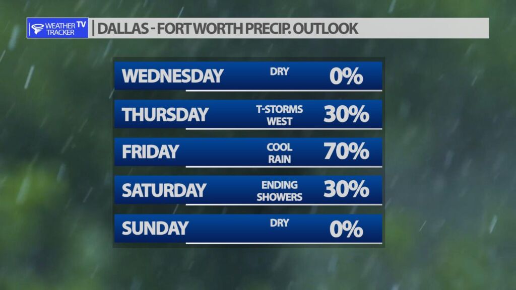
It’s a tale of two different days for the weekend. Saturday starts cloudy with ending showers and a cooler afternoon. Sunday looks great with plenty of sun and a high around 70.
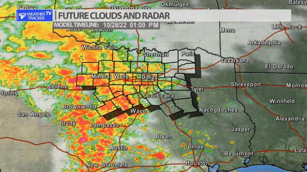
Rain chances return to the forecast across North Texas late on Thursday into Friday. A strong upper level storm system will slowly creep across the area bringing lingering rain chances through most of the day Friday. Right now, it appears the severe risk should stay to our west with West Texas and the Big Country more favorable for severe storms (wind and hail threat). Rainfall totals look generous with 1″ – 3″ common in the area. Rain chances taper off on Saturday with clearing skies into the weekend.


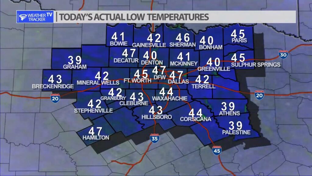
It was a chilly start to the morning with actual lows a mix of 40’s with even a few upper 30’s reported.