THE EIGHTH TROPICAL STORM OF THE SEASON FORMS, BUT IN THE EASTERN ATLANTIC… …HEAVY RAINS FORECAST FOR THE CANARY ISLANDS

Texas Weather Tracker TV Alert

THE EIGHTH TROPICAL STORM OF THE SEASON FORMS, BUT IN THE EASTERN ATLANTIC… …HEAVY RAINS FORECAST FOR THE CANARY ISLANDS

At 800 PM CVT (2100 UTC), the center of Tropical Storm Hermine was located near latitude 18.6 North, longitude 20.5 West. Hermine is moving toward the north-northwest near 10 mph (17 km/h), and this general motion with some decrease in forward speed is forecast this weekend, with a turn to the northwest possible early next week.

Download App

If you have not already downloaded the Free Texas Weather Tracker TV mobile app – do that now. Search your app store for Texas Weather Tracker TV. Also, add our free Live Channel to your TV through Roku, Apple or Amazon Fire TV streaming players.

Streaming Servicet

Like our forecasts? Love our severe weather coverage? Help support us and local Texas weather coverage. Join our Patreon for $2.99 per month. www.patreon.com/texasweathertrackertv

Patreon

ALERT 3:08 PM | An Air Quality Alert has been issued for the DFW Metroplex for Saturday September 24

Texas Weather Tracker TV Alert

From William Cole: A Air Quality Alert has been issued for the following counties in North Texas until Saturday September 24. Collin, Dallas, Denton, Ellis, Henderson, Hunt, Johnson, Kaufman, Parker, Rockwall, Tarrant & Wise.

OZONE ACTION DAY The Texas Commission on Environmental Quality (TCEQ) has issued an Ozone Action Day for the Dallas-Fort Worth area for Saturday, September 24, 2022. Atmospheric conditions are expected to be favorable for producing high levels of ozone air pollution in the Dallas-Fort Worth area on Saturday. You can help prevent ozone pollution by sharing a ride, walking, riding a bicycle, taking your lunch to work, avoiding drive-through lanes, conserving energy, and keeping your vehicle properly tuned. For more information on ozone: Ozone: The Facts (www.tceq.texas.gov/goto/ozonefacts) Air North Texas: (www.airnorthtexas.org) EPA Air Now (www.airnow.gov/index.cfm?action.local_state&STATEID=45&TAB=0) Take care of Texas (www.takecareoftexas.org) North Central Texas Council of Governments Air Quality (www.nctcog.org/trans/air/index.asp)

Stay with William Cole and Weather Tracker TV Dallas – Fort Worth for continuing coverage online, on our free mobile app and on TV thru Roku, Apple and Amazon Fire TV.

HURRICANE CONDITIONS EXPECTED TO BEGIN ON ATLANTIC CANADA TONIGHT

Texas Weather Tracker TV Alert

HURRICANE CONDITIONS EXPECTED TO BEGIN ON ATLANTIC CANADA TONIGHT

At 200 PM AST (1800 UTC), the center of Hurricane Fiona was located near latitude 37.8 North, longitude 62.0 West. Fiona is moving toward the northeast near 35 mph (56 km/h). A slower north-northeast or northward motion is expected later today through Sunday. On the forecast track, the center of Fiona will approach Nova Scotia later today, move across Nova Scotia and into the Gulf of St. Lawrence on Saturday, and then across Labrador and over the Labrador Sea on Sunday.

Download App

If you have not already downloaded the Free Texas Weather Tracker TV mobile app – do that now. Search your app store for Texas Weather Tracker TV. Also, add our free Live Channel to your TV through Roku, Apple or Amazon Fire TV streaming players.

Streaming Servicet

Like our forecasts? Love our severe weather coverage? Help support us and local Texas weather coverage. Join our Patreon for $2.99 per month. www.patreon.com/texasweathertrackertv
Patreon

GASTON MOVING TOWARDS THE CENTRAL AZORES… …TROPICAL STORM CONDITIONS AND HEAVY RAINFALL EXPECTED OVER THE WESTERN AND CENTRAL AZORES TONIGHT AND SATURDAY

Texas Weather Tracker TV Alert

GASTON MOVING TOWARDS THE CENTRAL AZORES… …TROPICAL STORM CONDITIONS AND HEAVY RAINFALL EXPECTED OVER THE WESTERN AND CENTRAL AZORES TONIGHT AND SATURDAY

At 600 PM GMT (1800 UTC), the center of Tropical Storm Gaston was located near latitude 39.8 North, longitude 28.5 West. Gaston is moving toward the southeast near 9 mph (15 km/h). A slower south-southeastward and then southward motion is forecast this evening, followed by a southwestward motion tonight and early Saturday, and a westward motion on Sunday. On the forecast track, the center of Gaston will move near or over portions of the Azores through early Saturday.

Download App

If you have not already downloaded the Free Texas Weather Tracker TV mobile app – do that now. Search your app store for Texas Weather Tracker TV. Also, add our free Live Channel to your TV through Roku, Apple or Amazon Fire TV streaming players.

Streaming Servicet

Like our forecasts? Love our severe weather coverage? Help support us and local Texas weather coverage. Join our Patreon for $2.99 per month. www.patreon.com/texasweathertrackertv
Patreon

Atlantic Tropical Weather Outlook

Texas Weather Tracker TV Alert

From the National Hurricane Center:

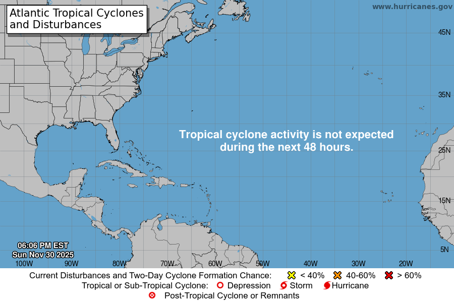
For the North Atlantic Caribbean Sea and the Gulf of Mexico:Active Systems:The National Hurricane Center is issuing advisories on HurricaneFiona, located north of Bermuda, on Tropical Storm Gaston, locatednear the central Azores, and on newly formed Tropical DepressionNine, located several hundred miles east-southeast of Jamaica overthe eastern Caribbean Sea.Eastern Tropical Atlantic:Shower and T-Storm activity associated with an area of lowpressure located between the Cabo Verde Islands and the west coastof Africa is showing increased signs of organization. Environmentalconditions are forecast to be generally conducive for furtherdevelopment during the next day or so, and a tropical depression islikely to form while the system moves northward at about 10 mph,roughly parallel to the coast of west Africa.* Formation chance through 48 hours high 80 percent.* Formation chance through 5 days high 80 percent.Central Tropical Atlantic:A broad area of low pressure located several hundred mileswest-southwest of the Cabo Verde Islands continues to produce somedisorganized shower and T-Storm activity. Despite marginalenvironmental conditions, some slow development of this system ispossible over the next several days while it drifts northwestward ornorthward over the central tropical Atlantic.* Formation chance through 48 hours low 20 percent.* Formation chance through 5 days low 30 percent.Public Advisories on Tropical Depression Nine are issued under WMOheader WTNT34 KNHC and under AWIPS header MIATCPAT4.Forecast/Advisories on Tropical Depression Nine are issued under WMOheader WTNT24 KNHC and under AWIPS header MIATCMAT4.Forecaster Reinhart

Cold Front Arrives Late Sunday

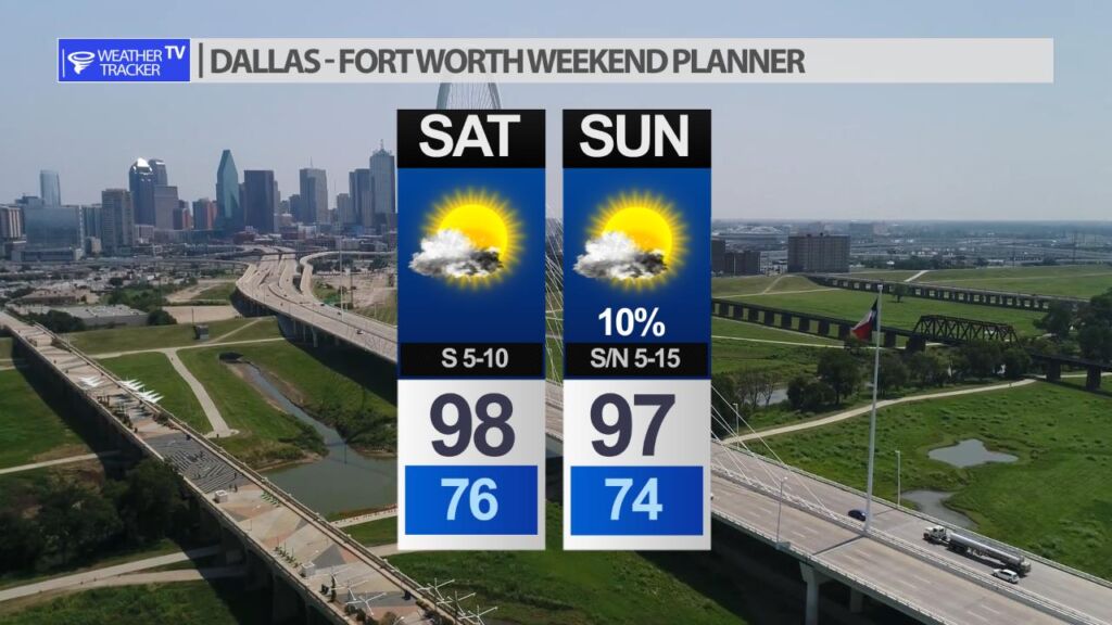
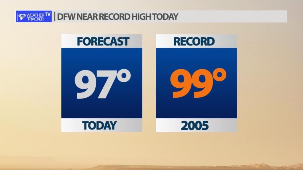
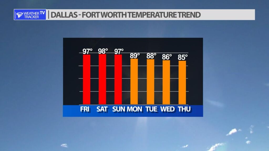
After near record highs this weekend a cold front arrives late on Sunday. While there isn’t a strong push a cooler air it will knock our temperatures down closer to average. A second push of less hot air arrives by mid week and will trend our temperatures slightly below normal.

Weekend Forecast

Our North Texas weekend can be summed up in one word – hot. High’s in the 90’s with mostly sunny skies. A cold front will arrive late on Sunday, and there is a very slight 10% chance of a stray or isolated shower or T-Storm. Otherwise, expect a dry weekend.