HURRICANE-FORCE WINDS, STORM SURGE, AND HEAVY RAINS CONTINUE ACROSS PORTIONS OF ATLANTIC CANADA

Texas Weather Tracker TV Alert

HURRICANE-FORCE WINDS, STORM SURGE, AND HEAVY RAINS CONTINUE ACROSS PORTIONS OF ATLANTIC CANADA

At 200 PM AST (1800 UTC), the center of Post-Tropical Cyclone Fiona was located near latitude 47.7 North, longitude 61.4 West. The post-tropical cyclone is moving toward the north near 25 mph (41 km/h), and a slower northward motion is expected during the next few days. On the forecast track, the center of Fiona will move across the Gulf of St. Lawrence through this evening, and then move across Labrador and over the Labrador Sea on Sunday.

Download App

If you have not already downloaded the Free Texas Weather Tracker TV mobile app – do that now. Search your app store for Texas Weather Tracker TV. Also, add our free Live Channel to your TV through Roku, Apple or Amazon Fire TV streaming players.

Streaming Servicet

Like our forecasts? Love our severe weather coverage? Help support us and local Texas weather coverage. Join our Patreon for $2.99 per month. www.patreon.com/texasweathertrackertv
Patreon

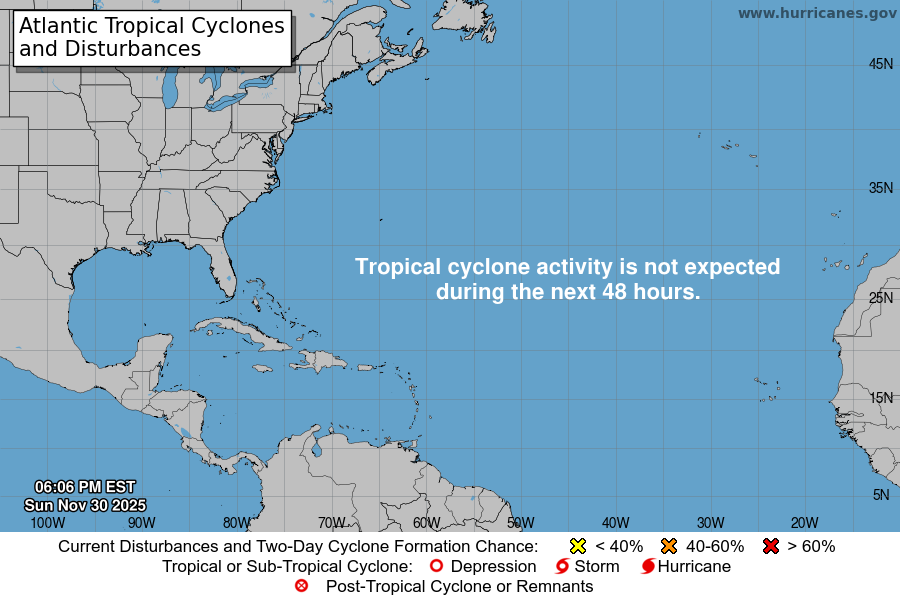
Atlantic Tropical Weather Outlook

Texas Weather Tracker TV Alert

From the National Hurricane Center:

For the North Atlantic Caribbean Sea and the Gulf of Mexico:Active Systems:The National Hurricane Center is issuing advisories on Post-TropicalCyclone Fiona, currently in the Gulf of St. Lawrence, onTropical Storm Gaston, located near the central Azores, on TropicalStorm Ian, located over the central Caribbean Sea, and on TropicalStorm Hermine, located over the far eastern Atlantic.Central Tropical Atlantic:Showers and T-Storms remain disorganized in association with abroad area of low pressure located several hundred mileswest-southwest of the Cabo Verde Islands. Despite unfavorableupper-level winds, some slow development of this system is possibleover the next several days while it drifts northwestward ornorthward over the central tropical Atlantic.* Formation chance through 48 hours low 20 percent.* Formation chance through 5 days low 30 percent.Public Advisories on Tropical Storm Hermine are issued under WMOheader WTNT35 KNHC and under AWIPS header MIATCPAT5.Forecast/Advisories on Tropical Storm Hermine are issued under WMOheader WTNT25 KNHC and under AWIPS header MIATCMAT5.Forecaster Bucci

GASTON MOVING WEST-SOUTHWESTWARD AWAY FROM THE AZORES

Texas Weather Tracker TV Alert

GASTON MOVING WEST-SOUTHWESTWARD AWAY FROM THE AZORES

At 300 PM GMT (1500 UTC), the center of Tropical Storm Gaston was located near latitude 38.0 North, longitude 30.8 West. Gaston is moving toward the west-southwest near 9 mph (15 km/h). A turn toward the west is anticipated later today, followed by a turn to the southwest by late Sunday.

Download App

If you have not already downloaded the Free Texas Weather Tracker TV mobile app – do that now. Search your app store for Texas Weather Tracker TV. Also, add our free Live Channel to your TV through Roku, Apple or Amazon Fire TV streaming players.

Streaming Servicet

Like our forecasts? Love our severe weather coverage? Help support us and local Texas weather coverage. Join our Patreon for $2.99 per month. www.patreon.com/texasweathertrackertv

Patreon

IAN FORECAST TO RAPIDLY STRENGTHEN LATER THIS WEEKEND… …HURRICANE CONDITIONS POSSIBLE IN THE CAYMAN ISLANDS EARLY MONDAY

Texas Weather Tracker TV Alert

IAN FORECAST TO RAPIDLY STRENGTHEN LATER THIS WEEKEND… …HURRICANE CONDITIONS POSSIBLE IN THE CAYMAN ISLANDS EARLY MONDAY

At 1100 AM EDT (1500 UTC), the center of Tropical Storm Ian was located near latitude 14.4 North, longitude 75.2 West. Ian is moving toward the west near 15 mph (24 km/h), and this general motion is expected to continue through tonight. A turn toward the northwest is forecast on Sunday, followed by a north-northwestward turn on Monday and a northward motion on Tuesday. On the forecast track, the center of Ian is forecast to move across the central Caribbean Sea today, pass southwest of Jamaica on Sunday, and pass near or over the Cayman Islands Sunday night and early Monday. Ian will then approach western Cuba late Monday and emerge over the southeastern Gulf of Mexico on Tuesday.

Download App

If you have not already downloaded the Free Texas Weather Tracker TV mobile app – do that now. Search your app store for Texas Weather Tracker TV. Also, add our free Live Channel to your TV through Roku, Apple or Amazon Fire TV streaming players.

Streaming Servicet

Like our forecasts? Love our severe weather coverage? Help support us and local Texas weather coverage. Join our Patreon for $2.99 per month. www.patreon.com/texasweathertrackertv

Patreon

HEAVY RAINS EXPECTED TO CONTINUE ACROSS THE CANARY ISLANDS DURING THE NEXT DAY OR TWO

Texas Weather Tracker TV Alert

HEAVY RAINS EXPECTED TO CONTINUE ACROSS THE CANARY ISLANDS DURING THE NEXT DAY OR TWO

At 200 PM CVT (1500 UTC), the center of Tropical Storm Hermine was located near latitude 20.8 North, longitude 20.8 West. Hermine is moving toward the north near 8 mph (13 km/h) and this motion is expected to continue during the next day or two. After that time, a turn toward the northwest is expected.

Download App

If you have not already downloaded the Free Texas Weather Tracker TV mobile app – do that now. Search your app store for Texas Weather Tracker TV. Also, add our free Live Channel to your TV through Roku, Apple or Amazon Fire TV streaming players.

Streaming Servicet

Like our forecasts? Love our severe weather coverage? Help support us and local Texas weather coverage. Join our Patreon for $2.99 per month. www.patreon.com/texasweathertrackertv
Patreon

HURRICANE-FORCE WINDS, STORM SURGE, AND HEAVY RAINS CONTINUE ACROSS PORTIONS OF ATLANTIC CANADA

Texas Weather Tracker TV Alert

HURRICANE-FORCE WINDS, STORM SURGE, AND HEAVY RAINS CONTINUE ACROSS PORTIONS OF ATLANTIC CANADA

At 1100 AM AST (1500 UTC), the center of Post-Tropical Cyclone Fiona was located near latitude 47.9 North, longitude 61.3 West. The post-tropical cyclone is moving toward the north near 25 mph (41 km/h), and a slightly slower northward motion is expected during the next few days. On the forecast track, the center of Fiona will move across the Gulf of St. Lawrence today, and then move across Labrador and over the Labrador Sea on Sunday.

Download App

If you have not already downloaded the Free Texas Weather Tracker TV mobile app – do that now. Search your app store for Texas Weather Tracker TV. Also, add our free Live Channel to your TV through Roku, Apple or Amazon Fire TV streaming players.

Streaming Servicet

Like our forecasts? Love our severe weather coverage? Help support us and local Texas weather coverage. Join our Patreon for $2.99 per month. www.patreon.com/texasweathertrackertv

Patreon