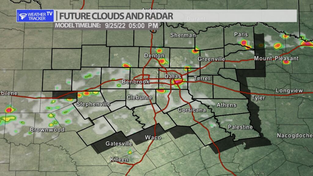
From William Cole: Strong T-Storms will impact portions of southwestern Hunt, northeastern Kaufman, northwestern Van Zandt and Rains Counties through 345 PM
At 257 PM , Live Radar was tracking strong T-Storms along a line extending from 7 miles east of Emory to 7 miles west of Quinlan. Movement was south at 15 mph.
Winds In Excess Of 40 Mph And Half Inch Hail. Gusty Winds Could Knock Down Tree Limbs And Blow Around Unsecured Objects. Minor Damage To Outdoor Objects Is Possible.
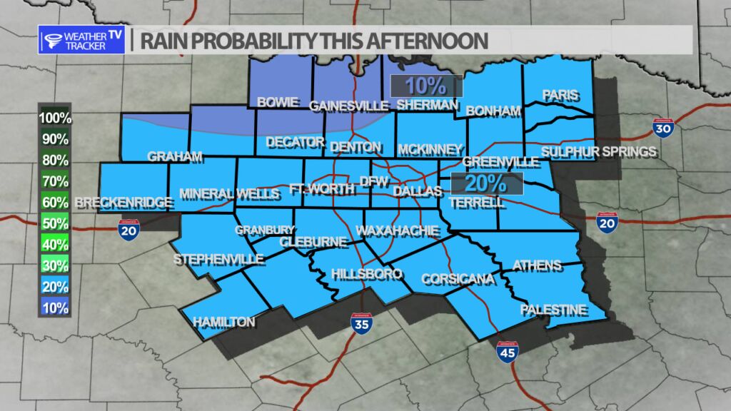
Stay with William Cole and Weather Tracker TV Dallas – Fort Worth for continuing coverage, online, on our app and on TV. Let’s stay safe together.